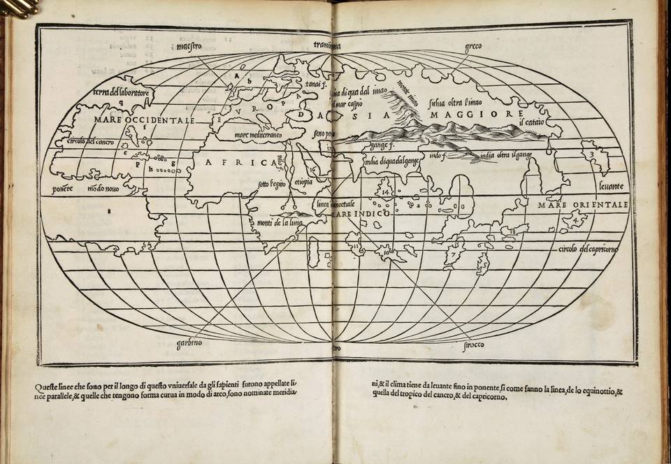
Isolario di Benedetto Bordone..
Isolario di Benedetto Bordone..
de tutte lIsole del mondo...
Venice, Aristotele (=Zoppino) , 1534
(Shirley 59; Ginsberg, Scandinavia, map 7; Burden, map 8: Suarez, Shedding the veil, pp 66/67; Harrisse Vetustissima no. 187
In folio, XIX quarter vellum
10 nn leaves; 74 folios
Title in engraved scrolls printed in red and black
Second edition of this important atlas, published in June 1534.The atlas includes the first edition of the oldest known report on Pizarros conquest of Peru and his victory over the Incas on March 15, 1533.
The modern ...
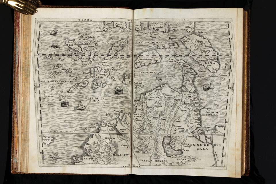
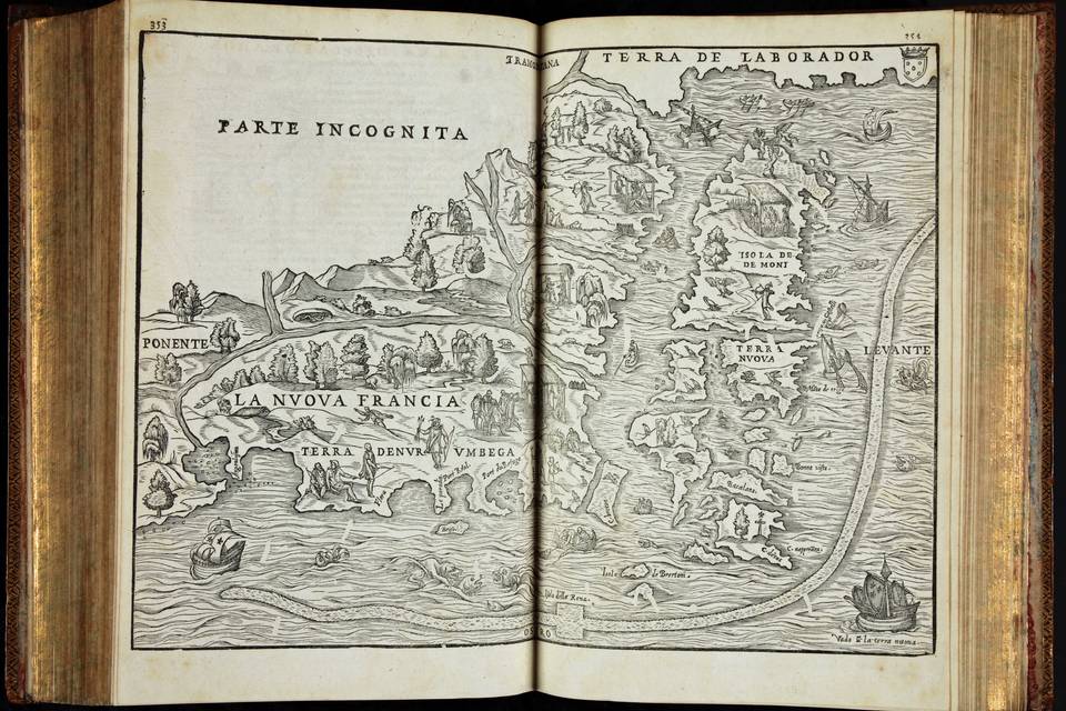
Delle navigationi et viaggi...
Venice, Giunti. 1613; 1583; 1606
(Adams: R136; R139; R140; European Americana 1563/22; 1583/59; Church 99, for different editions; Sabin 67735; 67738 & 67742)
In folio, 3 Vols, uniformly rebound in the XVIII century in full calf.
Spine with raised bands and gilt title & decoration. Edges gilt.
4 nn lvs; 34 and 394 numbered leaves: three copper plate engraved maps; 18 numbered leaves; 10 nn lvs; 256 and 90 numbered leaves
6 nn lvs; 36 and 430 numbered leaves: 6 folding woodcut maps
In all three volumes together there are 53 woodcuts in the text
Condition: Rebound & cut in the XIX century. Margins still wide. Spine ...
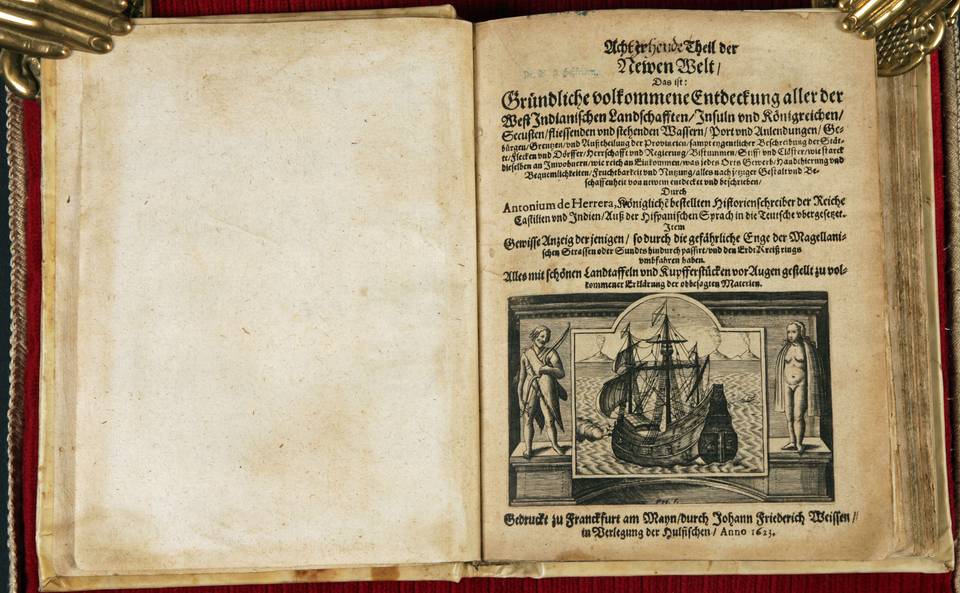
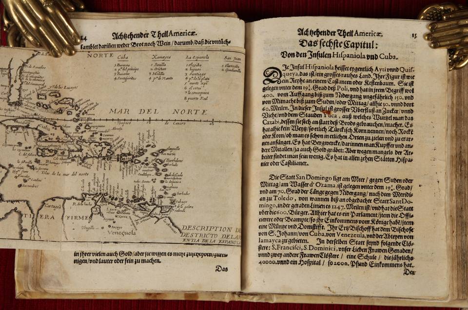
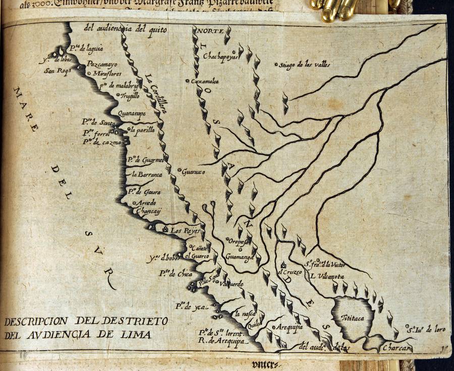
Achtzehenter Theil der Newen Welt...
(Herreras atlas and description of the Americas)
Franckfurt am Mayn,
Weissen, in Verleging die Hulsischen. 1623
(Church 310; JCB I 573)
Small in quarto. Remboitage in old vellum over boards
4 nn leaves, including engraved title page;
256 pages
14 (folding) maps
First and complete translation in German of Antonio de Herreras Descripcion de las Indias, 1601, the second atlas ever to be dedicated to the Americas. This essential atlas accompanied his magnificent Historia de los Hechos de los Castellanos en las Indias Occidentales, Madrid 1601-1615. The ...
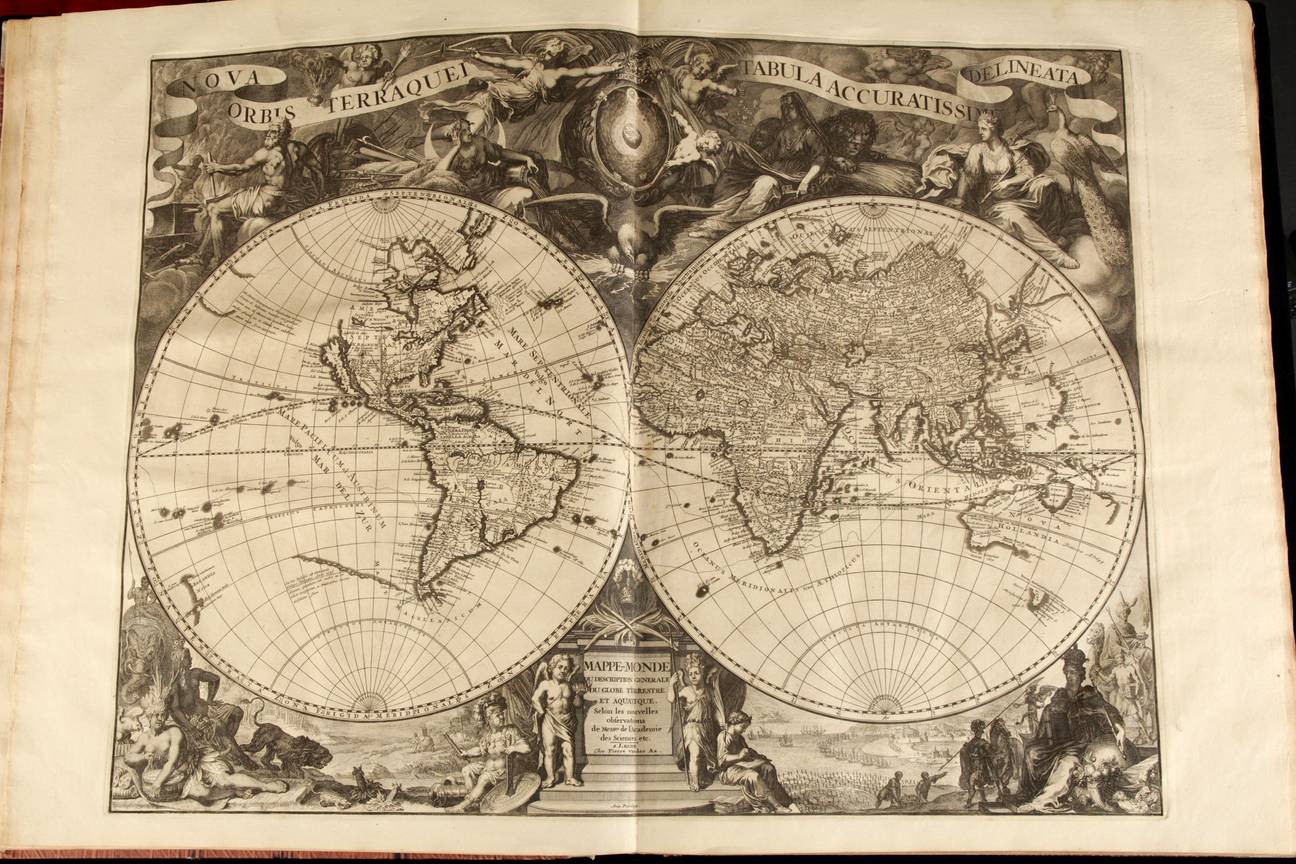
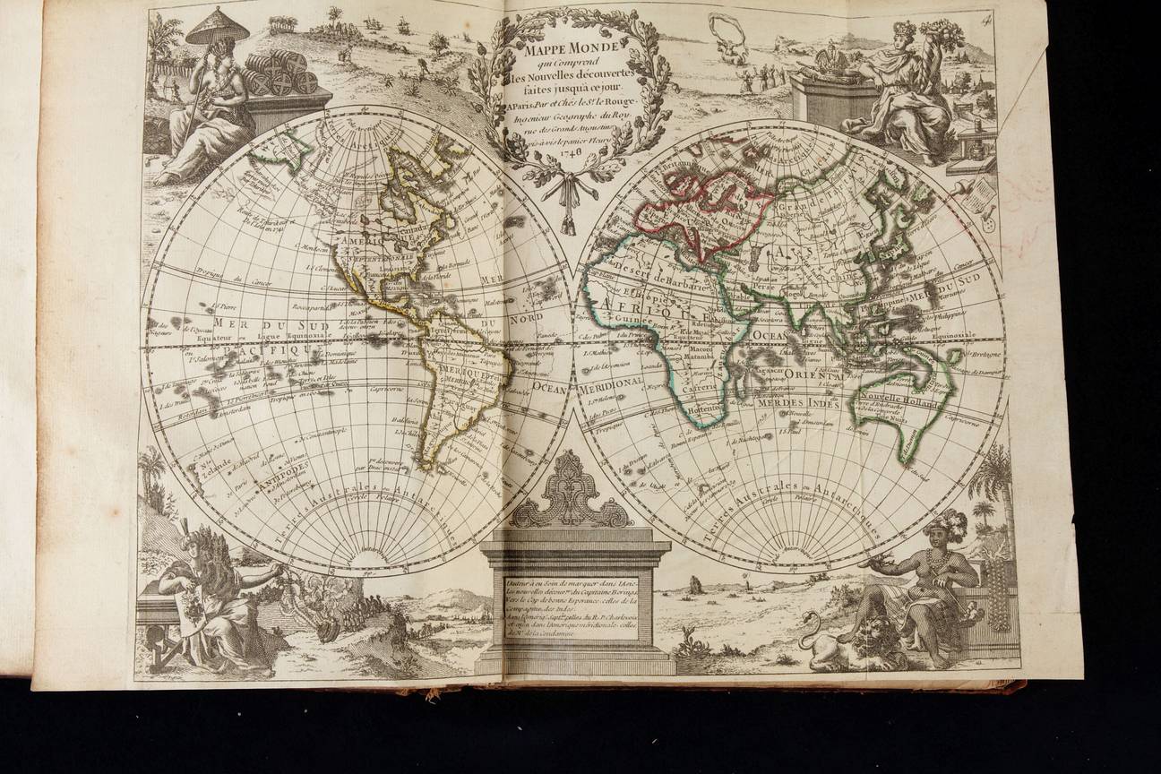
Le Nouveau Theatre du Monde ou la Geographie Royale
Leiden, van der Aa, 1713
(Koeman, Aa 6)
Grand Folio, 56x43 cm
Half vellum and XIX century boards
Letter title page
Engraved title page
Letter title page in red and black
3 nn lvs: dedication, 1 nn leaf: preface, 1nn leaf: index
2 double page folded world maps 50x65 cm
66 and 76 leaves of text in broadsheet (landscape) paper, interleaved with
4 double page continent maps (Europe; Africa; Asia and the Americas) and one double page country map (Italy) plus 88 maps on 44 map sheets covering the whole world but especially the Netherlands and Europe.
Condition: excellent. Strong paper that ...
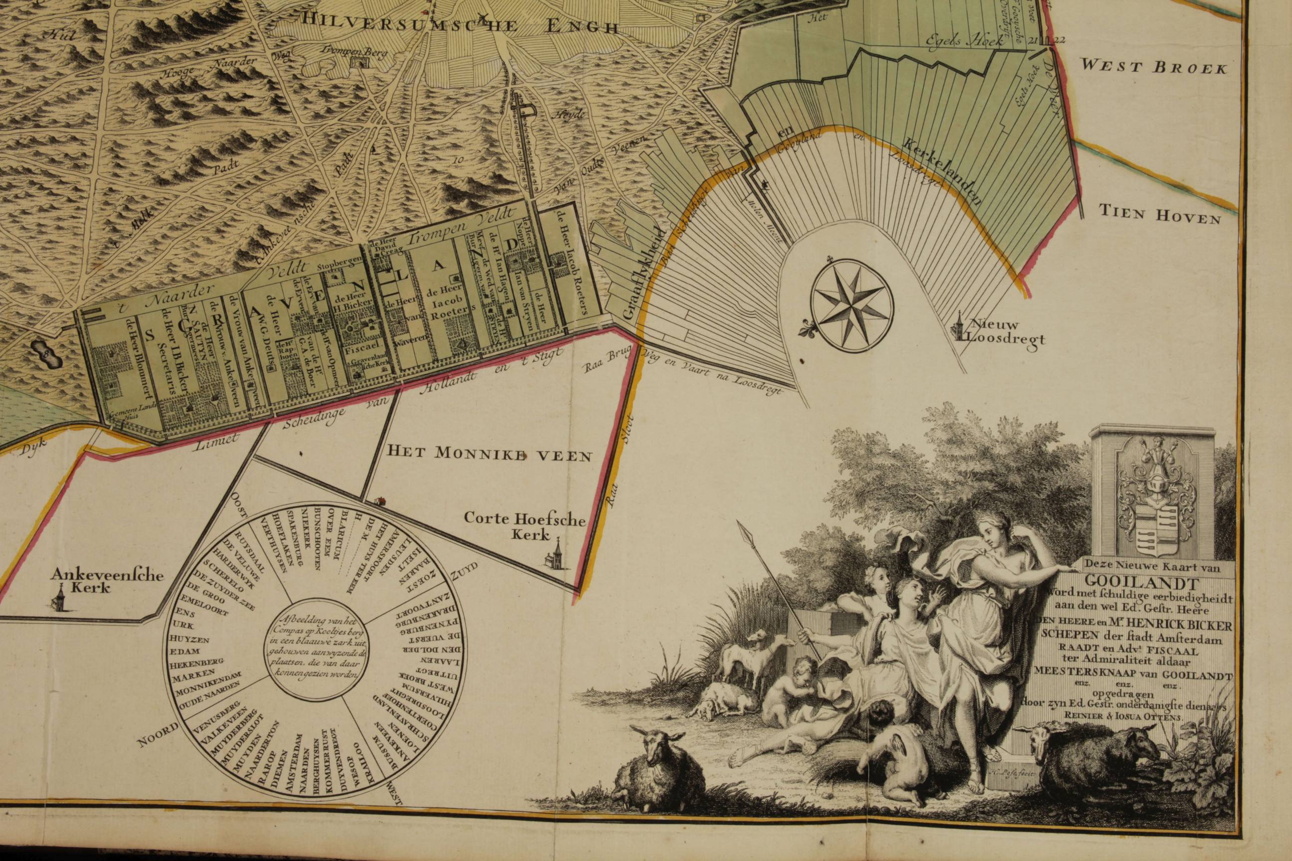
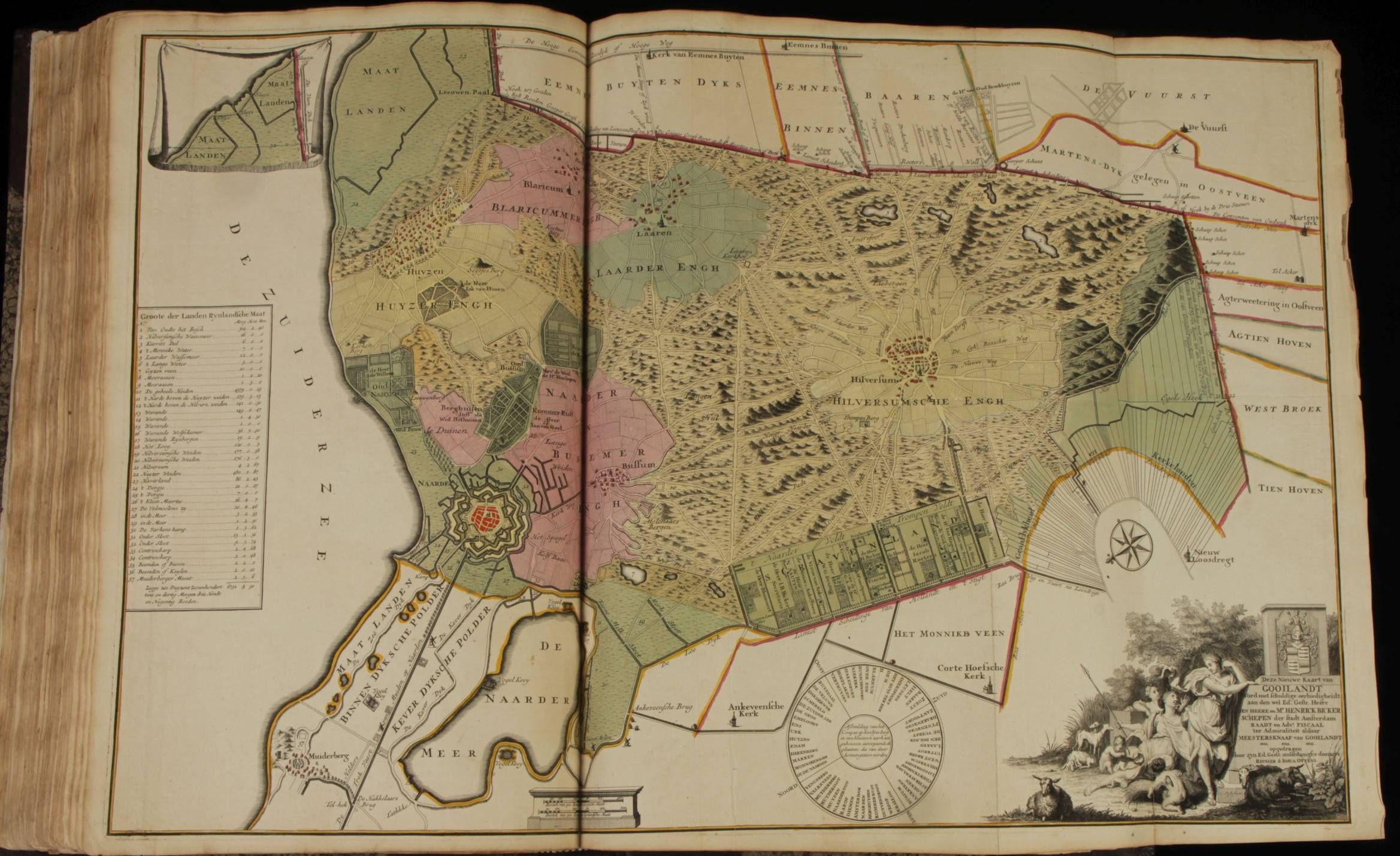
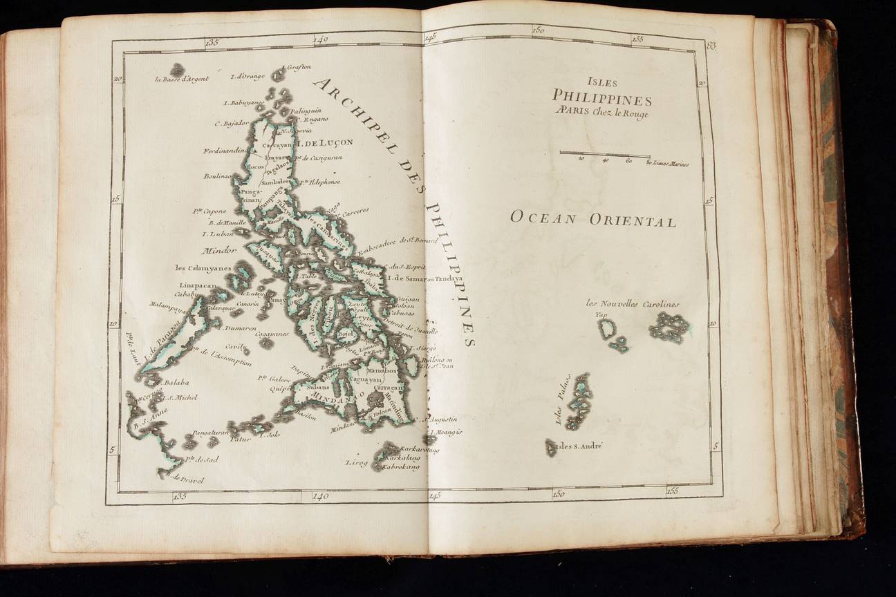
Composite atlas (no title)
Amstelaiedami apud Reinervm et Iosvam Ottens
1730 or shortly afterwards (no date)
Koeman Ott(ens) 1; Cf. Philips 522
Engraved title page, 119 double-page engraved maps of which 14 folded and 6 double-page engravings, all except one coloured in a fine contemporary hand. Special items are:
Leo Hollandicus, Comitatus Hollandiae Denua Formâ Leonis, published by Claas Janszoon Visscher and dated "1648" in the plate
...Nieuwe Kaart van Gooilandt.., Gerrit Post published by R. & J. Ottens, 51x83 cm ca. 1725
Large folio 53,5 x 33 cm, recent binding, made to style.
Rare early 18th-century Dutch composite atlas ...

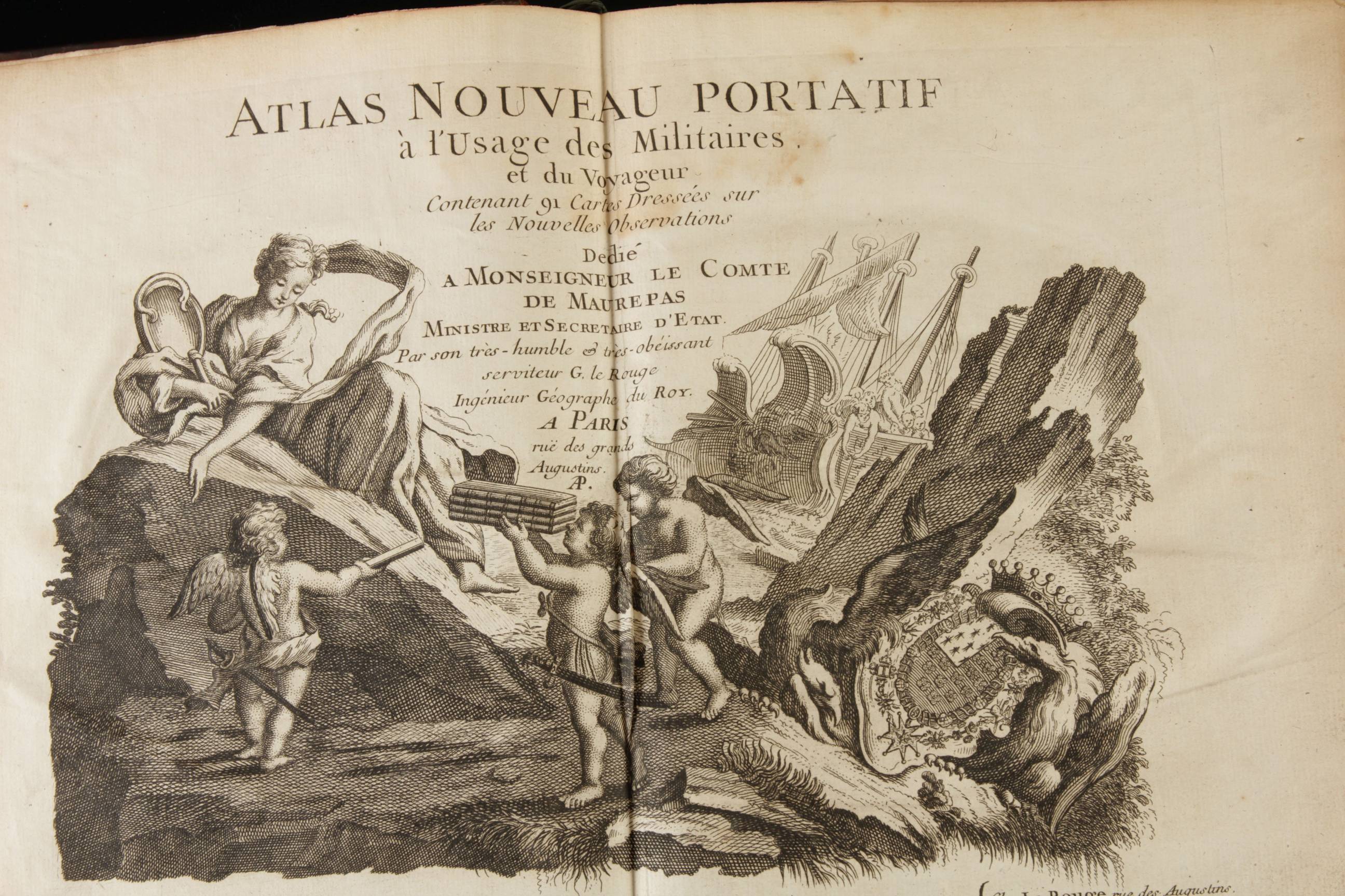
Atlas nouveau portatif a l usage de....
Paris 1756
Small in quarto; contemporary calf
Spine comparted; title and gilt on the spine.
Contemporary fly leaves
Condition : modest waterstain to the first half of the text leaves. Maps clean. Oveall in fine, original, unmanipulated condition
Engraved, double page title page
Letter title page
3 lvs : General presentation
36 pages : Introduction into geography
91 double page maps in contemporary outline color
1 leaf: Register of the maps
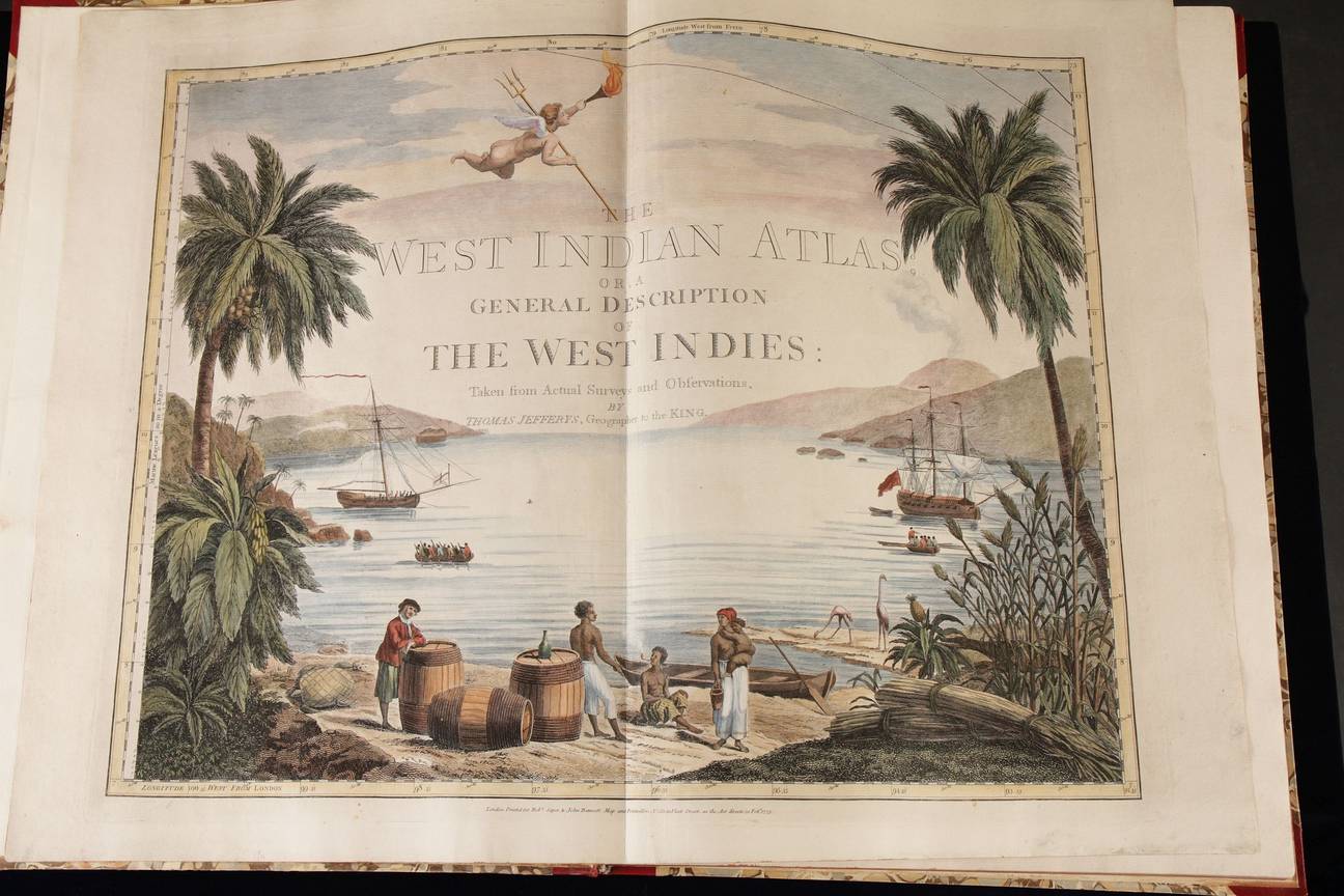
The West-Indian atlas
London, Sayer & Bennet 1775
Sabin 35970;
Grand folio (56x42 cm).
Modern half Morocco
Engraved title page
2 nn lvs; 27 pp;
39 charts, 36 of them double page all in later colour.
The maps measure c 50x63 cm each.
Rare first edition of this detailed, maritime atlas of the Caribbean.
Thomas Jefferys was an outstanding cartographer and publisher...the finest maps of the time of North America and the West Indies For that reason his North American Pilot; West India Atlas and American Atlas went through many re-issues by Sayer and Bennet and Laurie and Whittle. Ours, the very first edition of the West Indian (maritime) Atlas, is rare. ...
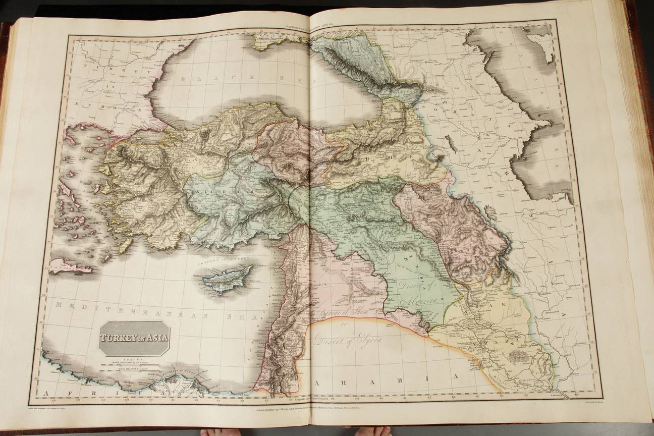
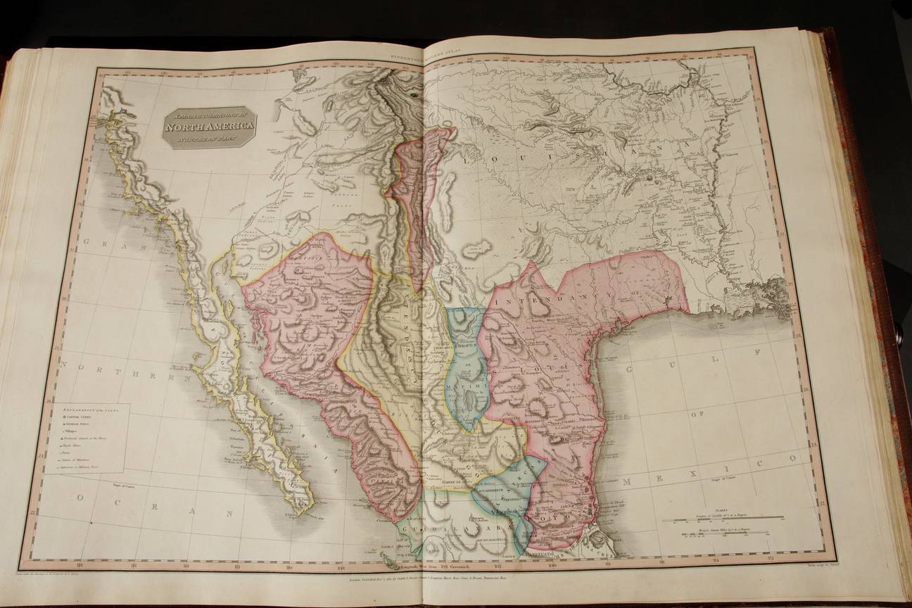
A modern atlas
London , Bensley 1815
Phillips atlases: 724
Grand folio, 55x43 cm, contemporary calf.
Raised bands, title engraved in the spine
Text and 60 double page maps
Contemporary, full body colour
First edition of this huge world atlas with 60 big and very detailed and conscientiously updated maps in contemporary full body hand colour.
The big plates, the strong colours and the geographical detail make this an attractive atlas. The updated political geography in North and South America generally preceding the successful revolutions in the South and expansion into the West in the North make this atlas the more important.
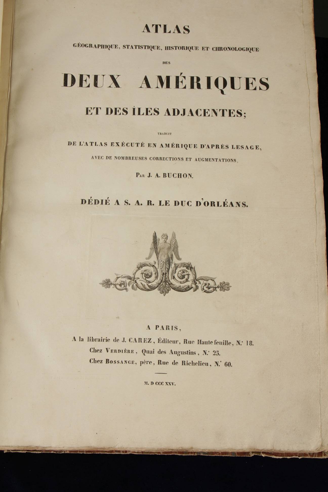
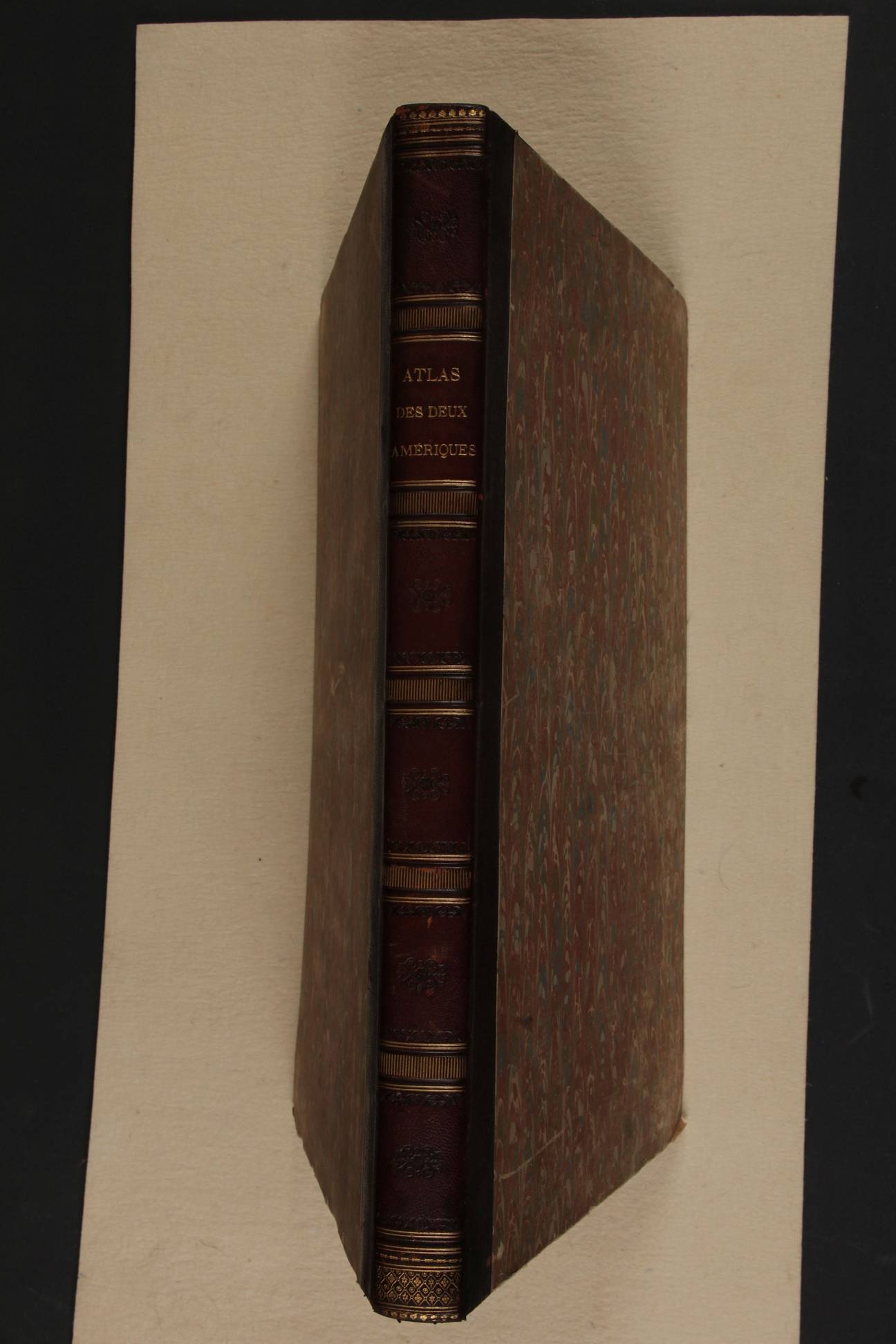
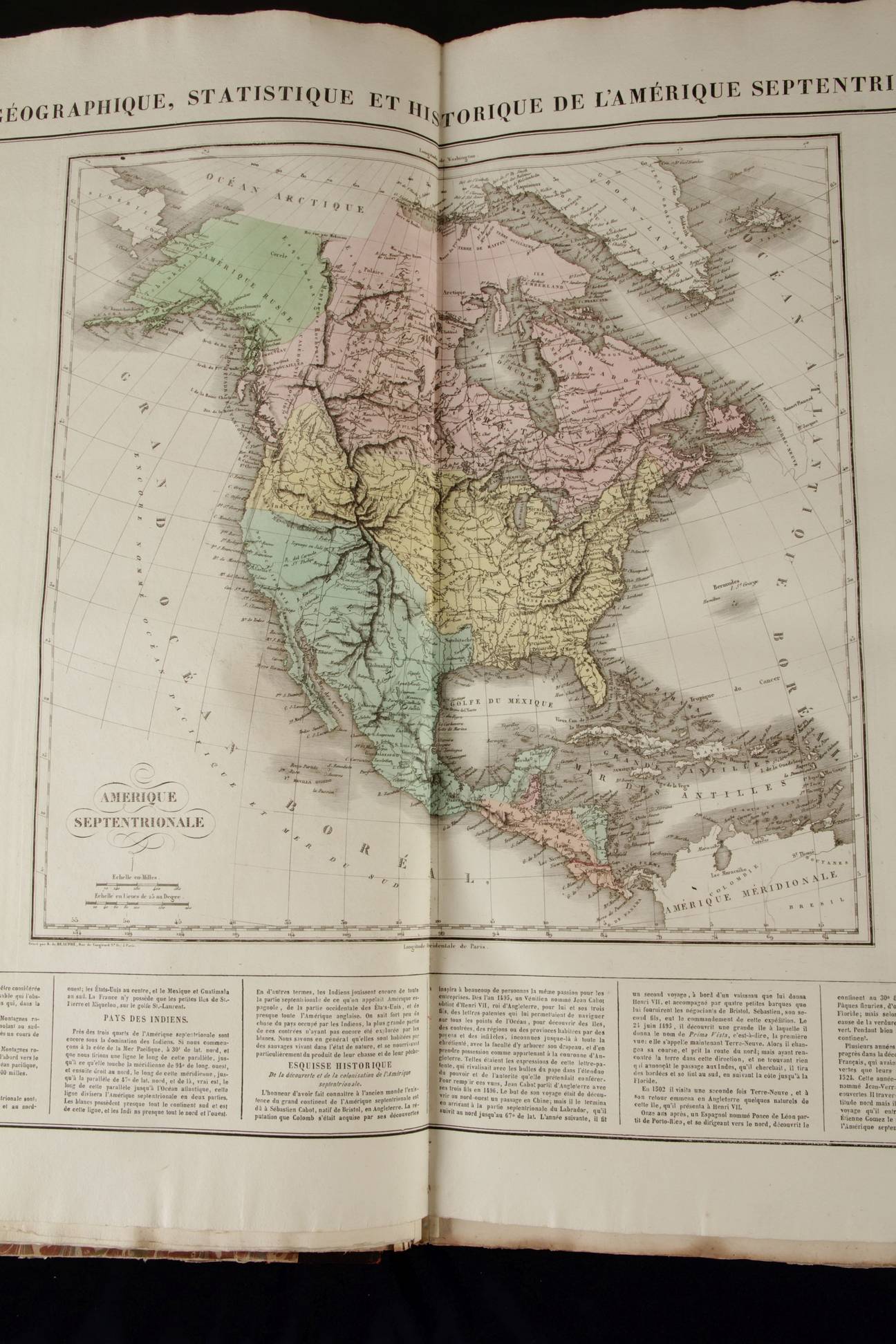
Atlas geographique, statistique...
des deux Ameriques
Paris, Carez. 1825
(Phillips 1167)
Atlas in Gran Folio (55,5x39 cm)
Uncut copy with 51 handcoloured maps and 2 printed tables
Condition: excellent
French and updated edition of the Carey and Lea atlas of the Americas of 1822. It has the 28 States of the United States of the time. This edition of the atlas is of special interest because it captures the South American revolutions. Apart of describing history of the countries concerned to the end in 1824 it includes the brand new constitutions of Haiti (1806); Colombia (1821) and Mexico dated October 4, 1824.
Important maps are:
...