Antique Maps
Tabula Anemographica seu Pyxis Nautica, vulgo Compass Charte
SEUTTER, Matthäus · Augsburg · Matthäus Seutter · [c. 1730-1740]
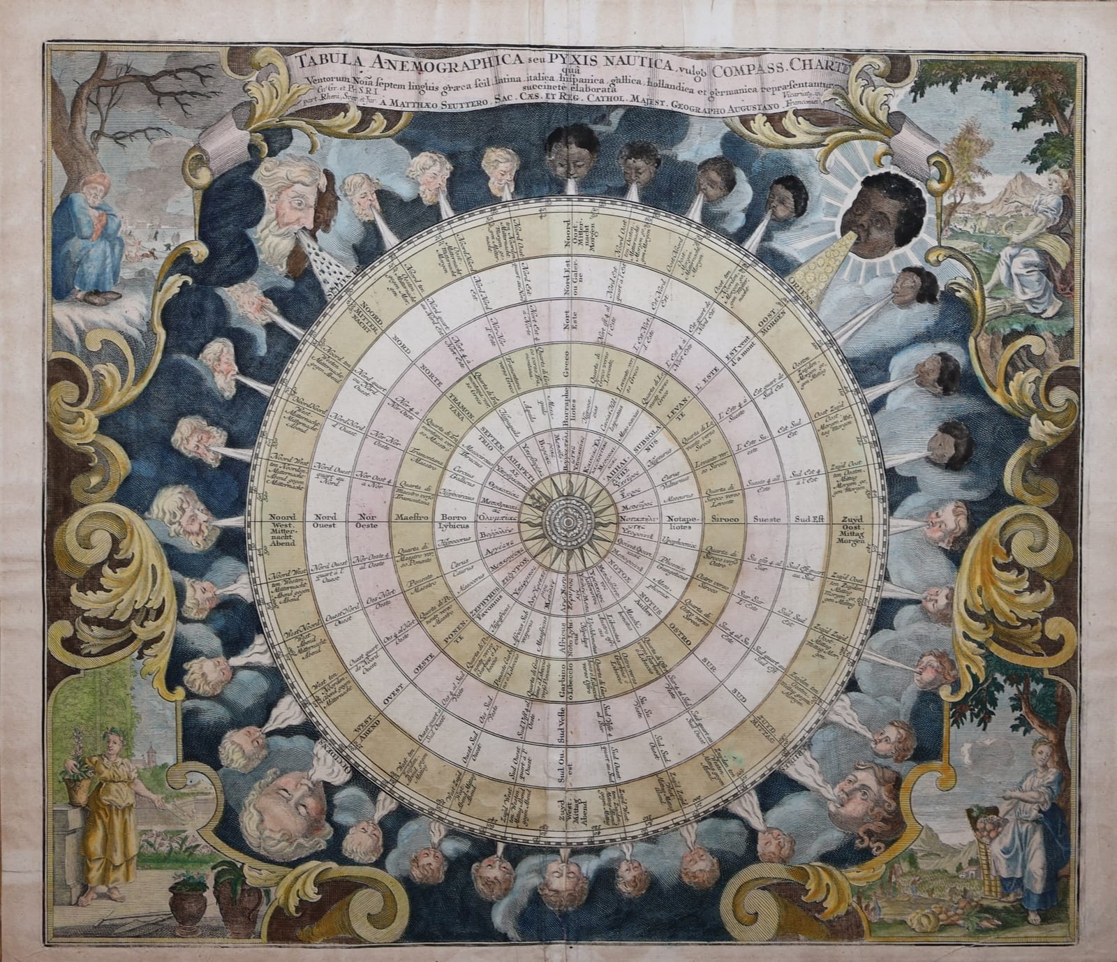
Seutter's decorative wind chart: a 32-point compass rose with the names of the winds in seven languages, surrounded by 32 wind heads and the four seasons, in contemporary hand colour, Augsburg, c. 1730-1740.
FM-0129
€ 2.400
All prices include VAT. Import duties outside the EU are not included.
Free insured shipping. The price shown is the price you pay.
Key Properties
Title: Tabula Anemographica seu Pyxis Nautica, vulgo Compass Charte, qua Ventorum Nomina septem linguis graeca scil. latina, italica, hispanica, gallica, hollandica et germanica repraesentantur
Publisher: Matthäus Seutter, Augsburg, Imperial Geographer
Technique: copper engraving, in contemporary hand colour
Contents: 32-point compass rose, the winds named in Greek, Latin, Italian, Spanish, French, Dutch and German, 32 wind heads, the four seasons in the corners
Size: 53.3 x 61.1 cm
Collation & Technical Description
Single double-page engraved sheet, in contemporary hand colour, with a centre fold.
Size: 53.3 x 61.1 cm.
Condition
Centre fold reinforced on the verso with an old paper strip; a large ring-shaped stain and remnants of old hinges on the verso; pencil numbers on the verso. Light toning to the margins.
Description
At the centre is a compass rose divided into 32 points. Around it, in concentric rings, each point carries the name of its wind in seven languages, as the title promises: Greek, Latin, Italian, Spanish, French, Dutch and German, so that Boreas, Septentrio, Tramontana, Norte, Nord, Noord and Mitternacht can be read side by side.
Around the rose 32 wind heads blow from the clouds, the cold winds of the north as old men, those of the south and east as African heads, with the rising sun in the east marked Oriens. In the corners stand allegorical scenes of the four seasons, winter in the upper left with an old man wrapped against the cold and skaters on the ice.
Historical Significance
Matthäus Seutter (1678-1757) was the leading map publisher of Augsburg in the first half of the eighteenth century and held the title of Imperial Geographer, which he displays in the title here. His wind chart combines the practical compass card of the navigator with the learned tradition of the named winds of antiquity, and the seven languages reflect the mixed vocabulary of European seafaring.