Antique Maps
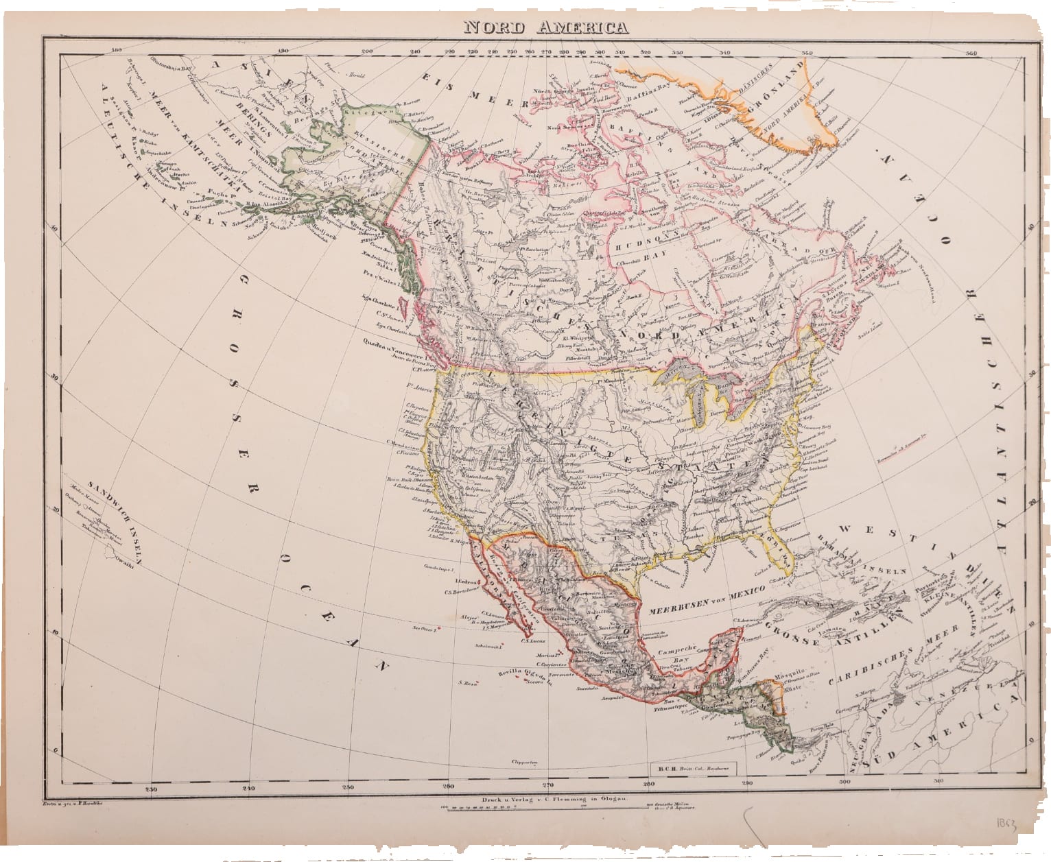
Nord America
Sohr, K. (Handtke, F.) · Glogau · C. Flemming · 1853
North America after the Mexican War: a lithographed map drawn by Friedrich Handtke for Sohr's Hand-Atlas, Glogau, dated 1853 in an old hand, with Alaska still Russian.
FM-0134
€ 250 VAT included (margin scheme)
Free insured shipping. The price shown is the price you pay.
Collation & Technical Description
Lithographed map with outline and wash colour. Sheet 43 x 35 cm.
Condition
Fine condition. Two light water stains on the verso.
References & Bibliography
atlassen.net, Sohr-Berghaus Hand-Atlas, 4e druk (1847-1850), with notes on the first edition of 1844 and on the pseudonym.
Description
Lithographed map of North America from the Hand-Atlas published under the name of Dr. K. Sohr by Carl Flemming in Glogau, Prussian Silesia. Below the border: "Entw. u. gez. v. F. Handtke" and "Druck u. Verlag v. C. Flemming in Glogau", with a scale in German miles. An old pencil note in the lower margin dates the sheet 1853.
The map shows the continent in the years after the Mexican War. Texas and California now lie within the United States, which reach from the Atlantic to the Pacific; Mexico has lost its northern provinces. In the north-west, Alaska and the Aleutians are coloured as Russian America, beside British North America and Danish Greenland. Central America, the West Indies and the northern edge of South America close the map to the south, with the Sandwich Islands set in the Pacific.
Historical Significance
"Dr. K. Sohr" is a pseudonym, most probably of the cartographer Friedrich Handtke, whose own name appears on this sheet. From 1847 the atlas also carried the name of Heinrich Berghaus, against his protest, and as the Sohr-Berghaus Hand-Atlas it was re-edited by Handtke into the 1880s. Set beside the Sohr map of the United States of 1844 (FM-0256), with Texas still a republic, this sheet shows how much of the continent changed hands within a decade; Russian America would follow in 1867.