Antique Maps
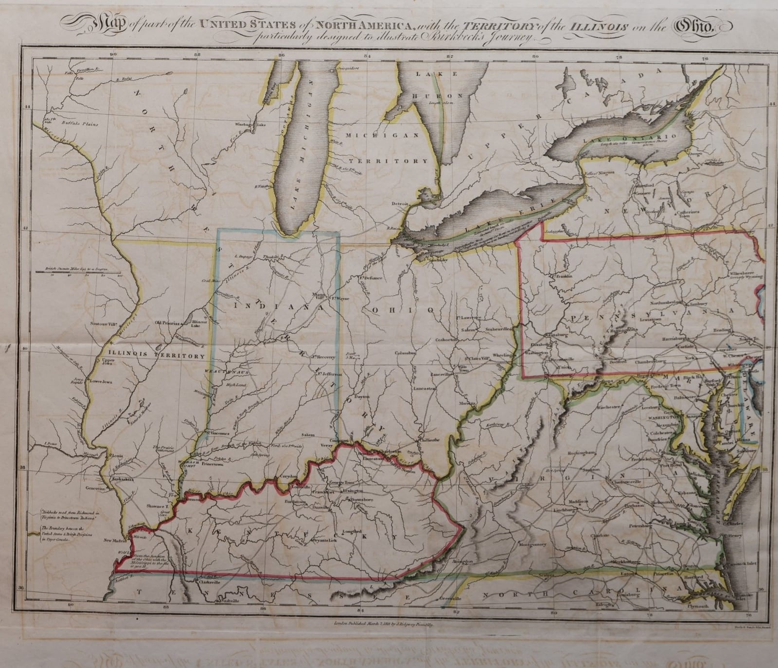
Map of part of the United States of North America, with the Territory of the Illinois on the Ohio, particularly designed to illustrate Birkbeck's Journey
Birkbeck, Morris · London · J. Ridgway · 1818
The Old Northwest two years before Illinois became a state: the folding map made to illustrate Morris Birkbeck's Notes on a Journey in America, London, J. Ridgway, 1818.
FM-0143
€ 1.500 VAT included (margin scheme)
Free insured shipping. The price shown is the price you pay.
Collation & Technical Description
Engraved folding map with outline colour, with the original folds; offset of the title in the lower margin. Sheet 43 x 33 cm.
Condition
Good condition, with minor repairs at the edges.
References & Bibliography
Howes B468 (Birkbeck, Notes on a Journey in America). Indiana Historical Society, Digital Image Collections: London, published March 1818 by J. Ridgway, Piccadilly; Neele & Son. Barry Lawrence Ruderman Antique Maps, stock no. 114640 (Dublin edition, 1818).
Description
Engraved folding map with outline colour, published in London by James Ridgway, Piccadilly, in March 1818, and engraved by Neele & Son, Strand, to accompany the London edition of Morris Birkbeck's Notes on a Journey in America from the Coast of Virginia to the Territory of Illinois.
The map covers the country from the Mississippi to Chesapeake Bay and from the Great Lakes to Tennessee and North Carolina. Illinois is still a territory, as is Michigan; Indiana, Ohio and Kentucky are drawn with their early towns, forts and roads, and much of the land west of Lake Michigan is marked as the North-West Territory, with Indian villages along the rivers. A note at lower left explains the two dotted lines: Birkbeck's road from Richmond in Virginia to Princeton in Indiana, and the boundary between the United States and the British possessions in Upper Canada. As on many maps of the period, the Illinois Territory is placed too far from Lake Michigan, and Chicago is not yet shown.
Historical Significance
Morris Birkbeck (1764-1825), an English farmer and reformer, travelled in 1817 from Norfolk, Virginia, across the Alleghenies and Kentucky to the prairies of the Illinois Territory, where he founded the English Settlement in Edwards County with George Flower; Flower laid out Albion and Birkbeck Wanborough. His Notes on a Journey in America appeared first in Philadelphia and went through eleven English editions within two years, drawing many English emigrants to the Old Northwest. Birkbeck later helped keep Illinois a free state in the slavery debate of 1823-1824. The map shows the region on the eve of Illinois statehood in December 1818.