Antique Maps
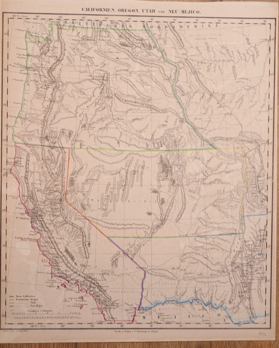
Californien, Oregon, Utah und Neu-Mejico
Sohr, K. (Handtke, F.) · Glogau · C. Flemming · c. 1853
The American Far West in the first years after the Mexican War: California, the Oregon, Utah and New Mexico territories, drawn by Friedrich Handtke for Sohr's Hand-Atlas, Glogau.
FM-0153
€ 575 VAT included (margin scheme)
Free insured shipping. The price shown is the price you pay.
Collation & Technical Description
Lithographed map with outline colour. Sheet 35 x 44 cm.
Condition
Good condition. The outline colour shows through on the verso.
References & Bibliography
atlassen.net, Sohr-Berghaus Hand-Atlas, 4e druk (1847-1850), on the atlas and the pseudonym. Geographicus Rare Antique Maps, Californien, Oregon, Utah, und Neu-Mejico (Flemming, c. 1850), on the dating by the absence of the Gadsden Purchase.
Description
Lithographed map of the American West from the Hand-Atlas published under the name of Dr. K. Sohr by Carl Flemming in Glogau, Prussian Silesia. Below the border: "Entw. u. gez. v. F. Handtke" and "Druck u. Verlag v. C. Flemming in Glogau". Longitudes are given from Ferro at the top and from Paris at the foot. A colour key in the lower left distinguishes the State of California and the territories of Oregon, Utah and New Mexico. An old pencil note in the lower margin dates the sheet 1853.
The map shows the lands gained from Mexico in 1848 in their first political form. California is already a state; Oregon Territory still runs from California to the British border, before Washington was split off; Utah Territory reaches from the Rockies to the California line; and New Mexico Territory stretches west to the Colorado, with its southern boundary still on the Gila River, before the Gadsden Purchase. Mountain ranges are drawn in hachures across the Great Basin.
Historical Significance
"Dr. K. Sohr" is a pseudonym, most probably of the cartographer Friedrich Handtke, whose own name appears on this sheet. Maps of the American West made in the few years between the Mexican cession of 1848 and the reorganisation of the territories in 1853 and 1854 record a short-lived arrangement: here Oregon still includes the later Washington, and New Mexico ends at the Gila. The sheet belongs with the Sohr maps of North America and the United States of 1844 and 1853 (FM-0256, FM-0257, FM-0134), which together follow the westward redrawing of the continent.