Antique Maps
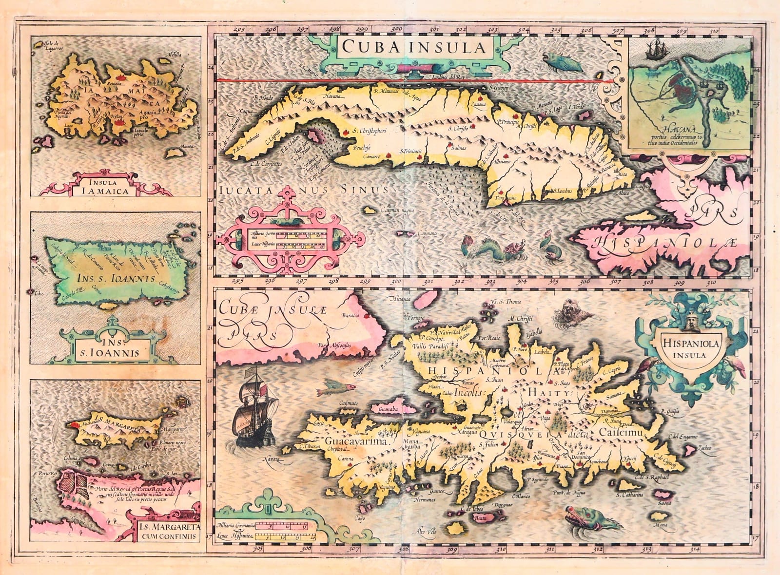
Cuba Insula / Hispaniola Insula / Insula Iamaica / Ins. S. Ioannis / I.S. Margareta cum confiniis (Cuba, Hispaniola, Jamaica, Puerto Rico and Margarita)
MERCATOR, Gerard / HONDIUS, Jodocus · Amsterdam · Jodocus Hondius and successors · 1606 (this impression from a French text edition, 1609-1633)
The Mercator-Hondius map of the Greater Antilles: Cuba with an inset of Havana, Hispaniola, Jamaica, Puerto Rico and Margarita on one sheet, with sea monsters and ships. French text edition, in attractive old colour.
FM-0160
€ 1.400
Key Properties
Copper engraving, five maps on one sheet, c. 35.5 x 49.5 cm (plate). Old colour: islands in yellow and green, borders and cartouches in pink and red. French text on the verso (Isles de la Cube, Espagnole, Iamaique, et S. Iean, et Marguerite). First issued in the Mercator-Hondius Atlas of 1606; this impression from one of the French editions (1609, 1613, 1619, 1628 or 1633). Van der Krogt (Koeman's Atlantes Neerlandici) 9610:1A. Burden, The Mapping of North America, 154.
Collation & Technical Description
One sheet, engraved on both faces of the paper: map recto, letterpress text verso. Cuba with inset plan of the harbour of Havana (Havana, portus celeberrimus); Hispaniola with strapwork title cartouche; at right, from top to bottom, Margarita with the coast of Cumana, Puerto Rico (Ins. S. Ioannis) and Jamaica, each in its own panel. Two sailing ships and two sea monsters. Scale bars in each panel.
Condition
Centre fold as issued. Paper evenly toned, with light browning and a few small stains, chiefly in the lower part of the sheet and along the fold; the verso with a browned patch at the lower centre showing faintly through. Margins adequate all round. The old colour well preserved; the impression strong. A good, unrestored example.
References & Bibliography
Van der Krogt, Koeman's Atlantes Neerlandici, vol. I, 9610:1A. Burden, The Mapping of North America, no. 154.
Description
The standard early seventeenth-century map of the Greater Antilles, first published by Jodocus Hondius in the 1606 Amsterdam edition of Mercator's Atlas, the first to add new maps of America to Mercator's work after Hondius bought the plates from the Mercator heirs in 1604. On a single sheet Hondius arranged five maps: the large islands of Cuba, with an inset plan of the harbour of Havana, and Hispaniola, one above the other, and in a column at the right Margarita with the pearl coast of Cumana, Puerto Rico (Isla de San Juan) and Jamaica. The geography goes back to the Spanish sources used by Ortelius and Wytfliet, but Hondius's sheet is the first to bring the Spanish islands together as a group, with the Havana inset a reminder of the port where the treasure fleets assembled. Strapwork cartouches, ships under sail and a pair of sea monsters complete the engraving in the manner of the Hondius workshop.
This impression comes from one of the French text editions of the Mercator-Hondius Atlas, issued at Amsterdam between 1609 and 1633, and is coloured in an attractive old palette of yellow and green for the islands with pink and red for the borders and cartouches.
Historical Significance
Hondius's Cuba sheet remained the model for the Caribbean in the Mercator-Hondius and Jansson atlases for half a century and is, with the Ortelius and Wytfliet maps, one of the three foundation maps of the Greater Antilles. Its Havana inset is among the earliest printed plans of the harbour.
Provenance
Frederik Muller Rare Books, Amsterdam (stock of the firm).