Antique Maps
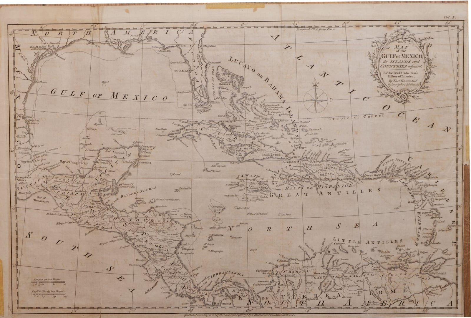
Map of the Gulf of Mexico, the Islands and Countries adjacent
Kitchin, Thomas · London · W. Strahan and T. Cadell · 1777
The Caribbean and the Gulf of Mexico on the eve of the American Revolution: Thomas Kitchin's folding map for the first edition of William Robertson's History of America, London, 1777.
FM-0167
€ 350 VAT included (margin scheme)
Free insured shipping. The price shown is the price you pay.
Collation & Technical Description
Engraved folding map with outline colour, with the original folds. Sheet 54 x 38 cm.
Condition
Slight tears and repairs around the edges, slight browning; otherwise in good condition.
References & Bibliography
Geographicus Rare Antique Maps, Map of the Gulf of Mexico, the Islands and Countries Adjacent (Kitchin, 1777): based on d'Anville 1746, prepared for Robertson's History of America, later dated 1795; OCLC 644944493. Robertson, W., The History of America (London: W. Strahan and T. Cadell, 1777).
Description
Engraved map of the Gulf of Mexico, the West Indies and the surrounding coasts, made by Thomas Kitchin, Hydrographer to His Majesty, for the first edition of the Rev. Dr. William Robertson's History of America. Imprint below the border: "Published according to Act of Parliament Sept. 29th 1777 by W. Strahan and T. Cadell in the Strand"; "Vol. I." in the upper right corner. The title stands in a rococo cartouche, with a compass rose below; longitudes are reckoned west from Ferro, and scales are given in leagues and English miles.
The map runs from the Mississippi and New Orleans to the mouth of the Orinoco. Florida is drawn as a broken peninsula of islands and lagoons; the Bahamas, Cuba, Jamaica, Hispaniola and Puerto Rico are named in detail, with the Lesser Antilles from the Virgin Islands down to Trinidad. On the mainland the provinces of New Spain, Yucatán, Chiapas, Guatemala, Honduras, Nicaragua and Costa Rica lead south to the Isthmus of Panama and the coast of Tierra Firme, from Cartagena to Caracas and Cumaná. On the Texas coast a note marks where La Salle settled in 1685.
Historical Significance
William Robertson (1721-1793), principal of the University of Edinburgh, published his History of America in 1777, as the war with the American colonies began; it was one of the most widely read histories of the Spanish conquest. Kitchin's map, based on d'Anville's map of North America of 1746, shows the Caribbean as the theatre in which Britain, Spain and France would fight in the years that followed. The map was reissued in later editions, with the date changed to 1795; this example carries the original imprint of 1777.