Antique Maps
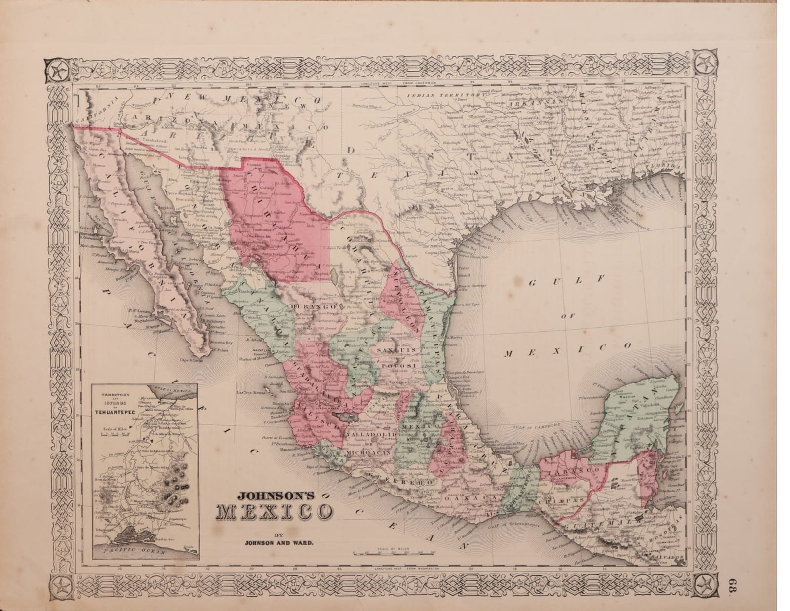
Johnson's Mexico
Johnson, A. J. (Johnson and Ward) · New York · Johnson and Ward · c. 1863-1865
Mexico state by state, with an inset of the Isthmus of Tehuantepec, from Johnson's New Illustrated Family Atlas, New York, published under the Johnson and Ward imprint of 1862 to 1865.
FM-0168
€ 200 VAT included (margin scheme)
Free insured shipping. The price shown is the price you pay.
Collation & Technical Description
Map with hand colour, inset of the Isthmus of Tehuantepec; text on the verso as issued. Sheet 46.5 x 36.5 cm.
Condition
Good condition.
References & Bibliography
Rumsey 0352.045 (Johnson's Mexico by Johnson and Ward, with inset Territory and Isthmus of Tehuantepec, Johnson's New Illustrated Family Atlas, 1864). Phillips, Atlases, 6140-49 (Johnson's Family Atlas). Geographicus Rare Antique Maps, Johnson's Mexico (1861), on the Johnson and Browning and Johnson and Ward imprints.
Description
Map of Mexico from Johnson's New Illustrated Family Atlas, signed in the title cartouche "Johnson's Mexico by Johnson and Ward", within the decorative strapwork border typical of the Johnson atlases, page number 68 in the right margin. The Mexican states are distinguished in hand colour, from Lower California, Sonora and Chihuahua to Yucatán, Tabasco and Chiapas, with relief in hachures and longitudes given both from Greenwich and from Washington. Across the northern border lie California, Arizona, New Mexico and Texas, with forts, settlements and notes such as "Desert, uninhabited"; the Gulf coast runs east to Louisiana and Florida.
An inset at lower left shows the Territory and Isthmus of Tehuantepec, then the subject of American projects for an interoceanic road, railway or canal between the Gulf of Mexico and the Pacific.
On the verso, as issued in the atlas, the text "Historical and statistical view of the West India Islands or Columbian Archipelago", with tables of the islands, their governments and populations for 1860, and population by divisions for Cuba and Puerto Rico.
Historical Significance
Alvin Jewett Johnson's Family Atlas grew out of the Colton atlas maps; the map historian Walter Ristow suggested that J. H. Colton sold his copyrights to Johnson. The imprint dates the sheet: Benjamin P. Ward bought into the firm in 1861, the Ward name first appears on maps of 1862 used in the 1863 issue, the 1864 atlas is the first fully under Johnson and Ward, and the partnership ended after 1865. The map therefore belongs to the years of the French intervention in Mexico, while its northern border shows the settlement reached after the Mexican War and the Gadsden Purchase.