Antique Maps
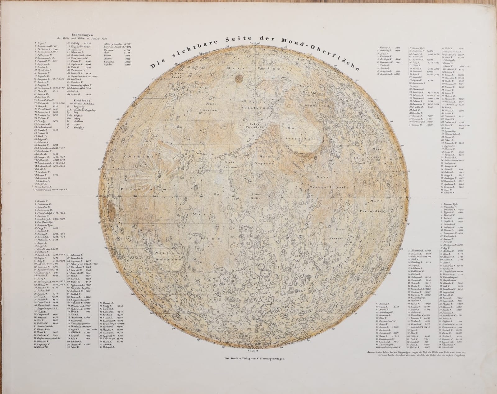
Die sichtbare Seite der Mond-Oberfläche
Sohr, K. · Glogau · C. Flemming · c. 1844
A map of the visible face of the Moon from Sohr's Hand-Atlas, Glogau, c. 1844, with tables naming several hundred craters, plains and mountains and giving their depths and heights in Paris feet.
FM-0169
€ 250 VAT included (margin scheme)
Free insured shipping. The price shown is the price you pay.
Collation & Technical Description
Lithographed map with colour wash. Sheet 44.5 x 35.5 cm.
Condition
Very good condition. The image shows faintly through on the verso.
References & Bibliography
atlassen.net, Sohr-Berghaus Hand-Atlas, 4e druk (1847-1850), on the atlas and the pseudonym. The Moon wiki, Beer and Mädler, on the Mappa Selenographica (1834-1836) and Der Mond (1837).
Description
Lithographed map of the near side of the Moon, from the Hand-Atlas published under the name of Dr. K. Sohr by Carl Flemming in Glogau, Prussian Silesia, whose first edition appeared in 1844. Below the disc: "Lith. Druck u. Verlag von C. Flemming in Glogau".
The disc, with a graticule and the north and south poles marked, shows the maria in a soft wash, from Mare Frigoris and Mare Imbrium to Mare Tranquillitatis, Mare Nubium and Oceanus Procellarum, and covers the surface with numbered craters and ranges. Around it, four numbered lists, one for each quarter of the disc, name the features and give, under the heading "Benennungen der Tiefen und Höhen in Pariser Fuss", the depth of each ring mountain below its wall and, where two figures are given, the height of the wall above the surrounding plain, as the note at the lower right explains. A key explains the abbreviations used: ring mountain, radiating ring mountain, mountain, walled plain, crater, depression.
Historical Significance
A general atlas that gave a full sheet to the Moon, with measured depths and heights, reflects how quickly selenography became part of popular geography in the 1830s and 1840s, after Wilhelm Beer and Johann Heinrich Mädler published their great map of the Moon in four quadrants (1834-1836) and its accompanying volume Der Mond (1837). "Dr. K. Sohr", the name on the atlas, is a pseudonym, most probably of the cartographer Friedrich Handtke.