Antique Maps
Mexico
Lowry, J. W. (Blackie & Son) · Glasgow, Edinburgh and London · Blackie & Son · c. 1859
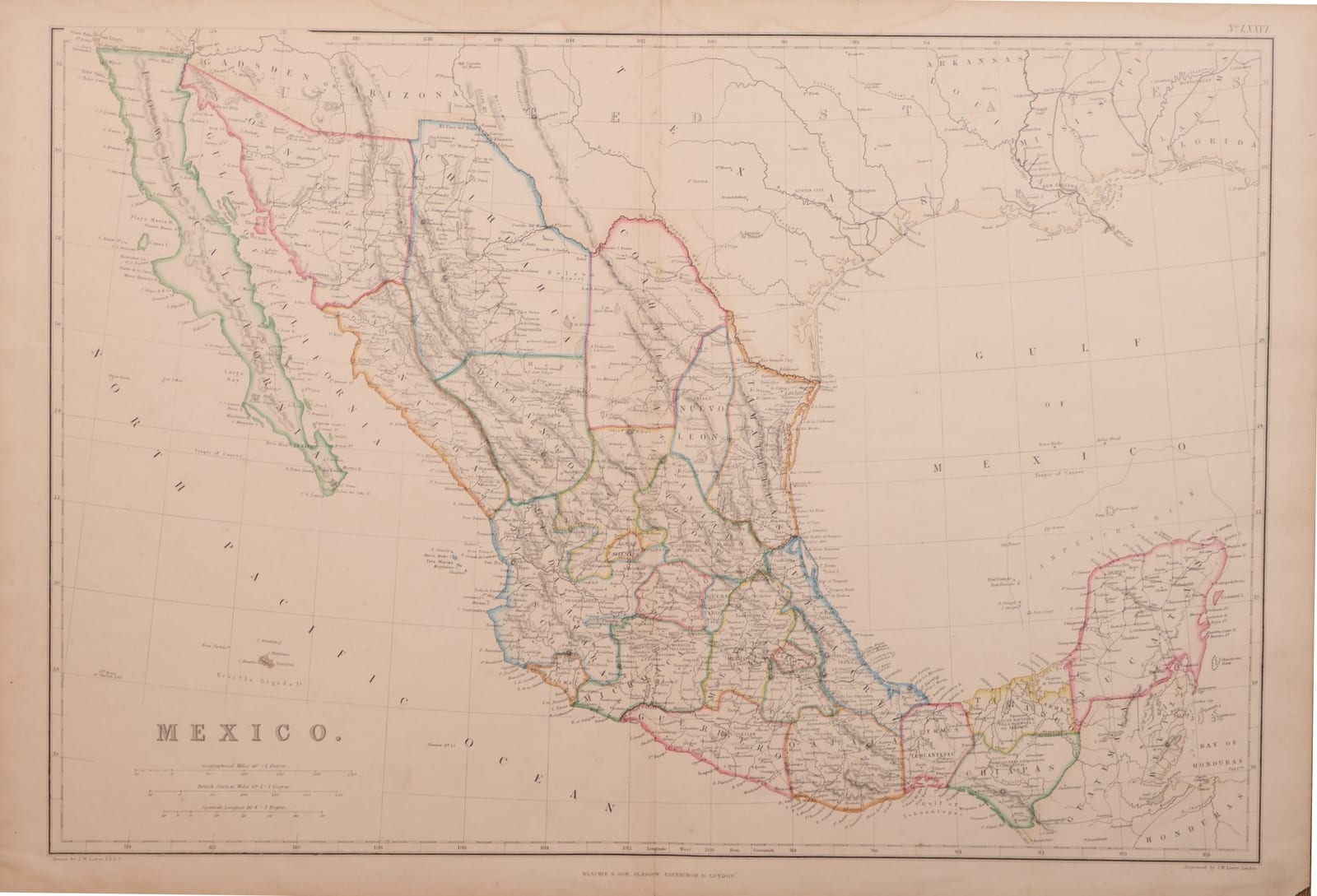
Mexico after the Gadsden Purchase, with Texas and the Gulf states, engraved by Joseph Wilson Lowry for Blackie's Imperial Atlas of Modern Geography, c. 1859.
FM-0170
€ 225 VAT included (margin scheme)
Free insured shipping. The price shown is the price you pay.
Collation & Technical Description
Engraved map with outline colour, centre fold as issued, verso blank. Sheet 55 x 37 cm.
Condition
A light water stain along the upper edge, visible on the verso.
References & Bibliography
Princeton University Library, Digital Maps: Lowry, Mexico, [ca. 1859?], "probably issued in The imperial atlas of modern geography ... London: Blackie and Son, 1859"; "No. LXXVI" in upper right margin.
Description
Engraved map of Mexico from The Imperial Atlas of Modern Geography published by Blackie & Son, Glasgow, Edinburgh and London. Lower left "Drawn by J. W. Lowry F.R.G.S.", lower right "Engraved by J. W. Lowry, London", plate number "No. LXXVI" in the upper right corner. Longitudes are reckoned west from Greenwich, with scales in geographical miles, British statute miles and Spanish leagues. Relief is shown by hachures.
The map shows Mexico in the form it took after the Mexican War and the Gadsden Purchase. The states are distinguished in outline colour, from Lower California and Sonora to Yucatán and Chiapas; across the northern border the names Gadsden and Arizona mark the strip bought from Mexico in 1853-1854, and Texas, Louisiana and the Gulf coast to Florida fill the upper right, with New Orleans, Galveston and Austin City. Guatemala, Belize and Honduras close the map to the south-east.
Historical Significance
The map was drawn and engraved by the London engraver Joseph Wilson Lowry (1803-1879) for Blackie's Imperial Atlas of Modern Geography, edited by W. G. Blackie and published in 1859, the probable source of this sheet. Placed beside the German Sohr maps of 1844 and 1853 in the collection (FM-0258, FM-0153), it shows the last stage of the redrawing of the border: after the Gadsden Purchase, the line between Mexico and the United States ran where it runs today.