Antique Maps
Imperii Abassini Tabula Geographica (Ethiopia)
Francesco Eschinardi · Rome · Published in connection with Melchisedech Thevenot's collection of voyages · 1674
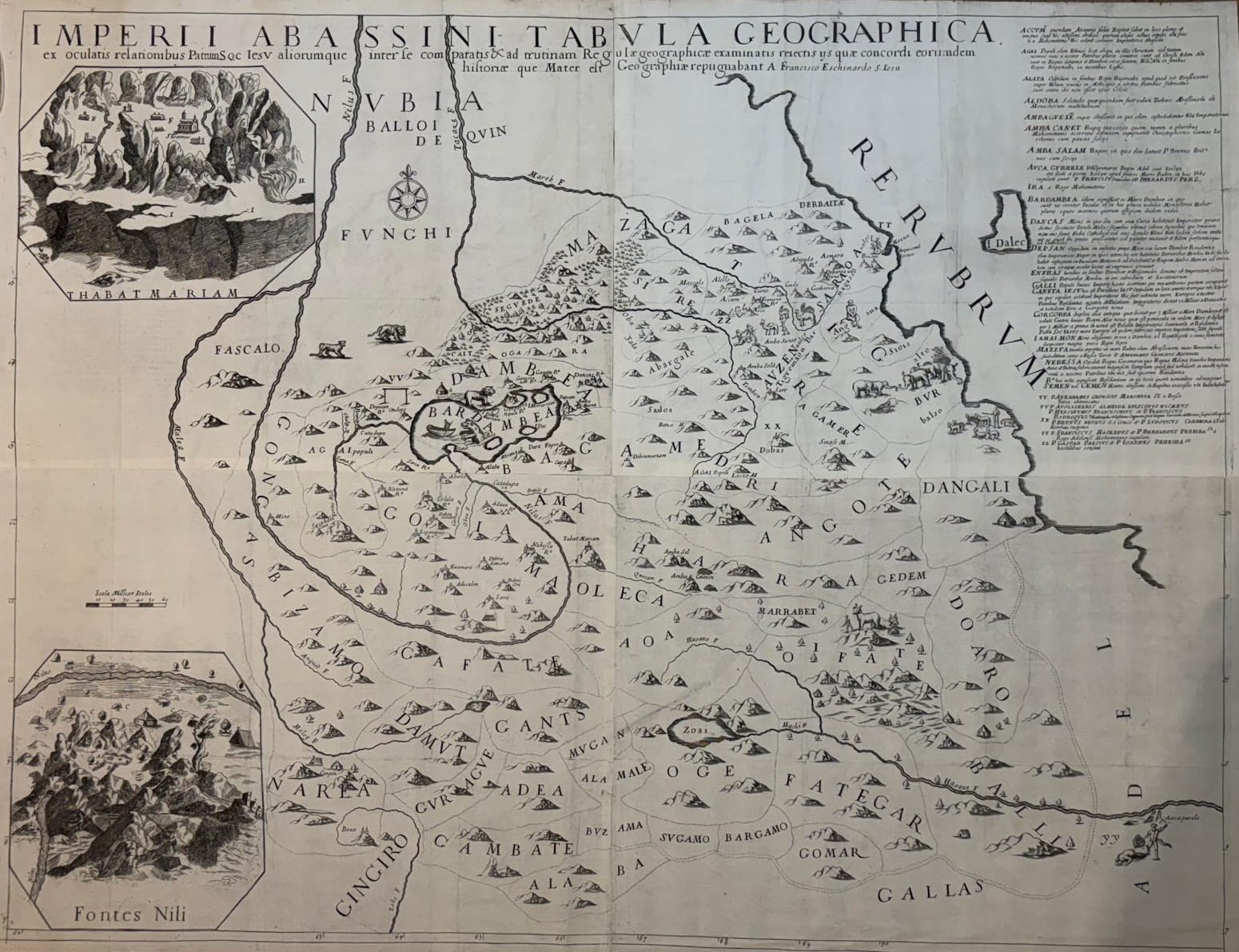
Francesco Eschinardi, monumental four-sheet Jesuit map of the Abyssinian Empire with the Fontes Nili and Thabat Mariam insets, published with Thevenot's collection of voyages, Rome 1674
FM-0174
€ 5.000
Key Properties
Edition: The four-sheet map, joined to form a single monumental map
Language: Latin
Format: Engraved map on four sheets, joined, c. 95 x 72 cm
Colouring: Uncoloured, as issued
Collation & Technical Description
A monumental and exceptionally detailed map of the Abyssinian Empire (Ethiopia), engraved on four copperplates and joined to form a single map of c. 95 x 72 cm. The full title, beginning Imperii Abassini Tabula Geographica, states that the geography was compiled from the eyewitness accounts of Fathers of the Society of Jesus and other sources, compared and examined according to geographical principles by Francesco Eschinardi in Rome (ex oculatis relationibus Patrum Soc. Iesu). The map is filled with engraved mountain ranges, rivers, settlements, churches, routes, animals and other pictorial detail, and the large explanatory text panel at the upper right identifies and comments upon numerous places and regions, making the sheet both a geographical map and a visual compendium of contemporary European knowledge of Abyssinia. Two large inset views: Fontes Nili, depicting the celebrated sources of the Nile in the Ethiopian highlands, and Thabat Mariam, a dramatic view of the Ethiopian mountain landscape with religious buildings and settlements.
Condition
A very fine and unusually well-preserved example. Strong, clear and well-defined impression throughout, the engraved details notably fresh. Generous margins. The two important inset views are complete and particularly well preserved. Some original folds and minor handling creases, as is normal for a map of this exceptionally large multi-sheet format; a few small repairs, neatly executed, otherwise no significant loss or staining apparent. A highly attractive example in very good condition.
References & Bibliography
Bibliothèque nationale de France, Imperii Abassini Tabula Geographica, 1674, recorded as a four-sheet map of approximately 92 x 70.5 cm. Sabin 68430 (in connection with Thévenot's Recueil de divers voyages). Cf. Tooley, Mapmakers, II, p. 30.
Description
One of the most ambitious seventeenth-century printed maps devoted specifically to Abyssinia, published in 1674 in connection with Melchisédech Thévenot's celebrated collection of voyages. Its exceptional size, dense geographical content and extensive pictorial detail distinguish it from the more conventional atlas maps of seventeenth-century Africa.
The map incorporates geographical information gathered by Jesuit missionaries who had travelled in Ethiopia and recorded the country from direct observation. That body of knowledge produced a substantially more informed European representation of the Ethiopian highlands and, especially, of the course and sources of the Blue Nile. The inset Fontes Nili depicts the celebrated sources of the Nile: European interest in the origin of the river had persisted since antiquity, and the Jesuit reports from Ethiopia provided some of the most important first-hand information available in seventeenth-century Europe, which gives the map a significance well beyond regional Ethiopian cartography. The second inset, Thabat Mariam, adds a dramatic view of the mountain landscape with its churches, visual testimony to the Jesuit geographical and missionary sources on which Eschinardi drew.
Historical Significance
Francesco Eschinardi (1623 to 1703) was an Italian Jesuit, mathematician, scientist and cartographer active in Rome, and his map stands at the meeting point of Jesuit missionary science and the European fascination with the Nile. The combination of the monumental four-sheet format, the Jesuit eyewitness sources, the early cartography of Ethiopia and the Blue Nile, and the striking Fontes Nili and Thabat Mariam inset views makes this one of the most distinctive maps of seventeenth-century Abyssinia.
Provenance
Available on request.