Antique Maps
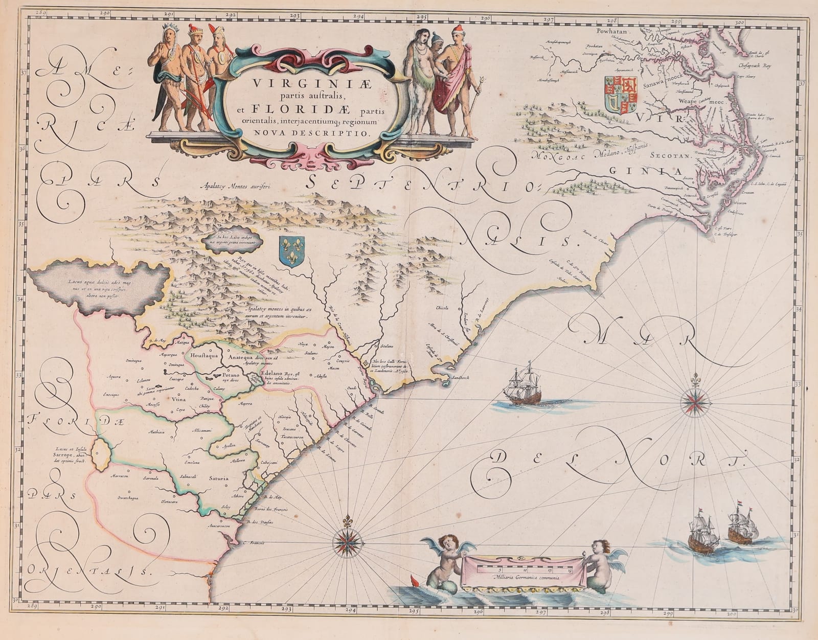
VIRGINIAE PARTIS AUSTRALIS, ET FLORIDAE PARTIS ORIENTALIS
Willem Janszoon Blaeu · Amsterdam · Willem (and Joan) Blaeu · c. 1640–1644; second state
Willem Janszoon Blaeu, Virginia, the Carolinas and Florida
FM-0019
€ 1.250
Key Properties
Edition: Second state
Language: French (text on verso)
Collation & Technical Description
Hand-coloured copper engraving. Sheet approx. 17½ × 21¾ in. Second state: the longitude sequence misnumbered 298, 299, 200, and the left-hand water-putto with the characteristic small tail. Burden, The Mapping of North America, no. 253, state 2.
Condition
The example appears good, with wide margins, a strong impression and attractive colouring. An additional vertical printer's crease is visible around the centre and there are a few minor edge defects. The colour appears plausibly old, but has not yet been confirmed as contemporary.
References & Bibliography
Burden, The Mapping of North America, no. 253, state 2 (small ‘tail’ on the left water-putto; longitude misnumbered 298, 299, 200).
Re-engraved from Blaeu's map in Le Théâtre du Monde, 1638; second state c. 1640.
Description
An important and visually strong map of the American south-east by Willem Blaeu. The sheet shows parts of Virginia and Chesapeake Bay, North Carolina, South Carolina, Georgia and northern Florida.
The map is recognisable as the second state. Along the lower edge the longitude sequence reads erroneously 298, 299, 200 instead of 298, 299, 300. In addition, the winged putto by the scale cartouche has the characteristic small tail.
The map is decoratively rich: a cartouche with native figures at the top, ships sailing in the Atlantic, and a scale cartouche borne by putti at the foot. The American subject makes the sheet internationally desirable.
Notable features: Blaeu map of early colonial America; Second state, recognisable by the putto and the longitude error; Strong decorative cartouches, ships and compass roses.
Historical Significance
One of the most artistically successful maps of seventeenth-century America; re-engraved from Blaeu's 1638 map, it provided the best depiction of the south-east until 1700.
Provenance
Not established.