Antique Maps
Terra Sancta, sive Promissionis, olim Palestina (The Holy Land)
DE WIT, Frederick · Amsterdam · Frederick de Wit, in de Calverstraet by den Dam in de Witte Pascaert · c. 1670-1680 (plate first published c. 1662-1666)
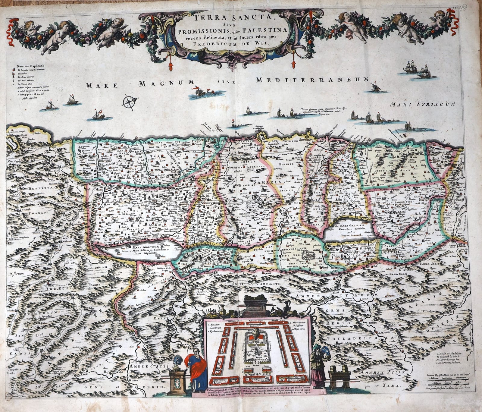
De Wit's large map of the Holy Land, Amsterdam c. 1670-1680, in old hand colour: the twelve tribes, the encampment of the Israelites with Moses and Aaron, the Ark of the Covenant, Solomon's fleet at sea and a border of putti with garlands of fruit and flowers.
FM-0208
€ 950
Key Properties
Edition: Frederick de Wit's own issue with his Kalverstraat imprint ('Gedruckt tot Amsterdam by Frederick de Wit in de Calverstraet by den Dam in de Witte Pascaert'), the plate first published c. 1662-1666; the engraved number 22 in the upper right corner places this impression in De Wit's atlases of the 1670s, before the plate passed to Covens and Mortier in 1710.
Map: oriented with west at the top; the title in a cartouche at the top centre flanked by six putti carrying garlands of fruit and flowers; the key ('Notarum Explicatio') upper left; a compass rose and ships in the Mediterranean, among them the fleet that Hiram of Tyre sent to Solomon (1 Kings 9); the scale of German and Italian miles and the imprint lower right.
Inset: the camp of the Israelites in the desert with the Tabernacle at its centre and the twelve tribes in their stations, with the Ark of the Covenant above and Moses and Aaron at the sides, with a Latin explanation.
Content: the land divided among the twelve tribes in colour, from Sidon and Damascus to the Sinai and the Red Sea, with the Dead Sea, the Sea of Galilee, Edom, Moab, Ammon and the Arabian deserts.
Colour: old hand colour, the tribes outlined in pink, green and yellow, the cartouches, ships and figures in full colour.
Dimensions: engraved surface approximately 46 x 55 cm; sheet 49.5 x 58.5 cm.
Verso blank.
Collation & Technical Description
One engraved sheet, verso blank, the vertical centre fold as issued. Engraved surface approximately 46 x 55 cm, the sheet 49.5 x 58.5 cm, with ample margins.
Condition
Good. Old hand colour, strong. Centre fold as issued. Paper evenly age-toned with some light spotting and small marks in the margins and a few in the image, the upper corners a little rubbed. A full sheet with wide margins.
References & Bibliography
Laor, Maps of the Holy Land, 860. Carhart, Frederick de Wit and the First Concise Reference Atlas (2016), 14.7. Cf. Van der Krogt, Koeman's Atlantes Neerlandici, for De Wit's atlases.
Description
Frederick de Wit's map of the Holy Land, one of the most decorative of the Dutch Terra Sancta maps of the seventeenth century. De Wit (1630-1706), who set up as an engraver and print-seller in Amsterdam in the 1650s and by the 1670s had built up one of the largest map businesses of the city, took the map from the Terra Sancta that Nicolaes Visscher had published in 1659 and gave it a new cartouche of putti and garlands running the full width of the sheet. The map is drawn in the tradition of the Visscher and Blaeu maps of the Holy Land, with the west at the top, so that the Mediterranean fills the upper part of the sheet and the land runs from Phoenicia and Damascus at the right to Egypt and the Sinai at the left.
The territory is divided among the twelve tribes, each in its own colour, with Samaria, Galilee, Judaea and the lands beyond the Jordan named in capitals and hundreds of biblical places marked. Along the coast ships sail in the Mediterranean, including, as the inscription explains, the fleet of the ships of Hiram, king of Tyre, sent to Solomon. In the lower centre an inset shows the camp of Israel in the desert with the Tabernacle at its centre and the twelve tribes drawn up around it in the order of the Book of Numbers, the Ark of the Covenant above and the figures of Moses and Aaron at either side.
The present impression carries De Wit's own imprint in the Kalverstraat and the atlas number 22, and belongs to the atlases he assembled in the 1670s. It is in old hand colour throughout.
Historical Significance
The map of the Holy Land was a fixture of the Dutch atlas and of the Dutch Bible, and the Visscher and De Wit maps are its classic seventeenth-century form. De Wit's version, with its long garland cartouche, its ships and its inset of the encampment, was among the most widely bought and was still being printed by Covens and Mortier half a century later. Impressions with De Wit's own Amsterdam imprint, like this one, are the early issues of the plate.
Provenance
Frederik Muller Rare Books, Amsterdam (stock of the firm).