Antique Maps
Hispaniae et Portugalliae Regna (Spain and Portugal)
VISSCHER, Nicolaes (II) · Amsterdam · Nicolaes Visscher · c. 1690-1700 (second plate, c. 1688; the first plate c. 1677)
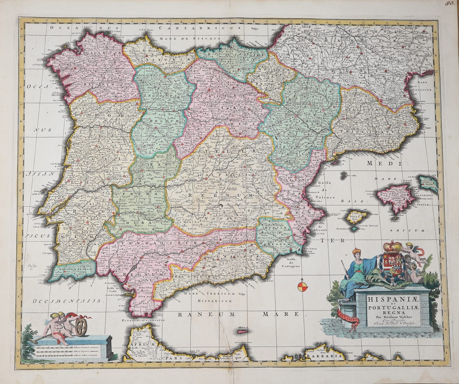
Visscher's large map of Spain and Portugal in old hand colour, the kingdoms and provinces outlined in pink, green and yellow, with the crowned arms of Spain on the title pedestal and putti with an armillary sphere at the scale; a strong impression with wide margins.
FM-0211
€ 650
Key Properties
Edition: Nicolaes Visscher's own issue, 'Per Nicolaum Visscher cum Privilegio Ordinum Hollandiae et Westfrisiae', from the second plate of the map, engraved c. 1688 with a graticule of latitude and longitude (the first plate of c. 1677 has none) and issued in Visscher's composite atlases and in the Atlas Minor, before the plate passed to Petrus Schenk; the manuscript number 90 in the upper right corner is the atlas number of an early owner.
Map: the whole Iberian peninsula with the Balearic Islands, the south of France to the Loire and the coast of Barbary from Tangier to Algiers; a graticule with the border lettered a to q and A to L for reference; the title on a pedestal at the lower right with the figure of Hispania holding a sceptre, the crowned arms of Spain, putti and the motto Plus Ultra; the scale of German, Spanish and French miles at the lower left with two putti, a surveyor's wheel and an armillary sphere.
Content: the kingdoms and provinces of Galicia, Asturias, Leon, Old and New Castile, Biscay, Navarre, Aragon, Catalonia, Valencia, Murcia, Granada, Andalusia, Estremadura, Portugal and the Algarve, each in its own outline colour, with towns, rivers, mountain ranges and roads.
Colour: old hand colour, the outlines in pink, green and yellow, the cartouches in full colour.
Dimensions: engraved surface approximately 46.5 x 57 cm.
Verso blank.
Collation & Technical Description
One engraved sheet, verso blank, the vertical centre fold as issued. Engraved surface approximately 46.5 x 57 cm, with wide margins on all sides.
Condition
Good. Old hand colour, fresh. Centre fold as issued; a tear in the lower part of the fold, in the Mediterranean, closed on the verso. Paper lightly age-toned with a few small spots and faint stains in the sea and in the margins; a small manuscript number in the upper right corner. A full sheet with wide margins.
References & Bibliography
Koeman, Atlantes Neerlandici, vol. III, Vis (the Visscher atlases). Cf. Van der Krogt, Koeman's Atlantes Neerlandici, for the Visscher firm.
Description
Nicolaes Visscher's map of Spain and Portugal, the standard large Dutch map of the peninsula of the last quarter of the seventeenth century. Nicolaes Visscher II (1649-1702) took over the family business on the Kalverstraat in Amsterdam after the death of his father in 1679 and obtained in 1682 a privilege from the States of Holland and West Friesland, which is cited in the title of this map. The Visscher firm, founded by Claes Jansz. Visscher in the first decades of the century, was by then one of the leading publishers of maps and atlases in the city, and its maps were issued both singly and in composite atlases made up to the buyer's wishes.
The map covers the whole Iberian peninsula together with the Balearic Islands, the south of France as far north as the Loire and the coast of North Africa from Tangier to Algiers. The kingdoms and provinces into which Spain and Portugal were then divided, from Galicia and Asturias in the north to Granada and the Algarve in the south, are each shown in their own outline colour, so that the political geography of the peninsula, still that of the old kingdoms, can be read at a glance. Towns, rivers, mountain ranges and roads are given in great detail, and the map is framed by a graticule and a lettered border that allowed the places named in the accompanying index to be found.
The title stands on a pedestal in the Mediterranean at the lower right, with the seated figure of Hispania holding a sceptre, the crowned arms of Spain supported by putti and, wound round a column, the motto Plus Ultra of the Spanish monarchy. At the lower left two putti with a surveyor's wheel and an armillary sphere hold the scales of German, Spanish and French miles. This example, in old hand colour and with wide margins, carries the manuscript number 90 of an early owner in the upper right corner, showing that it once formed part of a bound composite atlas.
Historical Significance
The Visscher map of Spain and Portugal was the map of the peninsula that most Dutch atlas buyers of the late seventeenth century owned. It appeared at a time when Spain, under the last Habsburg king Charles II, was in decline and the Dutch Republic had become the centre of the European map trade, and it remained in print into the eighteenth century, when the plate passed to Petrus Schenk. As a picture of Spain and Portugal on the eve of the War of the Spanish Succession, with the old kingdoms still marked out, it is a document of the political geography of the peninsula before the Bourbon reforms.