Antique Maps
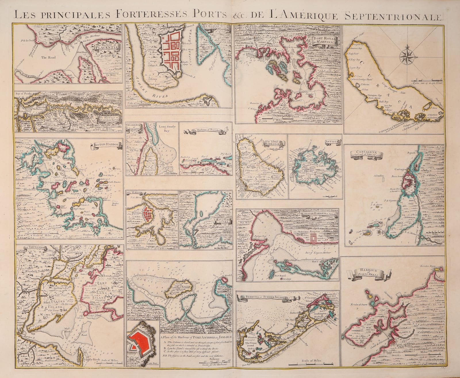
Les Principales Forteresses, Ports &c. de l'Amérique Septentrionale (The principal fortresses and harbours of North America and the West Indies)
COVENS, Johannes and MORTIER, Cornelis (after Henry Popple) · Amsterdam · Johannes Covens and Cornelis Mortier · c. 1737-1745
Covens and Mortier's sheet of twenty-two harbour plans of British and Spanish America in original outline colour, from Placentia and Boston to Havana, Cartagena and Porto Bello, after the insets of Henry Popple's great map of the British Empire in America; one of the earliest printed collections of plans of the harbours of North America and the Caribbean.
FM-0212
€ 2.100
Key Properties
Edition: Covens and Mortier's engraving after the harbour insets of Henry Popple's A Map of the British Empire in America (London 1733), published in Amsterdam for their Atlas Nouveau and for sale with their reduced Popple; the plans keep Popple's English titles, scales and soundings under a French general title.
Plans: The Harbour of Placentia (Newfoundland); Bay of Fundy with the Harbour of Annapolis Royal; Boston Harbour; New York and Perth Amboy Harbour with Staten Island and part of Long Island; Charles Town (Charleston) on the Ashley and Cooper rivers; the Harbour of St Augustine; the Harbour of Providence (Bahamas); the Havana; the Port of St Iago in Cuba; the Harbour of Port Antonio in Jamaica with a plan of its fort; Fort Royal in Martinica; the island of Barbadoes; Antigua; Kingston Harbour in Jamaica with Port Royal; the Bermuda or Summer Islands; Curaçao; Cartagene on the coast of New Spain; the Harbour of Porto Bello.
Colour: original outline colour in pink, yellow and green, the fortifications in red.
Dimensions: sheet approximately 54 x 66 cm.
Verso blank.
Collation & Technical Description
One engraved sheet, verso blank, the vertical centre fold as issued, with the general title in a letterpress-style engraved line across the top and the plans in a grid of ruled compartments. Sheet approximately 54 x 66 cm.
Condition
Very good. Original outline colour, fresh. Centre fold as issued, a little offsetting along it. Paper clean and strong, with wide margins; a few faint marks and minor signs of handling.
References & Bibliography
Koeman, Atlantes Neerlandici, C&M (Covens and Mortier, Atlas Nouveau). Cf. Babinski, Henry Popple's 1733 Map of the British Empire in America, for the source of the plans; Kapp, The Printed Maps of Jamaica; Sellers and Van Ee, Maps and Charts of North America and the West Indies 1750-1789, for the later derivatives.
Description
A single sheet bringing together twenty-two plans of the harbours and fortified places of the British and Spanish possessions in America, engraved and published in Amsterdam by Johannes Covens and Cornelis Mortier. The plans are taken from the insets that Henry Popple had placed round the borders of his enormous twenty-sheet Map of the British Empire in America, published in London in 1733 at the request of the Lords of Trade and Plantations. Popple's map was the first large-scale printed survey of the British colonies and their French and Spanish neighbours, and its harbour plans, drawn from the latest surveys sent home by colonial governors and naval officers, were the best then available. Covens and Mortier, who kept the largest map business in Amsterdam and specialised in reissuing the work of French and English cartographers for the continental market, gathered the plans on one sheet under a French title, keeping the English lettering, scales and soundings of the originals, so that the sheet could be sold both with their reduced version of Popple's map and in their Atlas Nouveau.
From north to south the sheet shows Placentia in Newfoundland, the Bay of Fundy with Annapolis Royal, Boston harbour with its islands, New York and Perth Amboy with Staten Island and the western end of Long Island, Charles Town between the Ashley and Cooper rivers, St Augustine in Florida and Providence in the Bahamas; then the Spanish and British West Indies, with Havana and Santiago de Cuba, Port Antonio and Kingston with Port Royal in Jamaica, Fort Royal in Martinique, Barbados, Antigua and the Bermudas; and on the Spanish Main the Dutch island of Curaçao, Cartagena and Porto Bello, the two great fortified harbours of the treasure fleets. Soundings, anchorages, shoals and the fortifications, picked out in red, make the sheet a small atlas of the strategic points of the Atlantic world on the eve of the War of Jenkins' Ear.
The plan of New York is one of the earliest printed plans of the harbour to show the town with Manhattan, Staten Island, Sandy Hook and the Narrows, and the Boston plan is among the first to give the whole harbour with its islands and soundings. This example is in original outline colour with the fortifications in red, clean and with wide margins.
Historical Significance
In the 1730s the harbours of America were the object of intense interest in Europe: British and Spanish quarrels over trade in the Caribbean led in 1739 to the War of Jenkins' Ear, in which Porto Bello was taken by Vernon and Cartagena besieged, and the northern harbours were the bases of the fisheries and the colonial trade. Popple's plans, and this Amsterdam sheet that spread them across the continent, gave the European public its first reliable pictures of these places. For collectors of American cartography the sheet is valued for its early plans of New York, Boston, Charleston and St Augustine, and for the West Indies it stands at the head of the printed harbour plans of the eighteenth century.