Antique Maps
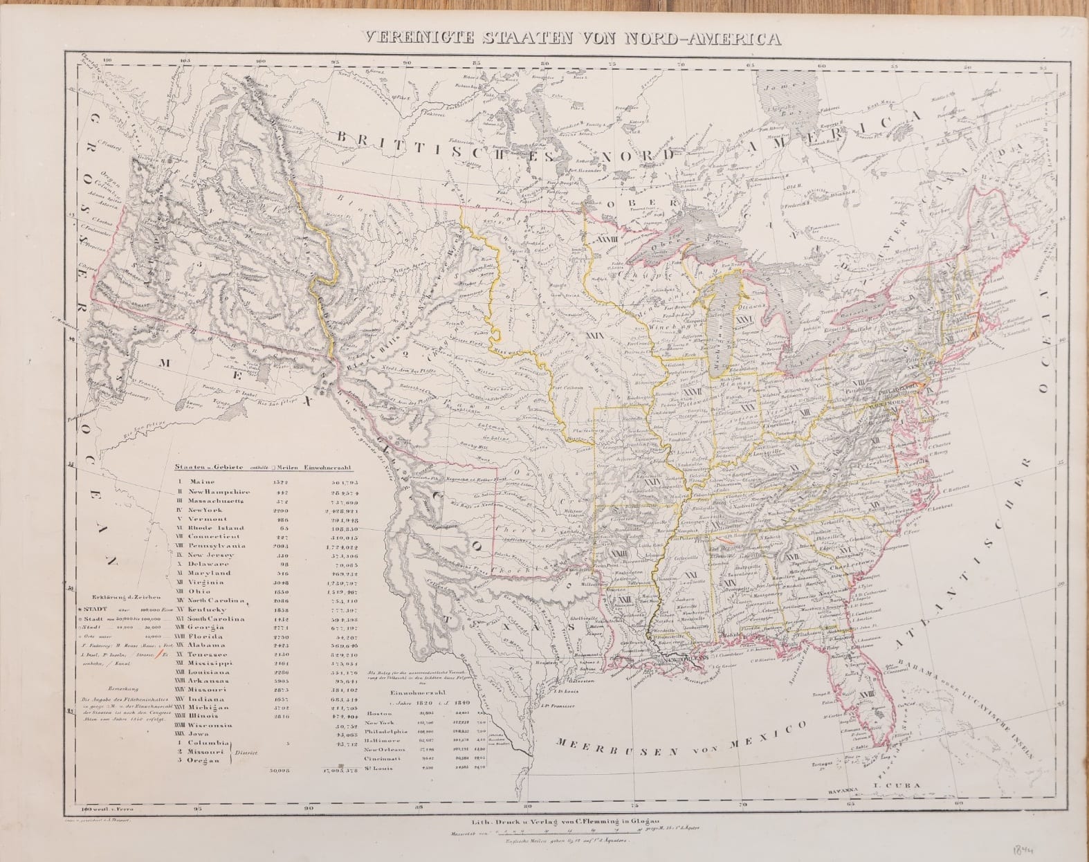
Vereinigte Staaten von Nord-America
Sohr, K. (Handtke, F.); drawn by A. Theinert · Glogau · C. Flemming · 1844
The United States on the eve of the annexation of Texas: a lithographed map from Sohr's Hand-Atlas, Glogau, c. 1844, with a statistical table of the states and territories after the census of 1840.
FM-0256
€ 325 VAT included (margin scheme)
Free insured shipping. The price shown is the price you pay.
Collation & Technical Description
Lithographed map with outline colour, verso blank. Sheet 44.5 x 35.5 cm.
Condition
Good condition.
References & Bibliography
atlassen.net, Sohr-Berghaus Hand-Atlas, 4e druk (1847-1850), with notes on the first edition of 1844 and on the pseudonym.
Description
Lithographed map of the United States from the Vollständiger Hand-Atlas published under the name of Dr. K. Sohr by Carl Flemming in Glogau, Prussian Silesia, whose first edition appeared in 1844; an old pencil note in the margin dates this sheet 1844. Imprint below the border: "Lith. Druck u. Verlag von C. Flemming in Glogau"; lower left "entw. u. gezeichnet v. A. Theinert". Longitudes are reckoned from Ferro.
The map shows the country at a precise moment. Texas stands on its own as a republic, between the United States and a Mexico that still reaches to the Pacific and includes California; the Oregon Country is outlined in the north-west, before the boundary with British North America was settled in 1846. Wisconsin and Iowa appear as territories, and Columbia, Missouri and Oregon as districts.
A large table lists the states and territories with their area in German square miles and their population, the area figures following the Congress records of 1840. A second table sets the populations of Boston, New York, Philadelphia, Baltimore, New Orleans, Cincinnati and St. Louis in 1820 against 1840, offered on the map itself as evidence of the extraordinary growth of the American population.
Historical Significance
"Dr. K. Sohr", the name on the title of the Hand-Atlas, is a pseudonym, most probably of the cartographer Friedrich Handtke. From 1847 the atlas also carried the name of Heinrich Berghaus, against his protest, and as the Sohr-Berghaus Hand-Atlas it was still being re-edited by Handtke in the 1880s. With Texas still independent, this sheet predates the annexation of December 1845 and the Oregon boundary settlement of 1846.