Antique Maps
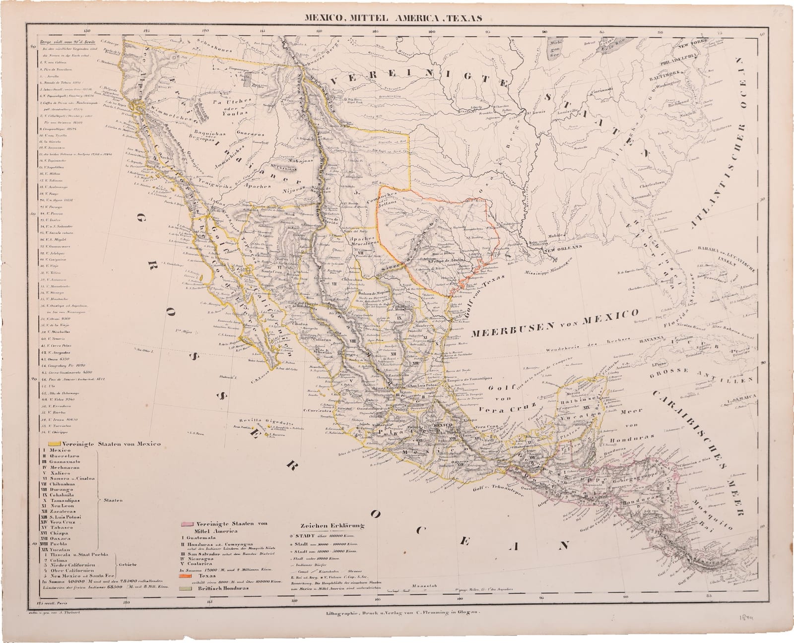
Mexico, Mittel America, Texas
Sohr, K.; drawn by A. Theinert · Glogau · C. Flemming · c. 1844
Mexico from California to Yucatán, the Republic of Texas and Central America: a lithographed map drawn by A. Theinert for Sohr's Hand-Atlas, Glogau, c. 1844.
FM-0258
€ 595 VAT included (margin scheme)
Free insured shipping. The price shown is the price you pay.
Collation & Technical Description
Lithographed map with outline and wash colour, verso blank.
References & Bibliography
atlassen.net, Sohr-Berghaus Hand-Atlas, 4e druk (1847-1850), on the atlas and the pseudonym. Simpson Galleries, Houston, 23 September 2023: Carl Flemming, Mexico, Mittel America, Texas, described as a Republic of Texas map.
Description
Lithographed map of Mexico, Central America and Texas from the Hand-Atlas published under the name of Dr. K. Sohr by Carl Flemming in Glogau, Prussian Silesia, whose first edition appeared in 1844. Below the border: "entw. u. gez. von A. Theinert" and "Lithographie, Druck u. Verlag von C. Flemming in Glogau". Longitudes are reckoned west of Paris. An old pencil note in the lower margin dates the sheet 1844.
Mexico is shown at its full extent before the war of 1846-1848, with Upper and Lower California and New Mexico (Santa Fe) among its territories. Texas is coloured on its own as an independent republic, and the key gives it some 8,000 German square miles and over 100,000 inhabitants. Central America appears as the United States of Central America with its five states, beside British Honduras, and the eastern United States, Florida, Cuba and the Bahamas fill the upper right.
The keys list the nineteen states and five territories of Mexico with their area and population, the states of Central America, and the signs used; a column at the left names fifty-four volcanoes and mountains south of 20 degrees, from Colima and Popocatépetl to Chiriquí, several with their heights.
Historical Significance
Maps that show Texas as a republic, between its independence in 1836 and its annexation by the United States in December 1845, are keenly collected, and this sheet adds the whole of Mexico as it stood before it lost California and New Mexico in 1848. It still shows Central America as one federation, although the federal republic had in fact broken apart by 1841. "Dr. K. Sohr", the name on the atlas, is a pseudonym, most probably of the cartographer Friedrich Handtke. The map belongs with the Sohr maps of the United States and of North America (FM-0256, FM-0257), which show the same moment from the north.