Antique Maps
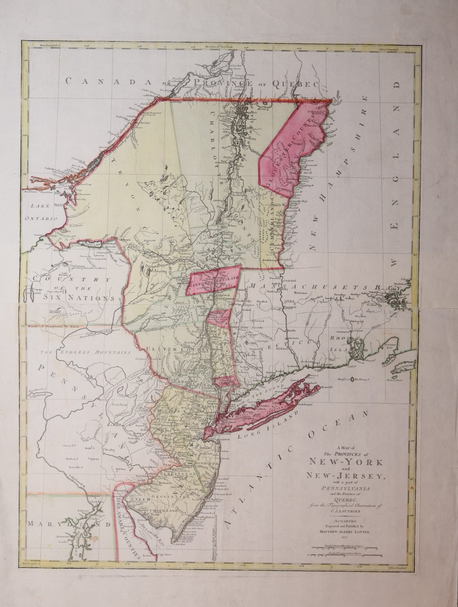
A Map of the Provinces of New-York and New-Jersey, with a part of Pennsylvania and the Province of Quebec
Sauthier, Claude Joseph; Lotter, Matthew Albert · Augsburg · Matthew Albert Lotter · 1777
New York and New Jersey in the first years of the American Revolution: Lotter's Augsburg edition of Claude Joseph Sauthier's map, 1777, with the counties in contemporary colour.
FM-0259
€ 2.250 VAT included (margin scheme)
Free insured shipping. The price shown is the price you pay.
Collation & Technical Description
Engraved map from two plates joined, with contemporary outline and wash colour; folded. Sheet 67 x 92 cm.
Condition
Very good condition. Some foxing and a light stain on the verso, not visible on the front.
References & Bibliography
McCorkle, New England in Printed Maps 1513-1800, 777.20. New York Public Library Map Division 01-1836. Bulletin of the New York Public Library, vol. 4 (1902), p. 86. Library of Congress, Maps of North America 1750-1789 (A map of the provinces of New-York and New Jersey ..., Lotter, 1777). Geographicus Rare Antique Maps, Lotter / Sauthier 1777.
Description
Large engraved map of the provinces of New York and New Jersey, with parts of Pennsylvania, Maryland, New England and the Province of Quebec, engraved and published by Matthew Albert Lotter in Augsburg in 1777 "from the Topographical Observations of C. J. Sauthier". The title stands in the Atlantic, beneath the long coast of New Jersey and Long Island. The sheet is printed from two plates joined, with the counties in outline and wash colour.
The map follows the counties of New York as they stood on the eve of independence: Albany, Ulster, Dutchess, Orange, Westchester and Long Island, the huge Tryon County to the west, Charlotte County along Lake Champlain, and, east of the Hudson, Cumberland and Gloucester Counties in the land that would become Vermont, then still claimed by New York. To the west lie the Country of the Six Nations and "the Endless Mountains" of Pennsylvania; to the north the boundary with Quebec runs along the 45th parallel. The Hudson and the corridor of Lake George and Lake Champlain, the main theatre of the war in the north, are drawn in detail, as are the roads, settlements and land patents of New Jersey.
Historical Significance
Claude Joseph Sauthier (1736-1802), a French-born surveyor in the service of the governors of North Carolina and New York, surveyed the province of New York for Governor Tryon; his map, with New Jersey after Bernard Ratzer, was published by William Faden in London in 1776. Lotter's Augsburg edition of 1777 brought the map to German readers in the second year of the war, when German auxiliary troops were serving with the British army in New York and New Jersey. It records the colonial counties and the New York claim to the land east of the Hudson shortly before the Declaration of Independence of Vermont in 1777.