Antique Maps
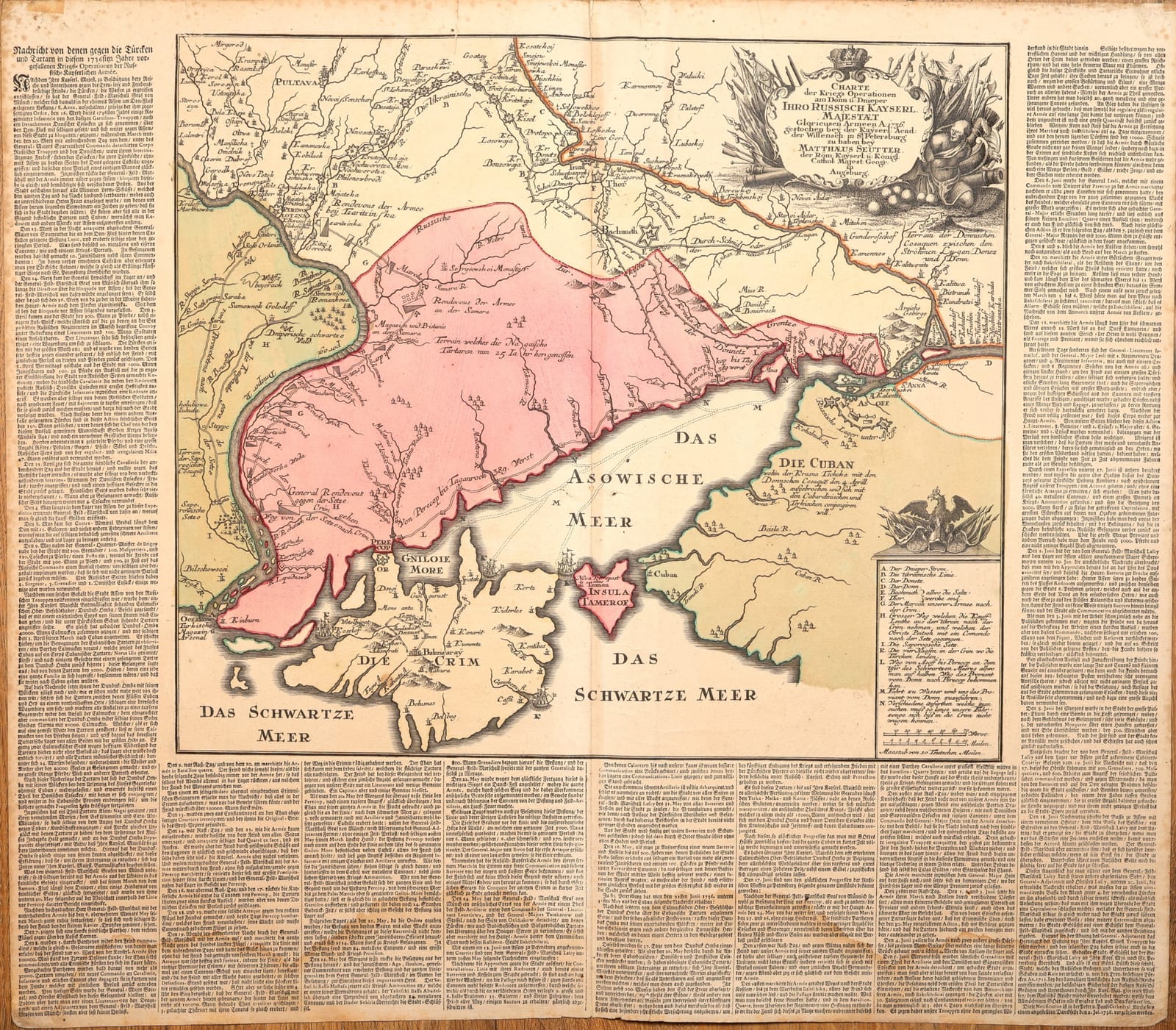
Charte der Kriegs Operationen am Donn u. Dnieper Ihro Russisch Kayserl. Majestaet Glorieusen Armeen A. 1736
SEUTTER, Matthäus · Augsburg · Matthäus Seutter · c. 1736-1737
Seutter's map of the Russian campaign of 1736 against the Crimean Tatars and the Ottomans: the lower Dnieper, the Sea of Azov and the Crimea, surrounded by printed German reports of the operations.
FM-0266
€ 1.250
All prices include VAT. Import duties outside the EU are not included.
Free insured shipping. The price shown is the price you pay.
Key Properties
Date: c. 1736-1737 (the campaign of 1736)
Technique: Copper engraving, hand-coloured
Size: sheet c. 54.5 x 62 cm
Text: German letterpress reports on three sides of the map
Region: Sea of Azov, Crimea, the lower Dnieper and Don, southern Ukraine
Condition
Folded as issued. On the verso an old strip of paper tape at the head of the centrefold and damp staining, a large stain on the left half and a tide line along the lower margin; pencil and ink numbers on the verso.
Description
A war map of the Russian campaign of 1736 in the Russo-Turkish War of 1735-1739. According to the cartouche, the map was "gestochen bey der Kayserl. Acad. der Wissensch. in St Petersburg" and was available from Matthäus Seutter, geographer to the Emperor, in Augsburg: Seutter brought the Russian Academy's map of the campaign to the German market, set within columns of letterpress text headed "Nachricht von denen gegen die Türcken und Tartarn in diesem 1736sten Jahre vorgefallenen Kriegs-Operationen der Russischen Kayserlichen Armée".
The map covers the steppe between the Dnieper and the Don, the Sea of Azov and the Crimea. It traces the Ukrainian defensive line, the rendezvous of the army on the Samara, the march to the isthmus of Perekop and into the Crimea, and the operations around Azov and the Kuban, with Poltava, Bakhmut, the Zaporozhian Sich, Kinburn and Ochakov marked along the way. A lettered key explains the rivers, the lines, the routes of the army and the supply by water, and the surrounding text gives a running account of the campaign under Field Marshals Münnich and Lacy.
Historical Significance
Maps like this one were the news media of an eighteenth-century war: engraved while the war was still being fought, they brought the Russian advance against the Tatars and the Ottoman Empire to readers in the German lands. Today the map is also an early cartographic record of southern Ukraine and the Crimea, drawn at the moment Russia first pushed into the Black Sea steppe.