Antique Maps
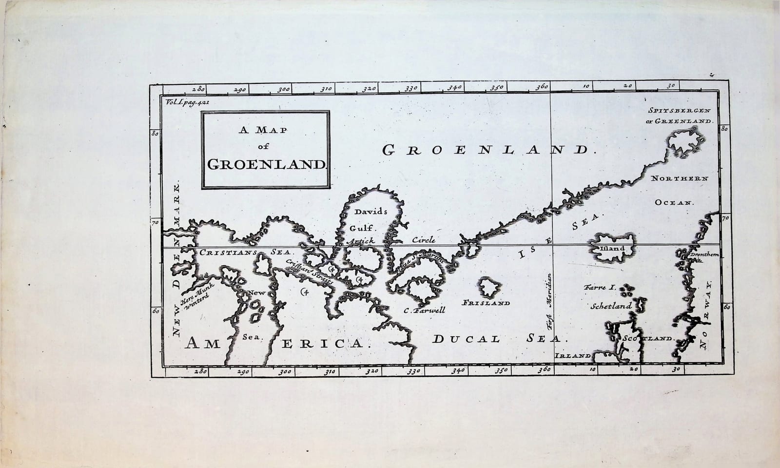
A Map of Groenland
MOLL, Herman (attributed) · London · [early 18th century]
English copper-engraved map of Greenland and the North Atlantic, after La Peyrère, marking where Jens Munk wintered in Hudson Bay.
FM-0271
€ 225
All prices include VAT. Import duties outside the EU are not included.
Free insured shipping. The price shown is the price you pay.
Key Properties
Title: A Map of Groenland, in a rectangular cartouche
Plate reference: engraved "Vol. I pag. 421" at upper left
Technique: Copper engraving, uncoloured
Region: Greenland, Iceland, Hudson Bay, Spitsbergen, the North Atlantic to Norway and Scotland
After: Isaac de La Peyrère, Relation du Groenland (Paris 1647)
Condition
Good. Uncoloured impression with wide margins. Verso blank; the printed image shows through faintly from the front.
References & Bibliography
Cf. Burden, The Mapping of North America, 285 (the Churchill plate "The Map of Groenland").
Description
An English map of the North Atlantic, from Hudson Bay to Norway, showing Greenland as a long coastline running north-east to Spitsbergen, with Iceland, the Faroes, Shetland and the mythical island of Frisland in the open sea.
On the American side the map marks "Here Munk winterd": the place near the mouth of the Churchill River where the Danish navigator Jens Munk wintered in 1619-20, sent by Christian IV to find a passage to Asia. Most of his crew died that winter; Munk and two companions sailed the ship home to Bergen in 1620.
The map follows the one Isaac de La Peyrère published in his Relation du Groenland (Paris 1647), which drew partly on Munk's own chart. La Peyrère made his own changes, and they survive here: a grid of latitude and longitude, Hudson Bay split into "Cristians Sea" and "New Sea", Baffin Island broken into several islands, and Greenland taken from the map of Hessel Gerritsz.
The engraved reference "Vol. I pag. 421" shows that the map was made to accompany an English collection of voyages. The English translation of La Peyrère's account appeared in the Churchill Collection of Voyages and Travels (London 1704); this version of the plate, with the title "A Map of Groenland", is attributed to Herman Moll. The particular collection and edition it comes from has not been established.
Historical Significance
Jens Munk's expedition of 1619-20 was the first to chart Hudson Bay as a whole. Through La Peyrère's book and its English translation, his discoveries reached English readers, but in a form that carried La Peyrère's errors into the cartography of the region for decades.