Antique Views
Tienen (Tiena, Brabantiae Opp. ad amnem Geta)
BRAUN, Georg and HOGENBERG, Frans · Cologne · Georg Braun and Frans Hogenberg · from Civitates orbis terrarum, volume III (first published 1581)
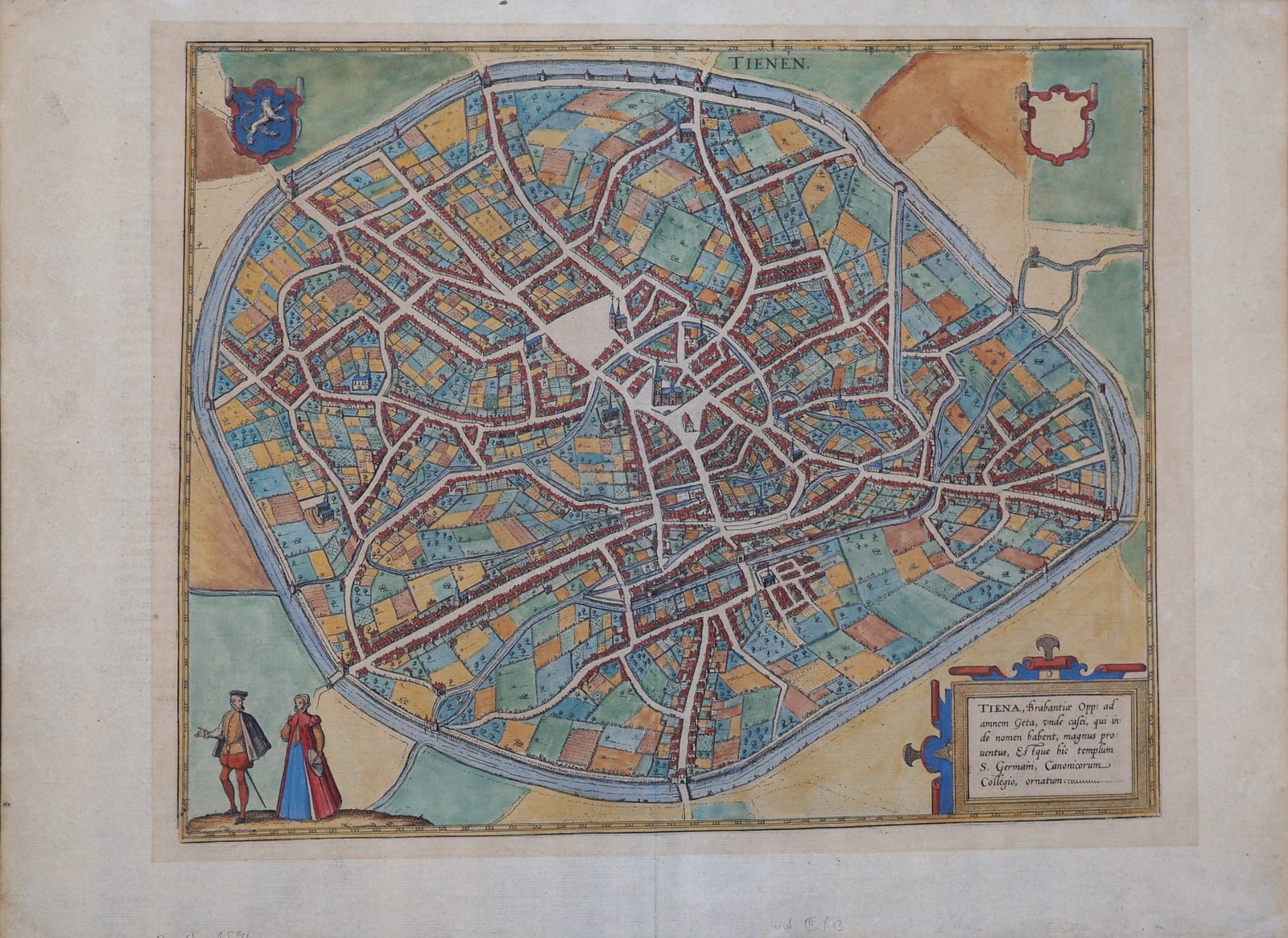
Braun and Hogenberg's bird's-eye plan of Tienen in Brabant, with a couple in costume and the arms of the town, from the third volume of the Civitates orbis terrarum; in old colour, with the Latin text on the verso.
FM-0277
€ 450
All prices include VAT. Import duties outside the EU are not included.
Free insured shipping. The price shown is the price you pay.
Key Properties
Source: Civitates orbis terrarum, volume III, plate 13
Technique: Copper engraving, old hand-colour
Text: Latin text 'Thenae' on the verso, page number 13
Region: Tienen (Tirlemont), Brabant, Belgium
Condition
Old hand-colour. Wide margins. On the verso a small loss at the upper left corner of the margin and some light browning and offsetting from the colour; old pencil notes in the lower margin.
References & Bibliography
Van der Krogt, Koeman's Atlantes Neerlandici, vol. IV (Braun & Hogenberg, Civitates orbis terrarum).
Fauser, Repertorium älterer Topographie (1978).
Füssel (ed.), Braun & Hogenberg, Cities of the World (Taschen, 2008).
Description
Tienen, on the river Gete between Leuven and Sint-Truiden, was one of the old towns of the Duchy of Brabant. Braun and Hogenberg show it in plan within its long ring of walls, the built-up streets around the market square and the church of Saint Germanus surrounded by a wide belt of gardens, orchards and fields still enclosed by the defences. A cartouche notes that the town was known for its cheeses, named after it, and for the chapter of canons at Saint Germanus; in the lower left a Brabant couple in costume stands on a small hill.
The Latin text on the verso, headed 'Thenae', describes the town as a granary of Brabant, derives its name from the tithes once stored there, and praises the orchards and the abundant corn of the surrounding country, which was carried down the Gete to Mechelen and Antwerp.
Historical Significance
The Civitates orbis terrarum, edited by Georg Braun and engraved largely by Frans Hogenberg in Cologne from 1572 onwards, was the first great atlas of town views and plans. The Low Countries are especially well represented, and many smaller Brabant towns such as Tienen appear here in print for the first time.