Antique Views
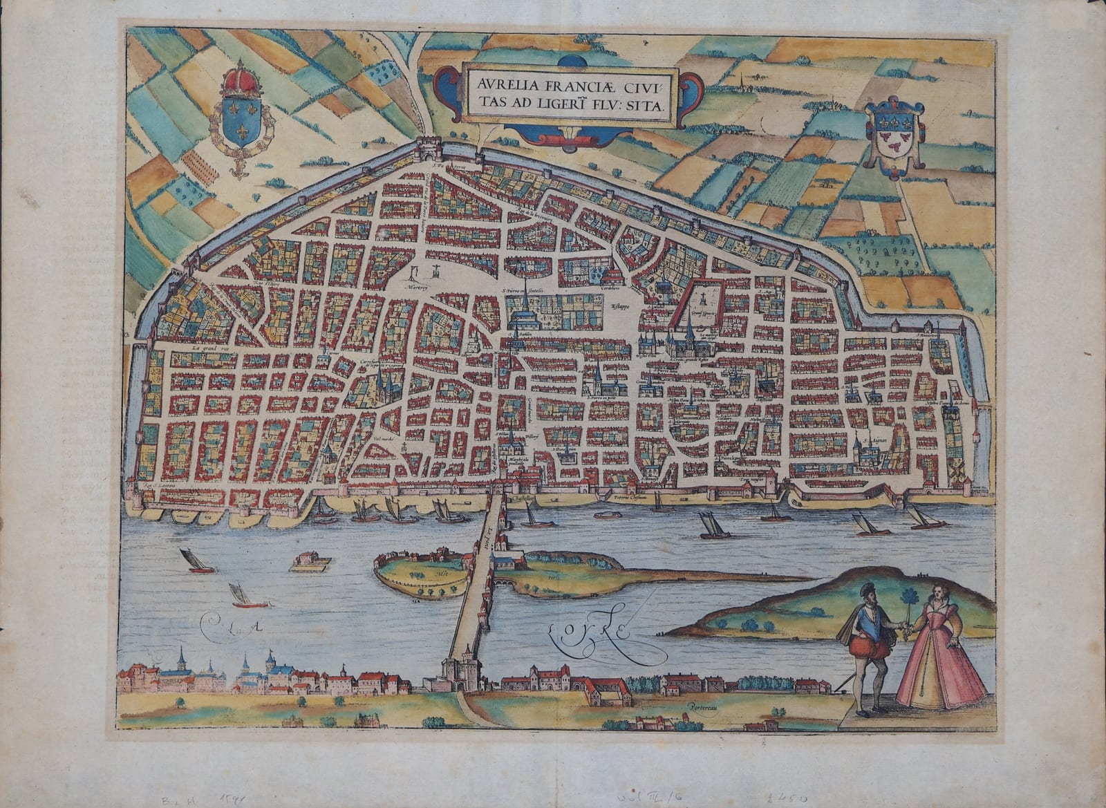
Aurelia Franciae civitas ad Ligeri flu: sita (Orléans)
BRAUN, Georg and HOGENBERG, Frans · Cologne · Georg Braun and Frans Hogenberg · from the Civitates orbis terrarum (Cologne, from 1572)
Braun and Hogenberg's bird's-eye plan of Orléans on the Loire, with the bridge, the islands, the faubourg of Portereau and a French couple in costume; in old colour, with the Latin text 'Aurelia' on the verso.
FM-0278
€ 595
All prices include VAT. Import duties outside the EU are not included.
Free insured shipping. The price shown is the price you pay.
Key Properties
Source: Civitates orbis terrarum
Technique: Copper engraving, old hand-colour
Text: Latin text 'Aurelia' on the verso, page number 6
Region: Orléans, Loire, France
Condition
Old hand-colour. Good margins. Some light browning and offsetting from the colour on the verso, a few small spots in the margins; old pencil notes in the lower margin.
References & Bibliography
Van der Krogt, Koeman's Atlantes Neerlandici, vol. IV (Braun & Hogenberg, Civitates orbis terrarum).
Fauser, Repertorium älterer Topographie (1978).
Füssel (ed.), Braun & Hogenberg, Cities of the World (Taschen, 2008).
Description
Orléans is shown from the south, across the Loire: the long walled city with its grid of streets and churches, the cathedral of Sainte-Croix, the market squares and the great cemetery, joined by the medieval bridge over the river and its islands to the fortified gatehouse and the faubourg of Portereau on the near bank. Boats sail on the Loire, the royal arms and the arms of the city are set in the fields above, and a French couple in fashionable dress stands in the lower right.
The Latin text on the verso, headed 'Aurelia', discusses the ancient name Genabum and the legend that the city was founded by the emperor Aurelian, praises the fertility of the surrounding country and its wines, and gives an account of the university founded by Philip the Fair in 1312, famous for law and for the purity of the French spoken there, which drew many foreign students, the Germans above all. It notes that the church of the Holy Cross had recently been destroyed by the Protestants, an echo of the Wars of Religion.
Historical Significance
The Civitates orbis terrarum, edited by Georg Braun and engraved largely by Frans Hogenberg in Cologne from 1572 onwards, was the first great atlas of town views and plans. Its plan of Orléans records the city shortly before the cathedral was rebuilt after its destruction in 1568.