Antique Views
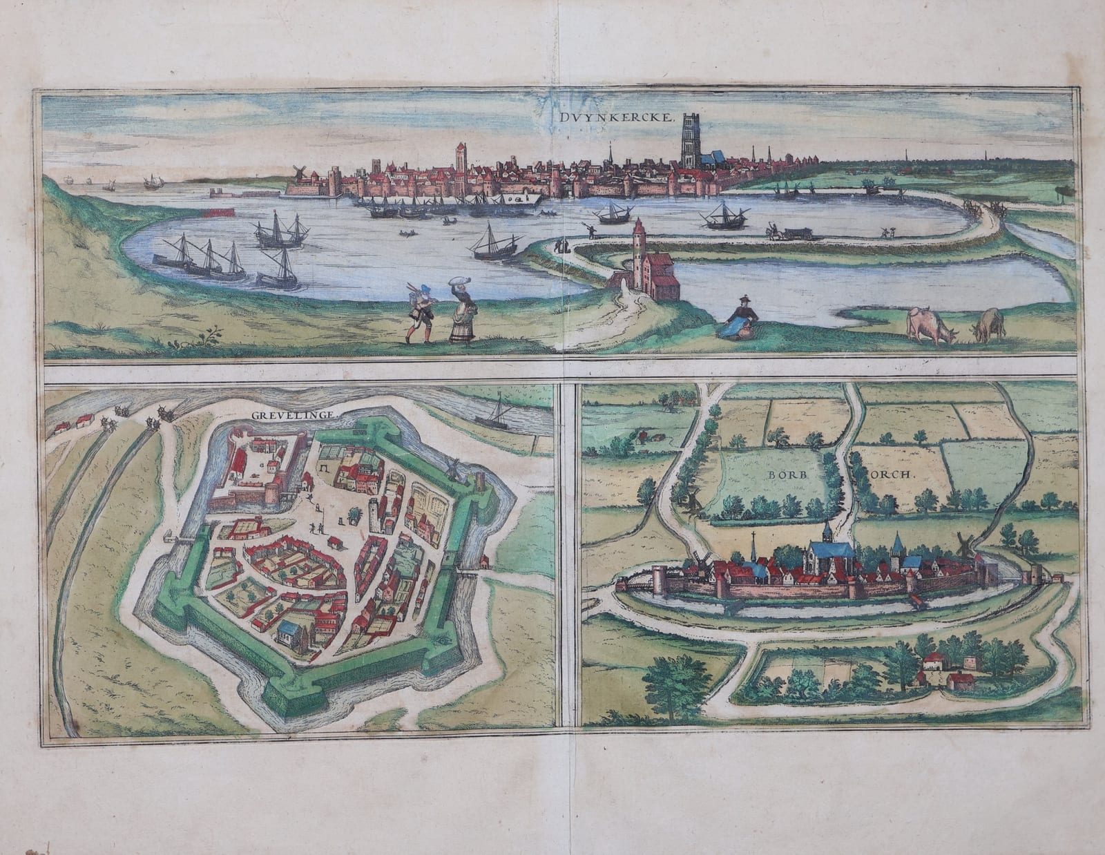
Duynkercke / Grevelinge / Borborch (Dunkirk, Gravelines and Bourbourg)
BRAUN, Georg and HOGENBERG, Frans · Cologne · Georg Braun and Frans Hogenberg · from the Civitates orbis terrarum (Cologne, from 1572)
Braun and Hogenberg's sheet of three towns of maritime Flanders: a wide view of Dunkirk and its harbour, with plans of Gravelines and Bourbourg below; in old colour, with the Latin text on the verso.
FM-0279
€ 550
All prices include VAT. Import duties outside the EU are not included.
Free insured shipping. The price shown is the price you pay.
Key Properties
Source: Civitates orbis terrarum
Technique: Copper engraving, old hand-colour
Text: Latin texts 'Duinkercka', 'Gravelinga' and 'Burburgum' on the verso, page number 23
Region: Dunkirk, Gravelines and Bourbourg, French Flanders
Condition
Old hand-colour. Good margins. A strong damp stain across the verso, faintly visible on the front in the sky and margins, and some browning; small paper remnants from old mounting at the upper edge of the verso.
References & Bibliography
Van der Krogt, Koeman's Atlantes Neerlandici, vol. IV (Braun & Hogenberg, Civitates orbis terrarum).
Fauser, Repertorium älterer Topographie (1978).
Füssel (ed.), Braun & Hogenberg, Cities of the World (Taschen, 2008).
Description
Three towns on the coast of Flanders between Calais and Nieuwpoort on one sheet. Across the top Dunkirk is seen from the dunes, its walls and great church tower rising beyond the harbour basin crowded with ships, with figures and grazing cattle in the foreground. Below, Gravelines appears in plan within its new star-shaped fortifications on the river Aa, and Bourbourg as a small walled town among fields and tree-lined roads.
The Latin text on the verso tells the story of the region in the wars of the sixteenth century: the founding of Dunkirk by Count Baldwin, its sack by the French in 1558 in the same campaign in which the English lost Calais after more than two hundred years, the strong new defences of Gravelines and the victory won there by Count Egmont over the French, and the modest earth-walled town of Bourbourg.
Historical Significance
The Civitates orbis terrarum, edited by Georg Braun and engraved largely by Frans Hogenberg in Cologne from 1572 onwards, was the first great atlas of town views and plans. The sheet is a record of the border fortresses of Spanish Flanders shortly after the Franco-Spanish wars of the 1550s.