Antique Maps
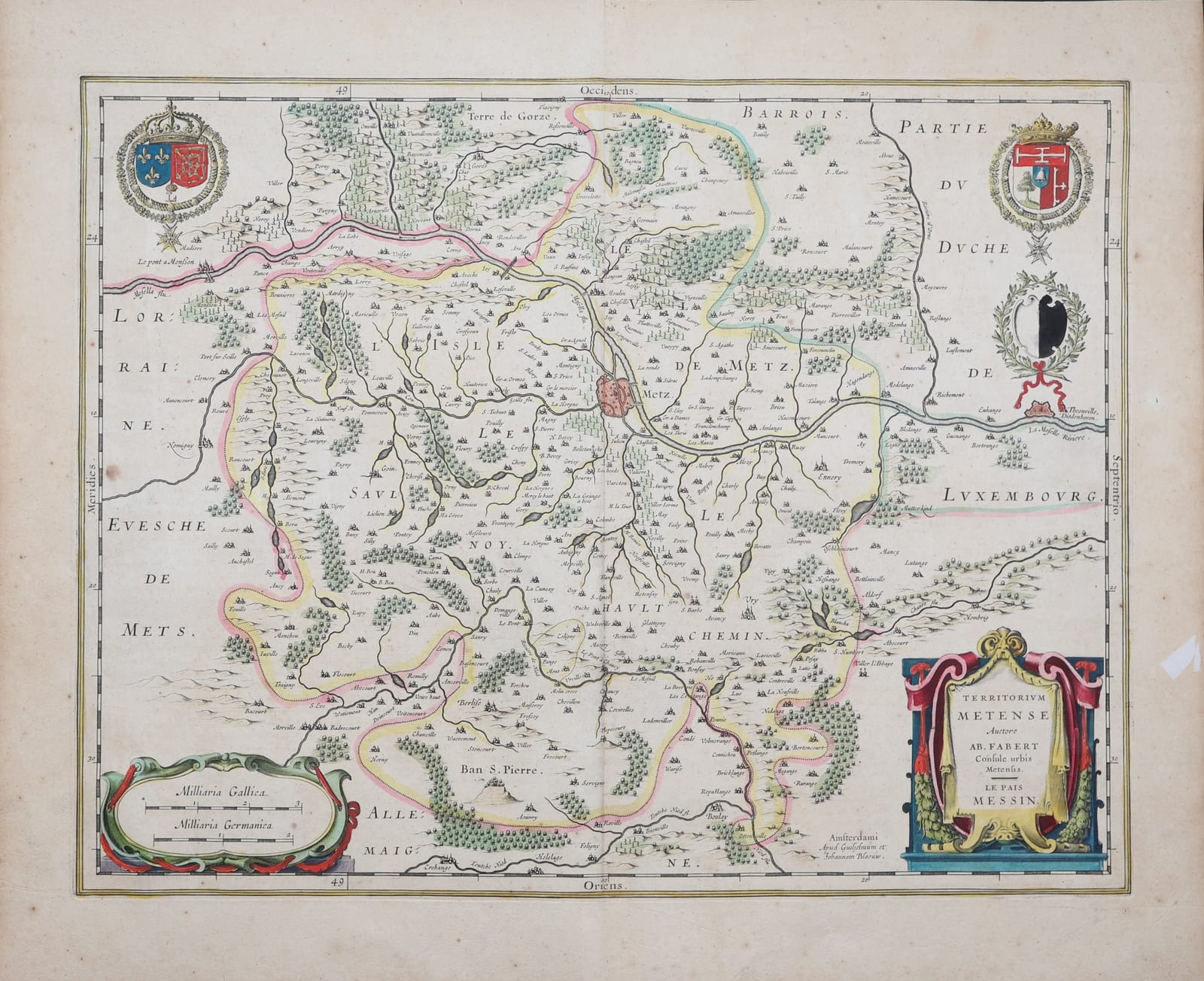
Territorium Metense. Auctore Ab. Fabert Consule urbis Metensis. Le Pais Messin
BLAEU, Willem and Joan · Amsterdam · Willem and Joan Blaeu · c. 1640, Latin text edition
Blaeu's map of the Pays Messin, the territory of Metz along the Moselle, after Abraham Fabert, with the arms of France and Navarre and of Metz; in old colour, with the Latin text on the verso.
FM-0282
€ 650
All prices include VAT. Import duties outside the EU are not included.
Free insured shipping. The price shown is the price you pay.
Key Properties
Source: Blaeu, Theatrum orbis terrarum sive Atlas novus, Latin text edition
Cartographer: after Abraham Fabert, master-échevin of Metz
Technique: Copper engraving, old hand-colour
Text: Latin text 'Metis, vulgo Metz' and 'Lotharingia' on the verso
Size: plate c. 38 x 49 cm (seller's measurement)
Region: Metz and the Pays Messin, Lorraine, France
Condition
Old hand-colour, the borders and the cartouches in full colour. A small tear in the right margin, outside the printed area. Light browning; centrefold as issued.
References & Bibliography
Van der Krogt, Koeman's Atlantes Neerlandici, vol. II (Blaeu, Atlas novus).
Description
The Pays Messin, the territory governed by the city of Metz, is shown with the Moselle running across the sheet from Pont-à-Mousson past Metz to Thionville, divided into its old districts: the Isle, the Val de Metz, the Saulnois and the Haut Chemin, with the boundaries of the territory marked in colour against Lorraine, the bishopric of Metz, the Barrois, Luxembourg and Germany. Forests, villages and abbeys are carefully drawn. The arms of France and Navarre and of the city of Metz, each with the collar of the Order of the Holy Spirit, decorate the upper corners, and a richly draped cartouche names the author, Abraham Fabert, master-échevin of Metz.
The Latin text on the verso describes the history of Metz, the ancient Divodurum of the Mediomatrici, the siege by Emperor Charles V in 1552 and its successful defence under the Duke of Guise, followed by a description of the duchy of Lorraine.
Historical Significance
Metz, with Toul and Verdun, had been held by France since 1552, and the map reflects a city at the frontier of the Kingdom and the Empire. Abraham Fabert, printer and magistrate of Metz, drew the first detailed survey of the territory; Blaeu took it into his Atlas novus.