Antique Maps
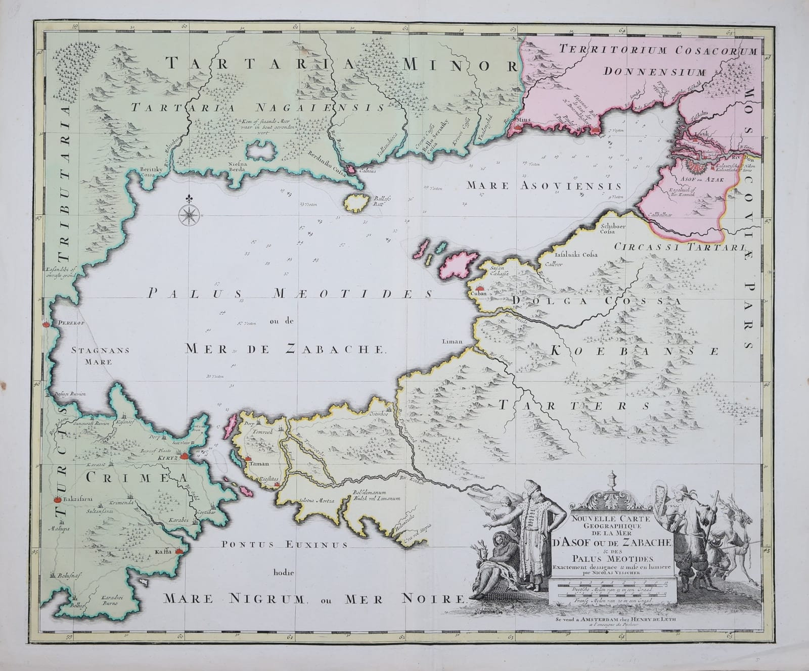
Nouvelle Carte Geographique de la Mer d'Asof ou de Zabache, & des Palus Meotides
VISSCHER, Nicolaes; LETH, Hendrik de · Amsterdam · Hendrik de Leth · Mid-18th century (plate first issued by Nicolaes Visscher II, c. 1696)
Nicolaes Visscher's chart of the Sea of Azov and the Crimea, made at the time of Peter the Great's Azov campaigns, in the issue of Hendrik de Leth, Amsterdam. In old colour.
FM-0286
€ 650
All prices include VAT. Import duties outside the EU are not included.
Free insured shipping. The price shown is the price you pay.
Key Properties
Imprint: Se vend a Amsterdam chez Henry de Leth a l'enseigne du Pêcheur
Author credit: Exactement dessignee & mise en lumiere par Nicolas Visscher
Technique: Copper engraving, in old colour
Size: c. 49 x 58 cm
Region: Sea of Azov, Crimea, Taman peninsula, Kuban, lower Don
Condition
Folded as issued, with a paper guard along the centrefold on the verso. A few small spots in the side margins. Pencil number on the verso.
References & Bibliography
Koeman, C., Atlantes Neerlandici (on Visscher and on De Leth).
Tooley's Dictionary of Mapmakers, s.v. Leth, Hendrik de; Visscher, Nicolaes II.
Bagrow, L., A History of Russian Cartography up to 1800 (on Cruys and the mapping of the Don and the Sea of Azov).
Description
Nicolaes Visscher II (1649-1702) engraved this chart of the Sea of Azov in the years of Peter the Great's Azov campaigns of 1695 and 1696. The capture of the Ottoman fortress at the mouth of the Don gave Russia its first harbour on the southern seas, and for a few years this little-known inland sea was followed closely all over Europe. Amsterdam, with its strong trading ties to Muscovy, was quick to supply a map.
The chart shows the Palus Maeotides or Mer de Zabache with the Crimea, from Perekop to Bakhchisarai (Bakzisarai), Kaffa and Kerch (Kirtz), the Taman peninsula with Temryuk and Taman, and the Kuban steppe of the Tatars. Azov (Asof ou Azak) and the Don delta appear in the upper right, with the territory of the Don Cossacks coloured separately. The depths in the sea are given in Dutch feet (voeten), and several notes are in Dutch, among them the salt lake north of the coast, 'waar in Sout gevonden wert'. The cartouche at lower right shows figures in Russian dress beside fur-clad northerners with a reindeer, a reminder of how Amsterdam engravers pictured the peoples of the tsar's realm.
This impression carries the imprint of Hendrik de Leth (1703-1766), who sold maps and prints in Amsterdam at the sign of the Fisherman (In de Visscher) and reissued plates from the Visscher stock. His maps were often supplied in composite atlases, which accounts for the fold. The chart was superseded only by Cornelis Cruys's survey of the Don and the Sea of Azov, published in 1703-1704.
Historical Significance
One of the first printed charts devoted to the Sea of Azov, made in direct response to Peter the Great's Azov campaigns, and a document of the Dutch role in bringing news and maps of Russia's southern expansion to Western Europe.