Illustrated Books
Britannia Romana: or the Roman Antiquities of Britain
HORSLEY, John (1685-1732) · London · John Osborn and Thomas Longman · 1732
First edition of Horsley's Britannia Romana, London 1732, the founding work of Romano-British archaeology, in a contemporary calf binding with the gilt crest of the Dukes of Newcastle
FM-0309
€ 1.250
All prices include VAT. Import duties outside the EU are not included.
Free insured shipping. The price shown is the price you pay.
Key Properties
Edition: first edition
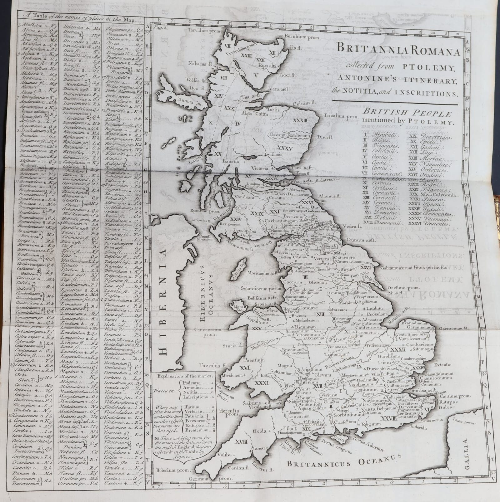
Illustration: engraved plates and maps, including the map of Roman Britain; complete with the full complement of engraved plates (according to the seller's description)
Format: folio
Binding: gilt-ruled calf with roll-tooled borders, both covers with the gilt arms of Henry Pelham-Clinton, 4th Duke of Newcastle-under-Lyme, within the Garter beneath a ducal coronet; spine gilt- and blind-tooled, lettered "Horsley's Britannia Romana" and "London 1732"; marbled endpapers
Provenance: Henry Pelham-Clinton, 4th Duke of Newcastle-under-Lyme (gilt crest on covers)
Dedication: to Sir Richard Ellys, Bart., with engraved headpiece by G. Vandergucht
Condition
Fine condition (according to the seller's description). Calf with gilt-ruled and roll-tooled borders, both covers with the gilt arms of the Duke of Newcastle within the Garter; spine gilt- and blind-tooled, lightly rubbed. Blind stamp "Library Collection" on the title-page.
References & Bibliography
BAL, RIBA Early Printed Books 1551.
Brunet III, 334.
ESTC.
Description
John Horsley, a Presbyterian minister and schoolmaster at Morpeth in Northumberland, spent years walking the line of Hadrian's Wall and the Roman roads and forts of the north, recording inscriptions and sculpture with a care that no one before him had attempted. He died in January 1732, only weeks before his book appeared.
Britannia Romana is in three books. The first gives the history of the Roman conquest and occupation and a detailed survey of the walls of Hadrian and Antoninus Pius with their forts. The second is a corpus of the Roman inscriptions and sculptured stones then known in Britain, arranged by county and illustrated on engraved plates. The third deals with the geography of Roman Britain as given by Ptolemy, the Antonine Itinerary, the Notitia Dignitatum and other sources, with maps. It remained the standard work on Roman Britain for well over a century and is still regarded as the foundation of Romano-British archaeology and epigraphy.
The book is dedicated to Sir Richard Ellys, Baronet, the learned nonconformist patron, beneath an engraved allegorical headpiece by Gerard Vandergucht, and contains among its plates the large maps of Roman Britain compiled from Ptolemy, the Antonine Itinerary, the Notitia and the inscriptions, together with Horsley's corrected map of Ptolemy's Britain, plans of the stations along the Wall, and the long series of plates of Roman altars and inscriptions arranged by county.
This copy comes from the library of Henry Pelham-Clinton, 4th Duke of Newcastle-under-Lyme: both covers bear his arms in gilt, encircled by the Garter and surmounted by a ducal coronet.
Historical Significance
The first systematic survey of the Roman remains of Britain and the foundation of Romano-British archaeology, with its classic account of Hadrian's Wall.
Provenance
Henry Pelham-Clinton, 4th Duke of Newcastle-under-Lyme (1785-1851), gilt crest on the covers.