Atlases
Nuovo atlante istorico
CACCIATORE, Leonardo · Florence · Tipografia all'Insegna di Dante · 1833
The plate volume of Cacciatore's Nuovo atlante istorico, Florence 1833: 130 engraved plates and maps of history, costume and geography, ending with a large folding map of Oceania
FM-0310
€ 850
All prices include VAT. Import duties outside the EU are not included.
Free insured shipping. The price shown is the price you pay.
Key Properties
Contents: plate volume only; 130 uncoloured engraved plates and double-page maps, many folding: historical scenes, costume studies, ancient and modern world maps, battle plans and ethnographic costume studies, concluding with a large folding map of Oceania (according to the seller's description)
Format: oblong small folio
Binding: rebound with black cloth spine, retaining older marbled boards
Text: with the publishers' Avviso and the three alphabetical indexes (Primo, Secondo, Terzo indice)
Note: lacking the title-page
Collation & Technical Description
Plate volume only: 130 uncoloured engraved plates and double-page maps, many folding; lacking the title-page (according to the seller's description).
Condition
Plate volume only, lacking the title-page. Lightly stained, some spotting to the text leaves. Rebound with a black cloth spine, retaining older marbled boards, these rubbed. Blind stamp "Library Collection" on the Avviso leaf.
References & Bibliography
Phillips, Atlases 154.
Cicognara 2004.
Description
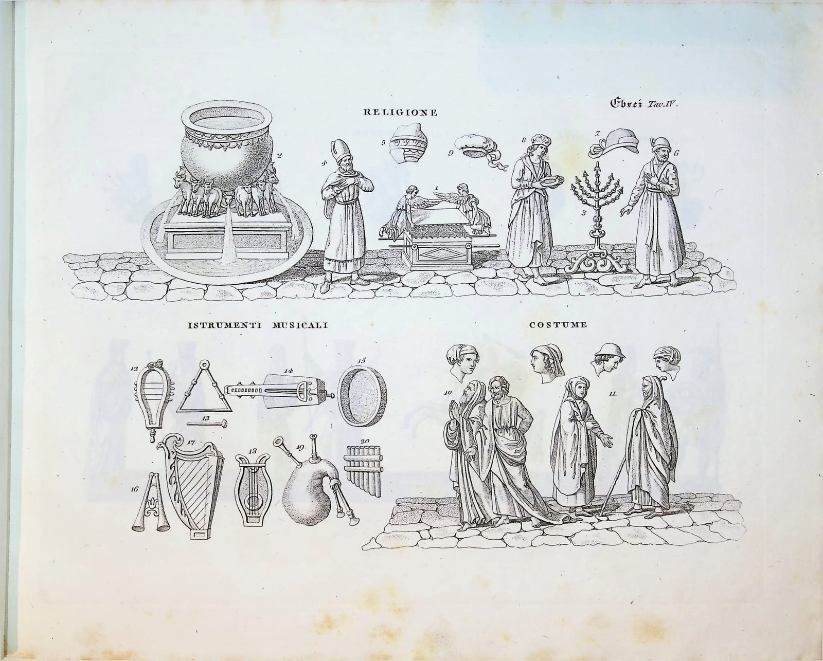
Leonardo Cacciatore's Nuovo atlante istorico was published in Florence in the 1830s as a visual companion to the study of universal history. Its plates take the reader from antiquity to the modern world in images: historical scenes, costume studies, battle plans, and maps of the ancient and modern world. The plates are arranged by peoples and periods, each series with its own numbering: the world known to the ancients (Tav. I), the Hebrews with maps of Palestine, the Twelve Tribes and the kingdom of David and Solomon, a plan of ancient Jerusalem and plates of their religion, musical instruments and costume, the Assyrians, Medes and Persians, ancient Egypt, and onwards through the history of the Church and the Ottoman Empire.
Cacciatore died before he could complete the work. As the publishers explain in the Avviso printed in this volume, they finished it with notes and additions of their own and closed the undertaking with a full alphabetical index in three parts, following the division of the work: ancient history (articles I to XVI), the history of the Church, the Ottoman Empire and related subjects (XVII to XXV), and the articles added after the author's untimely death to complete the atlas.
This is the plate volume, with 130 engraved plates and maps, many of them double-page or folding, together with the Avviso and the three indexes. It closes with a large folding map of Oceania, showing New Holland, New Guinea, Micronesia and the Pacific islands as they were known in the 1830s.
Historical Significance
An Italian Romantic-era historical atlas in which history, costume and cartography are presented together in a single sequence of plates.