Antique Maps
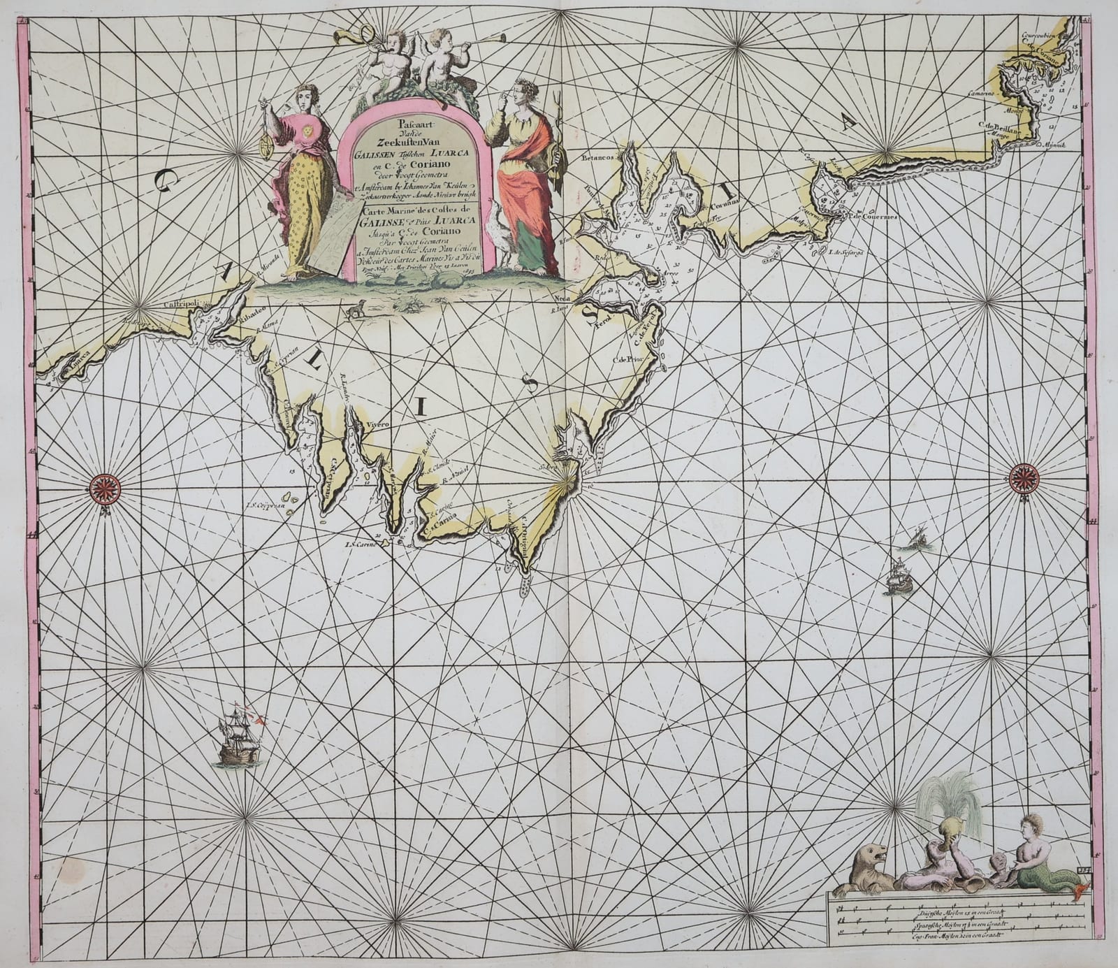
Pascaart vande Zeekusten van Galissen tusschen Luarca en C. de Coriano (sea chart of the north coast of Galicia)
KEULEN, Johannes van; VOOGHT, Claes Jansz. · Amsterdam · Johannes van Keulen · 1708-1709 (plate dated 1695)
Johannes van Keulen's Dutch and French sea chart of the north coast of Galicia, from Luarca to La Coruña, Ferrol and Cape Ortegal, compiled by the geometer Claes Jansz. Vooght, with a large allegorical cartouche; in original colour, from the Groote Nieuwe Vermeerderde Zee-Atlas of 1708-1709.
FM-0319
€ 750
All prices include VAT. Import duties outside the EU are not included.
Free insured shipping. The price shown is the price you pay.
Key Properties
Region: north coast of Galicia and western Asturias, from Luarca to beyond La Coruña
Technique: copper engraving, original hand colour
Titles: Dutch and French in an arched cartouche ("Pascaart vande Zeekusten van Galissen ... door Vooght Geometra ... t'Amsterdam by Johannes van Keulen" / "Carte Marine des Costes de Galisse ...")
Imprint: Johannes van Keulen, Amsterdam, "Met Privilegi voor 15 Iaaren", dated 1695
Format: double-page sea chart with centre fold
From: De Groote Nieuwe Vermeerderde Zee-Atlas ofte Water-Waereld, Amsterdam, Johannes and Gerard van Keulen, 1708 (1709)
Size: sheet c. 63.5 x 53 cm (25 x 21 in)
Condition
Original hand colour. Centre fold. The verso shows browning behind the coloured cartouche and a few small stains (see photographs).
References & Bibliography
Koeman, C., Atlantes Neerlandici, vol. IV, Keu 28 (De Groote Nieuwe Vermeerderde Zee-Atlas ofte Water-Waereld, Amsterdam, Gerard van Keulen, 1709; 185 charts).
Description
A handsome Dutch sea chart of the rugged north coast of Galicia, from Luarca in Asturias westwards past Ribadeo, Vivero and Cape Ortegal to Ferrol, Betanzos and La Coruña, with Camariñas and Corcubión at the far end. Depths, anchorages, rocks and shoals are marked along the coast, and the sea is crossed by a dense network of rhumb lines radiating from compass roses. The arched cartouche is flanked by two allegorical women, one with a compass and a chart, and crowned by two putti blowing trumpets; in the lower right a group of tritons and a sea lion sit beside the scale bars.
The chart was compiled by Claes Jansz. Vooght (c. 1638-1696), the surveyor and mathematician who worked for the firm of Johannes van Keulen and whose charts formed the core of the Nieuwe Lichtende Zee-Fakkel, the great Dutch sea atlas first published from 1681. This copy comes from De Groote Nieuwe Vermeerderde Zee-Atlas ofte Water-Waereld of 1708-1709, the great folio sea atlas in which Gerard van Keulen gathered the plates of the firm, including this chart with the privilege date 1695. The titles in Dutch and French made the charts usable for pilots of several nations, and the Van Keulen firm, "In de Gekroonde Lootsman" on the Nieuwe Brug in Amsterdam, remained the leading publisher of sea charts in Europe for more than a century.
The harbours on this coast were among the most important in Spain. La Coruña was the port from which the Spanish Armada sailed for England in 1588, and the following year it was attacked by Drake; Ferrol would become the principal naval base of northern Spain.
Historical Significance
A Van Keulen chart compiled by Claes Jansz. Vooght, from the Groote Nieuwe Vermeerderde Zee-Atlas of 1708-1709, covering the strategic Galician harbours of La Coruña and Ferrol.