Antique Maps
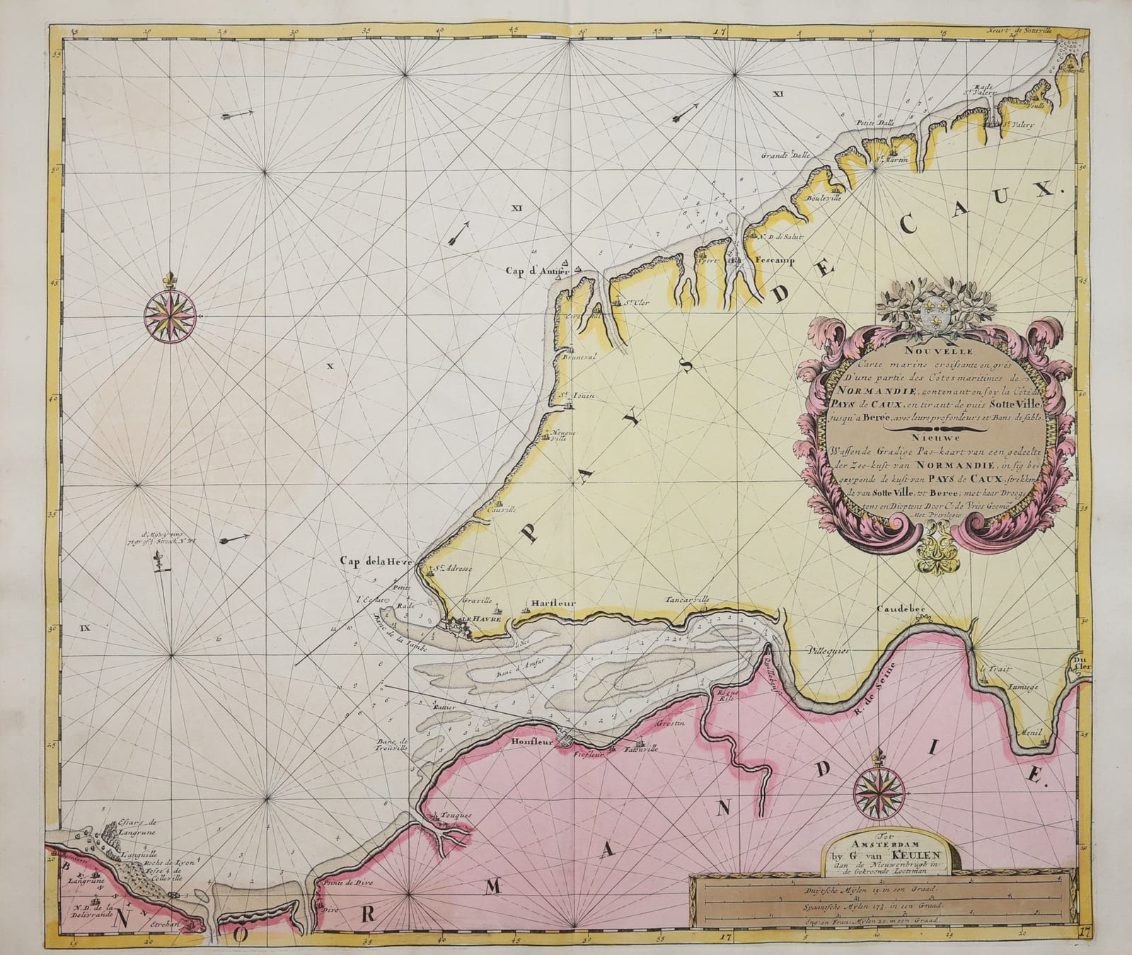
Nouvelle Carte marine ... de Normandie ... Pays de Caux (sea chart of the Pays de Caux and the Seine estuary)
KEULEN, Gerard van; VRIES, Claes de · Amsterdam · Gerard van Keulen · 1708-1709
Gerard van Keulen's French and Dutch sea chart of the coast of Normandy from Sotteville to the Seine estuary, with Le Havre, Harfleur, Honfleur, Fécamp and Étretat, compiled by Claes de Vries; in original colour, from the Groote Nieuwe Vermeerderde Zee-Atlas of 1708-1709.
FM-0320
€ 750
All prices include VAT. Import duties outside the EU are not included.
Free insured shipping. The price shown is the price you pay.
Key Properties
Region: coast of Normandy, Pays de Caux, from Sotteville past Fécamp and Étretat to Le Havre, Honfleur and the Seine up to Caudebec and Jumièges
Technique: copper engraving, original hand colour
Titles: French and Dutch in an acanthus cartouche with the arms of France ("Nouvelle Carte marine croissante en degrés ..." / "Nieuwe Wassende Gradige Pas-kaart ... Door C. de Vries Geom.")
Imprint: "Tot Amsterdam by G. van Keulen aan de Nieuwenbrugh in de Gekroonde Lootsman", with privilege
Format: double-page sea chart with centre fold
From: De Groote Nieuwe Vermeerderde Zee-Atlas ofte Water-Waereld, Amsterdam, Johannes and Gerard van Keulen, 1708 (1709)
Size: sheet c. 63.5 x 53 cm (25 x 21 in)
Condition
Original hand colour. Centre fold. The verso shows browning behind the coloured cartouche and title panel and some light stains (see photographs).
References & Bibliography
Koeman, C., Atlantes Neerlandici, vol. IV, Keu 28 (De Groote Nieuwe Vermeerderde Zee-Atlas ofte Water-Waereld, Amsterdam, Gerard van Keulen, 1709; 185 charts).
Description
A large Dutch sea chart of the Normandy coast, from Sotteville near Saint-Valery-en-Caux past Fécamp, Étretat and the Cap d'Antifer to the Cap de la Hève, and then into the estuary of the Seine with Le Havre, Harfleur and Honfleur, the sandbanks of the river mouth, and the river itself up to Caudebec, Le Trait and Jumièges. Soundings and sandbanks are marked in detail; the land is coloured in yellow and pink, and the sea is crossed by rhumb lines from two compass roses. The title, in French and Dutch, stands in a large acanthus cartouche crowned by the arms of France.
The chart is "wassende gradig", drawn on Mercator's projection with increasing degrees of latitude, so that a straight compass course could be laid on it. It was compiled by Claes de Vries, the geometer and teacher of navigation who worked for the Van Keulen firm, and published by Gerard van Keulen (1678-1726) in De Groote Nieuwe Vermeerderde Zee-Atlas ofte Water-Waereld, the great folio sea atlas of 1708-1709, who led the family business "In de Gekroonde Lootsman" on the Nieuwe Brug in Amsterdam and was appointed hydrographer to the Dutch East India Company.
The Seine estuary was the gateway to Rouen and Paris. Le Havre, founded by Francis I in 1517 as the new royal harbour at the mouth of the river, appears here as a fortified town, with Honfleur opposite.
Historical Significance
A Van Keulen chart of the Seine estuary and the Pays de Caux by Claes de Vries, from the leading Dutch sea atlas of the early eighteenth century.