Voyages & Discovery
Rerum et urbis Amstelodamensium historia
Isaac Pontanus (Johannes Isacus Pontanus) · Amsterdam · Jodocus Hondius · 1611
Isaac Pontanus, the first history of Amsterdam, with the early Dutch voyages to the Indies and important maps.
FM-0034
€ 20.000
Key Properties
Edition: First edition
Language: Latin
Format: Small folio (29.2 × 19.2 cm)
Binding: Contemporary vellum over boards, embossed, title in a contemporary hand on the spine
Illustration: Engraved title-page; 6 folding maps + 1 folding plate (Amsterdam Beurs); 42 text engravings, of which 8 are maps
Collation & Technical Description
4 preliminary leaves; 292 pp.; 6 leaves; 38 pp.; 2 leaves. Text in Latin. Engraved title-page; six folding maps and one folding plate (the Amsterdam Beurs); 42 text engravings, of which 8 are maps. Complete. With an additional autograph letter from Pontanus to Aernout van Buchel (Harderwijk, 1634).
Condition
A mint example of this important source for the earliest Dutch voyages to the Indies.
References & Bibliography
Tiele, Nederlandsche bibliographie no. 876; Ginsberg (2006), p. 175; Schilder, Monumenta Cartographica Neerlandica VII (fig. 8.30; map 11.2.1).
Description
The first edition of this highly important history of Amsterdam. The work is in three parts: the first treats the early history of the city; the second is dedicated to the early Dutch voyages to the Indies, 1594–1611; the last to the laws and government of Amsterdam and a list of its (past) governors.
Of special interest is the account of Cornelis de Houtman's voyage, with details not previously published (drawn from notes by Jan Jansz Carel de Jonge), accompanied by two Hondius maps, one of the Septentrion showing Hudson's voyage of 1608, the other the route of the Houtman fleet to the Indies.
Isaac Pontanus (Johannes Isacus Pontanus, 1571–1639) was born at sea but became a noted doctor, philosopher and historian, teaching at the University of Harderwijk and working for some years with Tycho Brahe. The accompanying letter is addressed to Aernout van Buchel (1565–1641), a fellow historian who preserved the memory of many early architectural jewels, later destroyed, by describing and drawing them in detail.
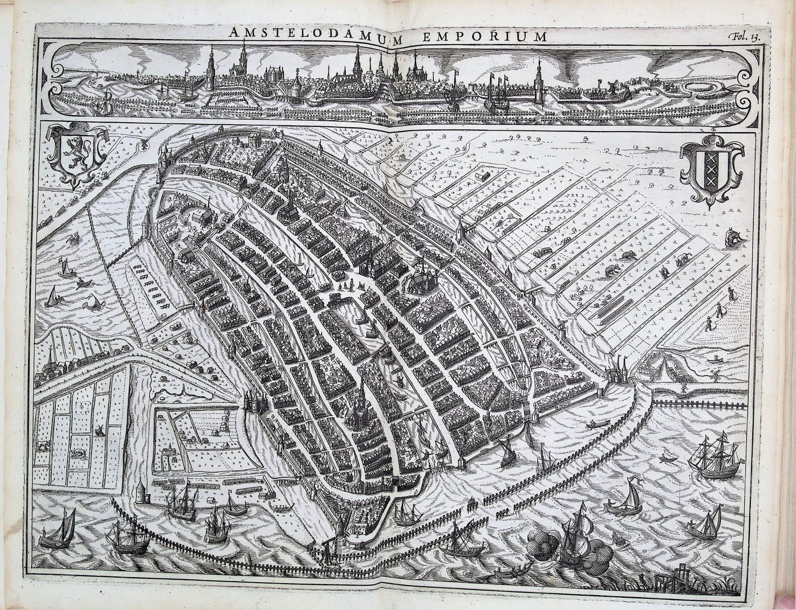
The six folding maps are: (1) Chorographia Hollandiae (largely present-day North and South Holland); (2) a plan and profile of Amsterdam; (3) the Tabula geographica (Septentrionale); (4) the route to the Indies (Vaart naar…); (5) Guineae nova descriptio; and (6) Amstelodamum (the city's extension works of the time). Maps in the text include, among others, Nova Zembla, Bali, Amboina and Java; the text engravings are exceptionally finely cut and printed.
Historical Significance
A foundational printed source for the earliest Dutch voyages to the Indies and for the history of Amsterdam. Two of its maps are of particular cartographic importance.
Tabula geographica in qua navigationes designantur (Schilder, Monumenta Cartographica Neerlandica VII, fig. 8.30). The Dutch had been seeking a north-east passage to the Spice Islands since Barentsz's first voyage of 1594; Barentsz's map, separately published by Cornelis Claesz in Amsterdam in 1598, is perhaps “the most important map of the far Northern regions” (Ginsberg). It reappears here in a reduced copy by Jodocus Hondius, who added a touch of Hudson, much as Spanish cartographers updated their padrón real as voyages returned to Seville. North of Nieu Land (Spitsbergen) runs a long wall of ice, “Glacies ab Hudsone detecta ann. 1608”, absent from Barentsz's polar map; it records Hudson's second voyage for the Muscovy Company, charged with finding the entrance to the Kara Sea.
Tabula geographica… ad intelligentiam navigationum Indicarum (Schilder, Monumenta Cartographica Neerlandica VII, map 11.2.1) was drawn by Willem Lodewycksz, commercial agent (commies) on Cornelis de Houtman's first voyage to the Indies, and published by Claesz in Amsterdam in 1598; the present map is a reduced copy by Jodocus Hondius.
Provenance
Available on request.