Antique Maps
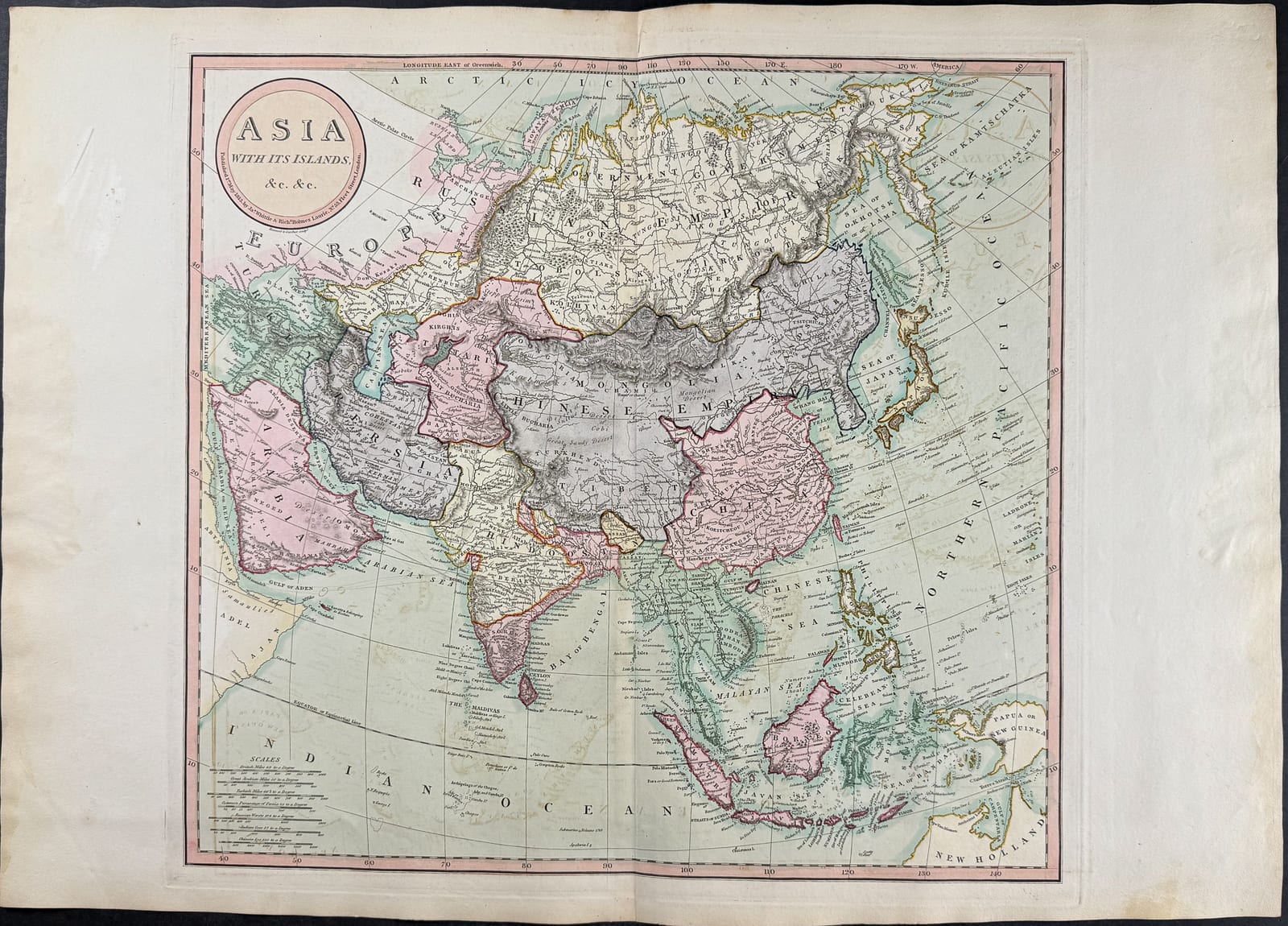
ASIA, WITH ITS ISLANDS AND DIFFERENT REGIONS
Robert Laurie & James Whittle · London · Laurie & Whittle · Copperplate 1794; issued in an atlas edition of 1814
Robert Laurie & James Whittle, large decorative map of Asia
FM-0001
€ 450
Key Properties
Edition: Later edition, from A New and Elegant Imperial Sheet Atlas
Language: English
Collation & Technical Description
Copper engraving with original hand-colouring. Approx. 29½ × 20½ in. (folding sheet). The map covers the whole Asian continent, incorporating the discoveries of George Vancouver and Jean-François de La Pérouse.
Condition
The photograph shows a normal vertical centre fold, light discolouration and a few minor age marks in the margins. No large tears or paper loss are immediately apparent.
References & Bibliography
From R. Laurie & J. Whittle, A New and Elegant Imperial Sheet Atlas, London. The plate is dated 1794 and was reissued in the 1814 atlas.
The map incorporates the discoveries of George Vancouver and Jean-François de La Pérouse, dating its geographical content to the 1790s.
Description
A large and decoratively attractive map of Asia, published by Laurie & Whittle in London. The sheet comes from a later edition of A New and Elegant Imperial Sheet Atlas. The copperplate is dated 1794 and was also used in the atlas issue of 1814.
The map covers the whole of the Asian continent and shows, among others, China, India, Persia, Siberia, Japan, Korea, South-East Asia and parts of Australia. The reference to the voyages of Vancouver and La Pérouse reflects the late-eighteenth-century updating of geographical knowledge.
It is above all a strong decorative map. The large format and the fresh colouring make it an immediately appealing wall sheet.
Notable features: Large wall format with wide margins; Bright historical colour fields; Attractive late-eighteenth-century map of the continent.
Historical Significance
A large and decorative commercial wall map representing the late-eighteenth-century state of geographical knowledge of Asia, updated with the Pacific voyages of Vancouver and La Pérouse.
Provenance
Not established.