When the Dutch endeavoured to sail to the Indies in 1595 they sailed on 3 ships and one boat: het Duyfken. …‘t Pinasken genaemt het Duyfken groot omtrent 30 last, gemonteerd met 20 man; twee metalen stukken…schipper Simon Lambertszoon Mau. That Pinasken, (image) is the one that was used by Willem Janszoon when he explored the east coast of the Gulf of Carpentaria in 1606. Janszoon had followed the south coast of New Guinee, passing by the Strait of Torres without entering it, and then followed the east coast of the Gulf of Carpentaria till 13,5 degrees South. He left no report that we know of, but his departure from Bantam and return are described by the English captain Saris who was in Bantam at the time (Heeres 1899, IV, V and VI)
From: le Maire, Spieghel der Australische navigatie…. Amsterdam Colijn 1622
The next better documented involvement of the Dutch with Terra Australis is the voyages of Jaques le Maire and Willem Schouten who approached the Indies from the West. They had to avoid Magellan’s Strait and, sailing further south, discovered the Strait of le Maire and rounded what they named Cape Horn at 58 degrees and 59 minutes on entering the Pacific. Sailing north into the Pacific to about 15 degrees S. and then, followng the stream sailing West they discovered Honden Island (Puka-puka) et al and Hoornse islands (Niufoóu) et al before hitting the north coast of New Guinee, just under the Equator and reaching the Moluccas (Image of the Map in le Maire,1622) and thereafter Bantam on Java in October 29, 1616.
|
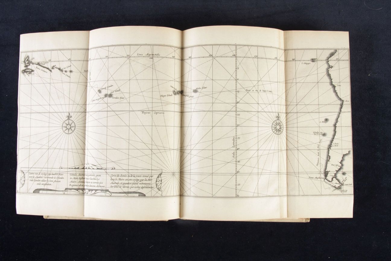
Le Maire, Kaerte van de Zeylage….Zuydzee, 1622
|


