Atlases
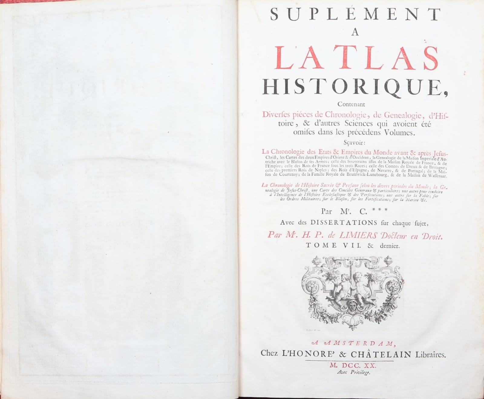
Suplément à l'Atlas historique, contenant diverses pièces de chronologie, de généalogie, d'histoire, & d'autres sciences qui avoient été omises dans les précédens volumes. Tome VII & dernier
CHATELAIN, Henri Abraham; dissertations by Henri Philippe de LIMIERS · Amsterdam · L'Honoré & Châtelain · 1720
The seventh and last volume of Chatelain's Atlas Historique, the supplement with 44 plates of chronology, genealogy, heraldry and history, Amsterdam, L'Honoré & Châtelain, 1720. Complete.
FM-0221
€ 4.000
Key Properties
Volume: Tome VII & dernier, the supplement
Imprint: Amsterdam, L'Honoré & Châtelain, 1720
Illustration: engraved frontispiece and 44 plates of maps, genealogies, tables and other illustrations
Text: dissertations by H. P. de Limiers
Copy: complete
Collation & Technical Description
Engraved allegorical frontispiece, facing the half-title "Suplément à l'Atlas historique, Tome VII. & dernier". Title-page printed in red and black with engraved vignette: "Suplément a l'Atlas historique, contenant diverses pièces de chronologie, de genealogie, d'histoire, & d'autres sciences qui avoient été omises dans les précédens volumes ... Par Mr. C*** Avec des dissertations sur chaque sujet, par Mr. H. P. de Limiers Docteur en Droit. Tome VII. & dernier. A Amsterdam, chez L'Honoré & Châtelain Libraires. M.DCC.XX. Avec Privilege."
Dedicatory epistle to Jean Antoine Schafgotsch. Table of the plates, numbered "Tom. 7 No.", several of them printed on two sheets (a and b). Dissertations by Limiers, among them on chronology (p. 1), the House of Austria (p. 21), the royal house of France (p. 31), the royal house of Brunswick and Lunebourg (p. 77) and the House of Wassenaer (p. 81, followed by starred leaves 81* to 84****, with a printed NB).
44 engraved plates, many folding or double-page: maps, genealogical tables, chronological tables, heraldry and other illustrations. Complete.
Bound in red half leather with corners, red grained boards.
References & Bibliography
Koeman, Atlantes Neerlandici II, Cha 1-7. Koeman's entry is regularly cited with the remark that copies vary in collation, so his description is a guide to the work and not a standard against which a single volume can be called complete.
Phillips, Atlases, 579.
Goffart, Historical Atlases. Cited at p. 132 by one dealer and at p. 134 by another, so the page is to be checked against the edition used.
P. van Waning, Chatelain's Atlas Historique, in Journal of the International Map Collectors' Society, Spring 2010.
For the plates of this volume: the individually catalogued plates of Tome 7 in the David Rumsey Map Collection, numbered Tome 7. No. 1 onwards. A comparison, not a collation of this copy.
Description
The seventh and last volume of Chatelain's Atlas Historique, published in 1720 as a supplement to the six preceding volumes.
The Atlas Historique, ou Nouvelle Introduction a l'Histoire, a la Chronologie et a la Geographie Ancienne et Moderne appeared in Amsterdam in seven folio volumes between 1705 and 1721, and again in a later edition under the imprint of Zacharie Chatelain between 1732 and 1739. It is less an atlas than an encyclopaedia built around maps: genealogy, cosmography, topography, heraldry and chronology are all carried by large engraved plates on which maps, tables, views and coats of arms share the sheet.
As its title says, this volume gathers the pieces of chronology, genealogy, history and other sciences that had been left out of the earlier volumes. Its 44 plates deal with chronology, the Occident and the Orient, heraldry, the regions and ruling houses of France, Austria, Italy, Spain and Portugal, military history, with plates on fortification and on the navy, and religion and mythology, among them a two-sheet plate on the history of the Church. The text of this volume was written by H. P. de Limiers, who supplies a dissertation for each subject. Among them is a dissertation on the Dutch House of Wassenaer, with its own genealogical plate, which refers to events of "l'année derniere 1719" and so was written while the volume was in the press.
Henri Abraham Chatelain (1684 to 1743) was a Huguenot pastor from Paris, the son of a wealthy Parisian merchant, who made his name in Amsterdam as a cartographer and publisher. The title-page names the author only as "Mr. C***". Recent scholarship has raised the question whether Zacharie Chatelain rather than Henri Abraham was the compiler of the work.
Historical Significance
The Atlas Historique is one of the most ambitious publishing projects of the early eighteenth century Amsterdam trade, and one of the first in which the map serves as the vehicle for a complete account of a state rather than as a picture of its territory alone. Its plates were reprinted and imitated for decades and remain among the most recognisable images of the golden age of French mapmaking as it was carried on in the Dutch Republic.