Antique Maps
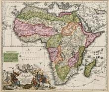
TOTIUS AFRICAE NOVA REPRAESENTATIO
Johann Baptist Homann · Nuremberg · Johann Baptist Homann · c. 1715
Johann Baptist Homann, map of Africa
FM-0012
€ 2.000
Key Properties
Edition: Homann's first map of Africa
Language: Latin
Collation & Technical Description
Hand-coloured copper engraving. Plate approx. 48.5 × 57.5 cm; frame approx. 65 × 74.5 cm. Striking decorative cartouche at lower left; extended note on the sources of the Nile.
Condition
The photograph shows fine colour, a normal centre fold and limited age marks. The map is framed; the verso and mounting cannot be inspected.
References & Bibliography
J. B. Homann, Totius Africae Nova Repraesentatio, Nuremberg, c. 1715.
Homann's first map of Africa and the first to carry an extended note on the sources of the Nile. Cf. Norwich, Maps of Africa; Tooley.
Description
A large and well-saleable map of the African continent by Johann Baptist Homann. The map combines historical geography with a striking decorative cartouche at lower left.
Several erroneous or speculative geographical elements still appear in the interior. The source of the Nile is shown according to early-eighteenth-century knowledge. It is precisely these historical misconceptions that increase collector interest.
Through its format, colour and recognisable subject this is an accessible wall object with a broader private market than many specialist regional maps.
Notable features: Large, colourful map of the continent; Rich cartouche with allegorical and exotic elements; Provenance: Deutsche Shipping Collection, Hamburg.
Historical Significance
Homann's first map of Africa and the first to carry a detailed note on the sources of the Nile; a leading German decorative continental map of the early eighteenth century.
Provenance
Deutsche Shipping Collection, Hamburg.
Related works
Antique Maps · FM-0013
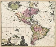
TOTIUS AMERICAE SEPTENTRIONALIS ET MERIDIONALIS NOVISSIMA REPRAESENTATIO
Johann Baptist Homann · Nuremberg · First state, c. 1710
€ 1.750
Antique Maps · FM-0014
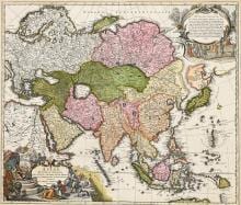
ASIAE RECENTISSIMA DELINEATIO
Johann Baptist Homann · Nuremberg · probably c. 1716–1720
€ 800
All 3 works: Johann Baptist Homann →