Antique Maps
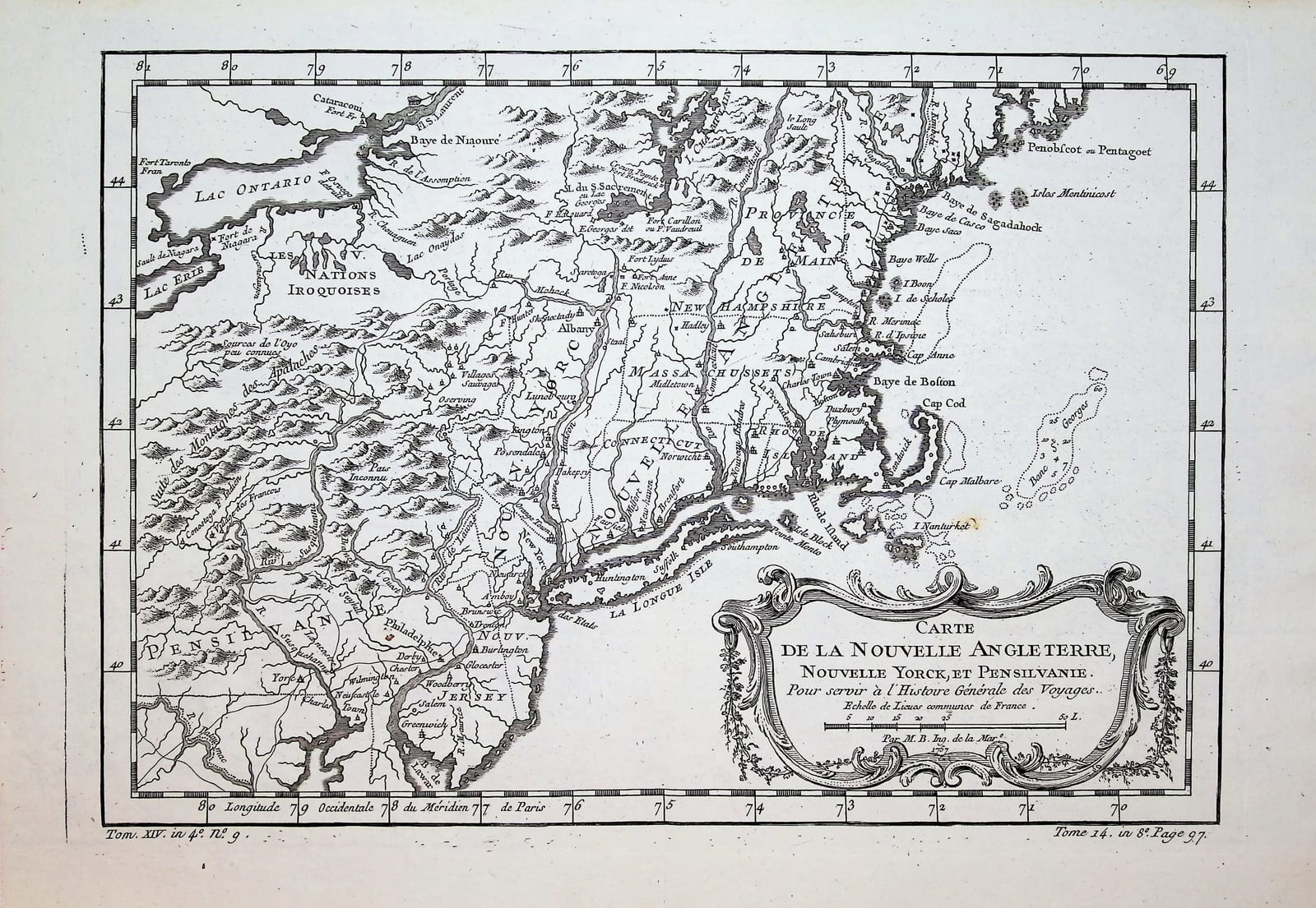
CARTE DE LA NOUVELLE ANGLETERRE, NOUVELLE YORCK ET PENSILVANIE
Jacques-Nicolas Bellin · Paris · For A.-F. Prévost, Histoire générale des voyages · c. 1757
Jacques-Nicolas Bellin, colonial north-eastern North America
FM-0008
€ 375
Key Properties
Edition: From Prévost, Histoire générale des voyages
Language: French
Collation & Technical Description
Copper engraving. Approx. 14 × 9¾ in. Colonial north-east: New England, New York, Pennsylvania, New Jersey, towards Lakes Ontario and Erie; forts, rivers and Iroquois territories indicated.
Condition
The sheet appears good, with generous margins, a clear impression and only a small foxing spot to the right of centre. No major damage is visible.
References & Bibliography
J.-N. Bellin, from A.-F. Prévost, Histoire générale des voyages, Paris, c. 1757.
Cf. Sellers & Van Ee, Maps and Charts of North America; McCorkle, New England in Early Printed Maps.
Description
The auction description attributes the sheet to Prévost, but the cartographer is Jacques-Nicolas Bellin. The map shows the colonial north-east of North America, with New England, New York, Pennsylvania, New Jersey and parts of the region towards Lake Ontario and Lake Erie.
Historically the map is appealing for its context in the French and Indian War. Forts, rivers and the territories of the Iroquois Nations are clearly indicated.
This is a tidy colonial map with an American audience, though Bellin maps from travel works appear regularly on the market.
Notable features: Colonial North America during the French and Indian War; Attractive rococo cartouche; Accessible American collecting object.
Historical Significance
Documents the colonial north-east during the French and Indian War, including the fortifications and the territories of the Iroquois Nations.
Provenance
Not established.