Voyages & Discovery
De Nieuwe en Onbekende Weereld: of Beschryving van America en 't Zuid-Land
MONTANUS, Arnoldus (Arnold van den Berg, c. 1625-1683) · Amsterdam · Jacob van Meurs · 1671
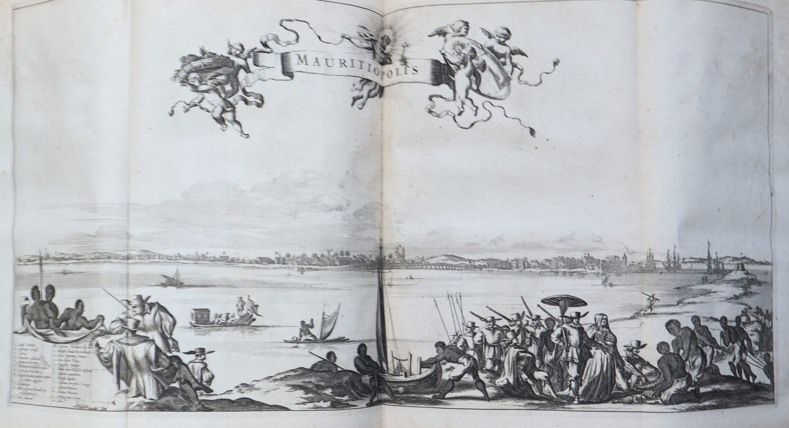
First edition, first issue, of the great Dutch folio on the Americas, COMPLETE: the engraved title, the large folding map of America, fifteen double-page maps after Joan Blaeu, thirty-two double-page plates including the folding Mauritiopolis and Nova Mexico, seven portraits and numerous text engravings; in contemporary vellum with a blind-stamped armorial medallion, the leaves 31 x 21 cm
FM-0087
€ 18.500
Key Properties
Edition: First edition, first issue. The first issue is distinguished by the portrait of Joan Maurits, Prince of Nassau, which is present here facing the letterpress title
Format: Folio, the leaves 31 x 21 cm, a wide and unsophisticated copy
Binding: Contemporary vellum over boards, the spine with raised bands, a blind-stamped armorial medallion within blind rules on both covers
Extent: 4 unnumbered leaves; 585 pp.; 13 unnumbered leaves (the register). Complete, collated leaf by leaf
Titles: engraved title lettered America (Amsterdam, Jacob van Meurs, 1671); letterpress title in red and black
Preliminaries: the engraved arms of Nassau as a headpiece to the dedication to Joan Maurits; the extract from the privilege of the States of Holland and West Friesland of 28 July 1670, signed by Johan de Witt
Maps: the large folding map by Van Meurs and fifteen double-page maps after Joan Blaeu, all present
Plates: thirty-two double-page plates, two of them folding (Nova Mexico and Mauritiopolis), all present, with numerous engravings in the text
Portraits: seven, being Joan Maurits, Columbus, Vespucci, Magellan, Atahualpa, Moctezuma and Pizarro
Arrangement: the discoverers of America, pp. 1-115; North and Central America, pp. 115-281; South America thereafter
Language: Dutch
References: Sabin 50086 and Church 613, both confirmed against the Library of Congress record for this edition; Tiele 763 and Asher, New Netherland, 14, from the owner's file; Howes M733, Borba de Moraes p. 586 and Phelps Stokes I, 142-143 and VI, 262 cited in the trade and not yet verified here
Collation & Technical Description
Folio, the leaves measuring 31 x 21 cm. 4 unnumbered leaves; 585 pp.; 13 unnumbered leaves, the register. Collated leaf by leaf against the book: COMPLETE.
Engraved title lettered America with the imprint of Jacob van Meurs, 1671; letterpress title in red and black with the device Invidiae Prudentia Victrix; the portrait of Joan Maurits, Prince of Nassau, which marks the first issue; the dedication to him beneath an engraved headpiece of his arms; and the extract from the privilege granted by the States of Holland and West Friesland on 28 July 1670, signed by Johan de Witt.
THE MAPS. The large folding map, Novissima et Accuratissima Totius Americae Descriptio per Jacobum Meursium, and fifteen double-page maps after Joan Blaeu: America Septentrionalis (p. 122), Nova Virginiae Tabula (134), Virginiae et Floridae (142), Aestivarum Insularum alias Barmudas dictarum (170), Insulae Americanae, Cuba, Hispaniola and Jamaica (172), Nova Hispania, Nova Galicia, Guatemala (230), Yucatan and Guatemala (258), Terra Firma et Novum Regnum Granatense et Popayan (280), Peru (294), Brasilia (358), Guiana sive Amazonum Regio (536), Venezuela (552), Paraquaria vulgo Paraguay (554), Chili (558) and Magellanica (572).
THE PORTRAITS. Seven engraved portraits: Joan Maurits in the preliminaries, Columbus (42), Vespucci (60), Magellan (74), Atahualpa (88), Moctezuma (244) and Pizarro (318), each within an elaborate baroque cartouche of arms, trophies and sea creatures.
THE PLATES. Thirty-two double-page plates, two of them folding: Angra op Tercera (50), Vetus Mexico (80), Arx Carolina (98), Pagus Hispanorum (148), Havana (154), Urbs Domingo in Hispaniola (160), Porto Rico (166), De Stadt Sint Martin (186), Viztlipuztli idolum Mexicanorum (220), Nova Mexico, folding (232), Portus Acapulco (246), St Francisco de Campeche (258), Truxillo (276), Cartagena (284), Callao de Lima (338), Cusco (342), Potosi (352), Sinus Omnium Sanctorum (384), Olinda de Phernambuco (386), I. Tamaraca (392), Urbs Salvador (402), Ostium Fluminis Parayba (424), Fluvius Grandis (426), Alagoa ad Austrum (438), Obsidio et Expugnatio Portus Calvi (454), Serinhaim (460), Castrum Mauritii ad Ripam Fluminis S. Francisci (466), Siara (472), Arx Principis Guilielmi (482), Mauritiopolis, folding (482), Arx Nassovii (484) and Boavista (484).
Numerous engravings in the text throughout. The text falls into three sequences: the discoverers of America to p. 115, North and Central America to p. 281, and South America thereafter.
Bound in contemporary vellum over boards, the spine with raised bands, a blind-stamped armorial medallion within blind rules on both covers.
Condition
The binding intact, the vellum lightly soiled, more so towards the lower cover, with a small stain to the upper cover; the joints and the spine firm. Internally a clean, well printed copy on strong paper, the impressions of the plates dark and sharp.
References & Bibliography
Sabin, 50086. Church, 613. These two are confirmed against the Library of Congress catalogue record for this edition (LCCN 05011011), which also records the physical make-up: [8], 585, [27] pages, 103 leaves of plates, 48 double-page plates, 16 maps and seven full-page engraved portraits.
Tiele, Bibliographie, 763, and Asher, A bibliographical and historical essay on the Dutch books and pamphlets relating to New Netherland (1854-1867), 14, are cited from the owner's file on the book.
Howes, M733; Borba de Moraes, p. 586; and Phelps Stokes, The iconography of Manhattan Island, I, 142-143 and VI, 262, are cited in the trade for this edition and have not been checked here against the printed works.
Description
The first edition, first issue, of the most ambitious Dutch book on the Americas of the seventeenth century, written by Arnoldus Montanus and published at Amsterdam by Jacob van Meurs in 1671. It is a folio of 585 pages, illustrated on a scale that no earlier account of the New World had attempted: a large folding map of America, fifteen double-page maps after Joan Blaeu, thirty-two double-page plates, six portraits and a great number of engravings worked into the text.
The first issue is identified by the portrait of Johan Maurits of Nassau, the former governor of Dutch Brazil, which stands before the third leaf and was dropped from later issues. It is present here.
Montanus, whose name in Dutch was Van den Berg, was a minister at Schellingwoude and afterwards at Schoonhoven, where he also ran the Latin school. He was born in Amsterdam around 1625 and died at Schoonhoven in 1683, and he never crossed the Atlantic. His book was assembled at a writing desk in Holland out of the reports, journals and letters that came back to the Republic from those who had, and out of everything the printed literature could supply. That method is the key to the whole work, and to its reputation.
The result is a book of two natures. Where Montanus had a good source in front of him he is remarkably full, and the sections on New Netherland, on Brazil under Johan Maurits and on the Spanish possessions preserve material that is not easily found elsewhere; the views of Manhattan and of the Dutch settlements have made the book a standard reference for the early topography of New York, which is why it is cited in Phelps Stokes. Where he had no source, or a bad one, he and his engravers supplied the gap themselves. A number of the American cities are shown with an architecture that owes more to the Netherlands than to the New World, and several of the animals and ceremonies are inventions. Van Meurs was working a large and expensive book to a schedule, and plates were adapted, reused and occasionally simply imagined.
A word about who made these plates, because the book answers the question itself. On the engraved title Jacob van Meurs calls himself "Plaetsnyder en Boeckverkooper", and on the letterpress title "Boek-verkooper en Plaet-snyder": engraver first, bookseller second. That was unusual. Most Amsterdam publishers put their copperwork out to specialist shops; Van Meurs ran his own, and so controlled the whole chain from the plate to the counter on the Keizersgracht. The privilege bound into this copy, granted by the States of Holland and West Friesland on 28 July 1670 and signed by Johan de Witt, gave him fifteen years of sole right over the book in any language and in any format, and that covered the plates as much as the text. It is why one house could put out a folio on this scale in a single year.
Who actually held the burin is not recorded. Van Meurs signed as a workshop rather than as a man, and the names of his engravers are largely lost, so any attribution to an individual hand is later guesswork.
What can be said is where the images came from, and there the series falls into three kinds. The Brazilian views rest on real material, the drawings made in Dutch Brazil in the 1630s and 1640s in the circle around Johan Maurits, among them Frans Post and Zacharias Wagener, which had already reached print through Barlaeus; that is why Mauritiopolis, Olinda and the Bay of All Saints carry conviction, because someone had stood there. The maps rest on Blaeu, the best cartography available in the city. And then there is everything for which no drawing existed, where the workshop supplied the gap: American towns given Dutch rooflines, animals cut from a written description, and, somewhere in the series, a unicorn. The line between the reported and the imagined is visible to the eye, which is part of what makes the book worth looking at.
Montanus's contemporaries noticed. John Ogilby brought the whole thing out in London in the same year, 1671, under the title America: being the latest, and most accurate description of the New World, a claim that has amused bibliographers ever since. Ogilby's edition takes over Van Meurs's plates, which is itself a measure of what the Dutch original was worth commercially.
None of this has diminished the book. It remains the fullest seventeenth-century Dutch account of the Americas, the handsomest, and the one in which a European reader of 1671 would have seen the New World as his own century imagined it, half reported and half invented, which is the more interesting half.
Historical Significance
Montanus wrote for a Republic that had just lost its American empire. Dutch Brazil had gone in 1654 and New Netherland in 1664, and by 1671 what remained of the Dutch Atlantic was Surinam, the Antilles and a memory. The book is therefore not a prospectus for colonisation but an inventory of what was once held and what others now hold, compiled at the moment when the Dutch had time to look back.
That timing explains its afterlife. The plates of New Amsterdam and of the Hudson settlements, made when the place had already become New York, became the images through which later centuries pictured the Dutch beginnings of the city, and they are reproduced in the standard iconography of Manhattan to this day. A book put together without its author ever leaving Holland ended by fixing how the New World was seen in the Old.
Related works
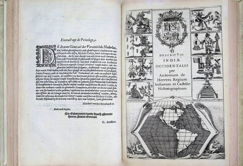
Voyages & Discovery · FM-0033
Spieghel der Australische navigatie
Jacob le Maire; Antonio de Herrera; Pedro Ordóñez de Ceballos · Amsterdam · 1621–1622
€ 35.000
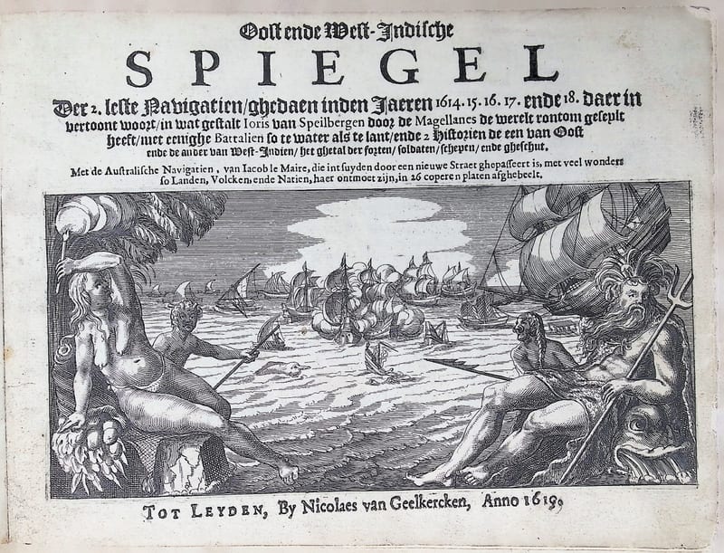
Voyages & Discovery · FM-0041
Oost ende West-Indische Spiegel
Joris van Spilbergen; with Jacob le Maire and Willem Schouten, Australische Navigatien · Leiden · 1619
Price on request

Voyages & Discovery · FM-0105
Speculum orientalis occidentalisque Indiae navigationum
Joris van Spilbergen; with Jacob le Maire, Navigationes Australes · Leiden · 1619
€ 15.000
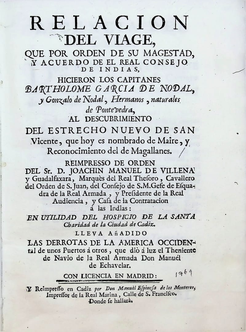
Voyages & Discovery · FM-0092
Relacion del viaje que por orden de su Magestad y acuerdo del Real Consejo de Indias hizieron los capitanes Bartolome Garcia de Nodal y Gonzalo de Nodal
Bartolomé García de Nodal and Gonzalo de Nodal · Cádiz · 1769
€ 8.400
All 13 works: The Strait of Magellan and Cape Horn →